Search

Oct 22, 2013

Farewell to paper nav charts - Uncle Sam says: read online or download a copy

It seems unbelievable.  NOAA’s Office of Coast Survey, which in 1862 began creating and maintaining the nautical charts of U.S. coastal waters, today announced that starting April 13, 2014, the federal government will no longer print traditional paper nautical charts. 

For a limited time, full-scale PDF  nautical charts are available for free download. This is on a "trial basis", so get their pdf maps while they're there.

The Stockton Harbor/Long Cove image is extracted from on of these charts (our caption).

Rear Admiral Gerd Glang, director of NOAA’s Office of Coast Survey said with marvellous understatement:  “We know that changing chart formats and availability will be a difficult change for some mariners who love their traditional paper charts."

 NOAA said  that the decision to stop production is based on the declining use of lithographic charts, the increasing use of digital and electronic charts, and "federal budget realities".

As for electronic charts, NOAA will continue to create and maintain  the increasingly popular Print on Demand (POD) charts.  They will also maintain NOAA's electronic navigational charts and raster navigational charts, (both updated weekly) along with the pdf nautical charts.

All are available for free download from the Coast Survey website.


Oct 15, 2013

Do upper Penobscot Bay marine fogs carry bay-upwelled mercury to upland coastal vegetation? And air breathers?

Marine fog has been shown on the west coast to carry vaporized mercury rising from a polluted seafloor area via water upwelling onto the leaves of mainland trees and other vegetation where the fog penetrates.  How about here? 
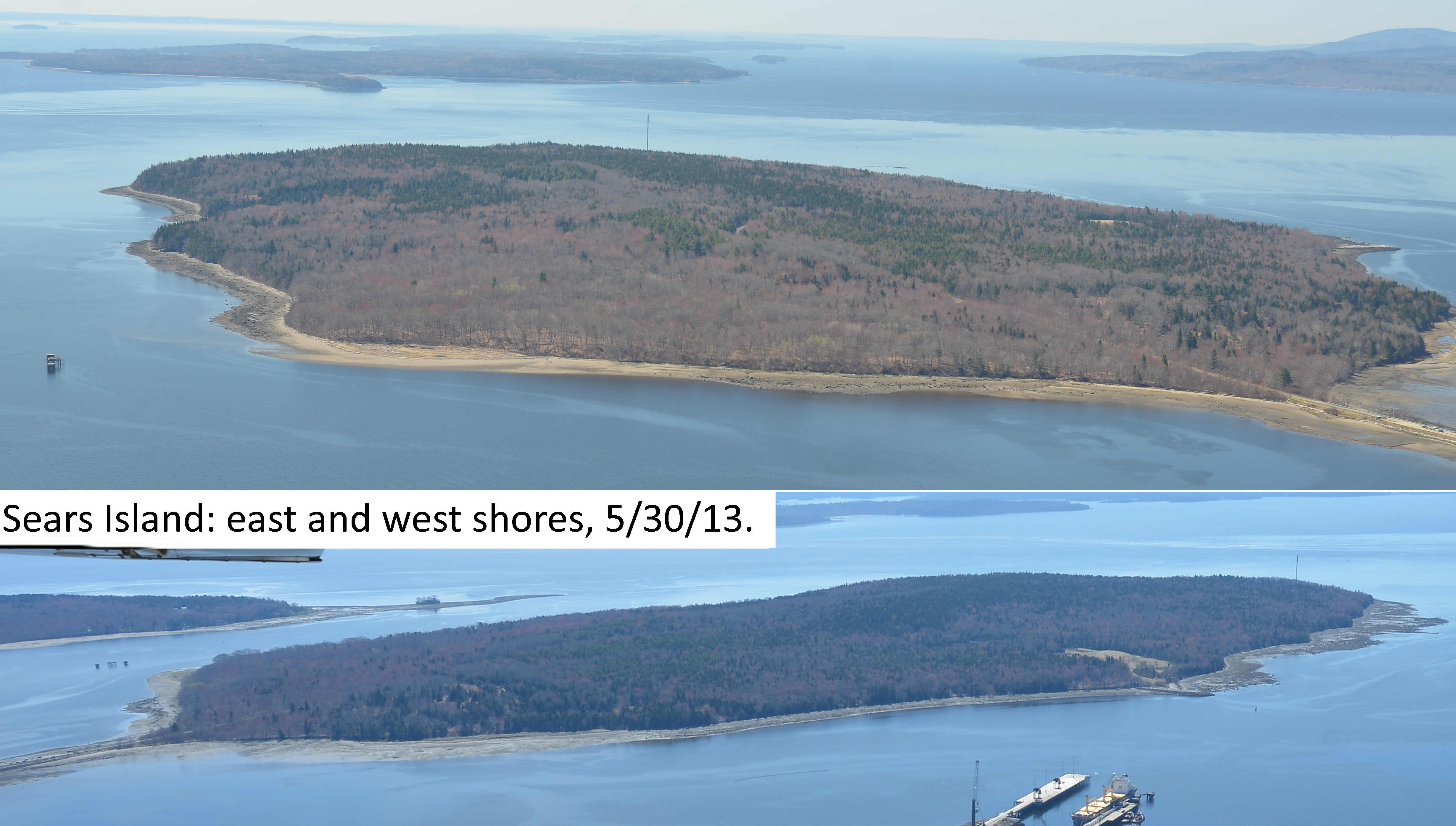
Sears Island getting fogged
Across the  continent, the  researchers at the UC Santa Cruz released a study in 2012 Total and monomethyl mercury in fog water from the central California coast.  Peter S. Weiss-Penzias, et al found that marine fog  collectively accounted for from 7–42% of elemental mercury and from 61–99% of methylmercury in total atmospheric deposition estimated for the coastal area . (Other vectors are rain, and dry deposition.)

According to that report"These initial measurements suggest that fog precipitation may constitute an important but previously overlooked input of MMHg to coastal environments. Preliminary comparisons of these data with associated chemical, meteorological and oceanic data suggest that biotically formed MMHg from coastal upwelling may contribute to the MMHg in fog water."

While this has been shown to be the case on a portion of the California Coast, the issue has not been examined in Maine. 

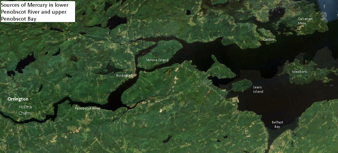
However, a significant amount of the tons of mercury spilled and leaked into the lower Penobscot River by HoltraChem has made its way into the sediments of the upper Penobscot Bay, according to a court ordered study.

In areas of the upper bay where upwelling is strong, it is likely that fog in the waters off Searsport, Belfast Stockton Springs and Islesboro and Castine could be transporting mercury to terrestrial vegetation and air breathers on the shore.

There are several prominent upwelling areas in the upper Penobscot Bay that could carry out that action: According to lobsterman Mike Dassatt,  if mercury tainted sediments are dumped in the Rockland Disposal Site  prevailing bottom currents will transport it up both sides of Islesboro and back to the upper bay. If dumped in the Belfast offshore dumpsite, strong upwelling currents there would even more quickly bring methy mercury to the surface if it were in the dredge spoils dumped there.

What is to be done?  Students at Unity College are preparing to carry out a study that will determine whether mercury can be found in the vegetation of Sears Island as well as long lived intertidal organisms.  The results of that study should be revealing.

Stay tuned.

Oct 10, 2013

Stockton Harbor: are acidic alum waste spoils harming the fish? Studies=96% mortality fish larvae.

What could aluminum pollution of a mudflat do to Stockton Harbor's biota?

Stockton Harbor southwestern shore has expanded into the harbor with significant amounts of  spent acidified bauxite and phosphate waste from historic alum and superphosphate  fertilizer  production dumped onto wooden cribs that expanded the shoreline bluff at the southwest end of the Harbor over top of part of the beach. Does it matter?

Researchers have been looking for some time into the effect on the survival of fish and shellfish and even plankton  role of acidified seawater in the uptake of toxic metals by fish and shellfish and their larvae.

Dissolved aluminium in acidic seawater has drawn concern. For either pollutant is relatively low impact until combined

Verdict?

"Larvae subjected to

* a single 24-hour, acid-only pulse of pH 4.5: No mortality
* a single 24 hour acid pulse and a monomeric aluminum pulse:  96% mortality


Significant effects have been noted low pH including pulses of acidity.  Below  are excerpts of  some of those studies, with important points boldfaced for convenience.

Egg and larval pH and aluminum associations  
Klauda et al. (1991) suggest that a range of pH 5.0 to 8.5 for both the alewife egg and prolarva life stage is optimal.  Klauda et al. (1987) suggested that during an acidic pulse between pH 5.5 and 6.2, critical conditions associated with more than 50% direct mortality could occur.

Klauda et al. (1991) found that larvae subjected to a single 24-hour, acid-only pulse of pH 4.5 experienced no mortality, while those subjected to a 24-hour single acid pulse and 446 µg/L inorganic monomeric aluminum pulse suffered a 96% mortality rate.  A single 12-hour acid-only pulse of 4.0 resulted in 38% mortality (Klauda et al. 1991).

-------------------------------------

The effects of aluminum and acid on the gill morphology in rainbow trout, Salmo gairdneii Robert E. Evans, Scott B. Brown and Toshiaki J. Hara
http://www.springerlink.com/content/n4863154757800t0/

------------------------------

Homeostasis and Toxicology of Non-Essential Metals ALUMINUM. 
Fish Physiology July 2, 2011, Volume 31, Part B, Pages 67–123
Excerpt: "Toxic mechanisms include impairment of gill ionoregulation (acceleration of passive ion losses and inhibition of their active uptake) by cationic Al species (especially Al3+), and/or respiratory dysfunction due to precipitation of Al(OH)3 or polymerization of aluminum hydroxides on the gill surface during alkalinization of water passing over the gills."

------------------------------

Low concentrations of inorganic monomeric aluminum impair physiological status and marine survival of Atlantic salmon 
Two strains of Atlantic salmon (Salmo salar) presmolts were exposed for 3 months to moderately acidic water (pH 5.8; 6 2 mug aluminum (Ali) l(-1) inorganic monomeric aluminum-acid exposure group) or non-acid water (pH > 6.5 -6.9; < 5 mug Ali l(-1)-Good/control group) at NINA Research Station, Ims, Southern Norway. Exposure to low concentrations of Ali raised the gill-aluminum (gill-Al) concentration by 20-30 mug At g(-1)
---------------------------------

Effects of acidic water and aluminum exposure on gill Na(+), K(+)-ATPase alpha-subunit isoforms, enzyme activity, physiology and return rates in Atlantic salmon

----------------------------
Salmon lice or suboptimal water quality — Reasons for reduced postsmolt survival? Norwegian Institute for Water Quality

1. Introduction
High levels of H+ and aluminium (Al) are lethal to Atlantic salmon (Salmo salar L.) smolts (Rosseland and Staurnes, 1994; Gensemer and Playle, 1999). Water toxicity is related to increased concentrations of H+ (reduced pH) and inorganic monomeric aluminum (Ali) in freshwater. At lethal concentrations, H+ acts primarily on the permeability of the cell membrane disrupting ionoregulation, whereas aluminum exerts its toxic properties by accumulation on and in the gill tissue, disrupting ionoregulation and impairing respiration. At lower concentrations, Al can still affect population traits by affecting growth, swimming performance, immune defence, behaviour and seawater tolerance (Rosseland and Staurnes, 1994; Staurnes et al., 1995, 1996; Kroglund and Staurnes, 1999; Ytrestøyl et al., 2001; Kroglund and Finstad, 2003).

---------------------------------------
Environment Canada Aluminum Salts and fish and plankton
2.4.1.1 Aquatic Organisms
Most of the research on the impact of aluminum on aquatic life has been related to the impacts of acid rain. In this report, emphasis was placed on the potential toxic impacts of aluminum in waters of neutral or near-neutral pH as the available information suggests that releases associated with the three aluminum salts being assessed occur primarily into waters of circumneutral pH (Roy 1999b; Germain et al., 2000). As described below, because of this consideration, the most relevant effects data identified were for fish. This assessment report does not provide a detailed examination of potential effects from exposure to polymeric aluminum, as polymeric aluminum is most likely to form, and to cause toxicity, during the neutralization of acidic aluminum-rich waters and this is unlikely to occur in the release scenarios considered in this assessment (Roy 1999b).
The gills are the primary target organ for aluminum in fish (Dussault et al. 2001). Aluminum binds to the gill surface, causing swelling and fusion of the lamellae and increased diffusion distance for gas exchange (Karlsson-Norrgren et al. 1986; Tietge et al. 1988). The resulting damage leads to loss of membrane permeability, reduced ion uptake, loss of plasma ions, and changes in blood parameters relating to respiration. Fish death may result from ionoregulatory or respiratory failure, or a combination of both, depending upon the pH of the water and concentration of waterborne aluminum (Neville 1985; Booth et al. 1988; Gensemer and Playle 1999). Ionoregulatory disturbances prevail at lower pH (e.g., below 4.5) and relate to decreased levels of plasma Na+ and Cl¯ ions (Neville 1985; Gensemer and Playle 1999). At pH levels above 5.5, binding of the positively charged aluminum species to negatively charged sites on the gill surface, with subsequent aluminum polymerization, leads to mucous secretion, clogging of the interlamellar spaces and hypoxia (Neville 1985; Poléo 1995; Poléo et al. 1995; Gensemer and Playle 1999).

Aluminum exposure may also disrupt ionic balance and osmoregulation in aquatic invertebrates (Otto and Svensson 1983). Reduced Na+ and/or Ca2+ uptake in response to aluminum exposure have been documented in crayfish (Appleberg 1985; Malley and Chang 1985), mayfly nymphs (Herrmann 1987) and the water boatman, Corixa sp. (Witters et al. 1984). Aluminum reduced Na+ influx and, to a lesser extent, increased outflux, in Daphnia magna, thereby impairing osmoregulation (Havas and Likens 1985). 

Aluminum may disrupt the respiratory organs of some invertebrates, such as the anal papillae of the phantom midge, Chaoborus sp. (Havas 1986). Respiratory effects can occur when acidic waters are rapidly neutralized, such as when an acidic tributary enters a larger, neutral receiving stream, leading to the formation of mononuclear and polynuclear aluminum species from the dissolved ion (Gensemer and Playle 1999). These species may bind to or precipitate onto the bodies of invertebrates, creating a physical barrier to respiration. Aluminum has been reported to impair reproduction in Daphnia magna (Beisinger and Christensen 1972), although recent work with Daphnia pulexsuggests that adaptive strategies which heighten survivorship and fecundity may occur following long-term exposure to sublethal levels (Wold et al. 2005). Hall et al. (1985) reported that aluminum may reduce the surface tension of water, affecting egg deposition, emergence, feeding and mating behaviour of some stream invertebrates.


----------------------------

Literature Review and Analysis of the Chronic and Acute Toxicity of Aluminum in Aquatic Environments  FINAL REPORT - March 27,1998
Robert W. Gensemer, Ph.D. Department of Biology, Boston University, and Richard C. Playle, Ph.D. Department of Biology, Wilfrid Laurier University Canada

"Investigating the biological effects of aluminum has become a major focus of
aquatic research. Much of this interest stems from recent work on the biological effects of acidic precipitation, because Al becomes more soluble and, hence, potentially more toxic to aquatic biota at acidic pH. Starting around 1980, it became widely accepted that Al was a major factor affecting the success of aquatic organisms and communities in acidic habitats (Cronan and Schofield 1979, Drablos and Tollan 1980, Muniz and Levistad 1980, Schofield and Trojnar 1980).

Since then, research on the biological effects of acidification often has supported the contention that Al can be a major factor responsible for the demise of biotic communities (Dillon et al. 1984, Campbell and Stokes 1985, Schindler 1988, Charles 1991, Last and Watling 1991, Scheuhammer 1991)"

-------------------------------

Episodic acidification of small streams in the northeastern United States:  Fish  mortality in field bioassays.
Van Sickle J(a); Baker J P; Simonin H A; Baldigo B P; Kretser W A;  Sharpe W E
Excerpt Ecological Application  6 (2):p408-421 1996
In situ bioassays were performed as part of the Episodic Response  Project, to evaluate the effects of episodic stream acidification on  mortality of brook trout (Salvelinus fontinalis) and forage fish species.  We report  the results of 122 bioassays in 13 streams of the three study  regions: the Adirondack mountains of New York, the Catskill mountains of  New York, and the Northern Appalachian Plateau of Pennsylvania.

Bioassays  during acidic episodes had significantly higher mortality than did   bioassays conducted under nonacidic conditions, but there was little  difference in mortality rates in bioassays experiencing acidic episodes  and those experiencing acidic conditions throughout the test period.  Multiple logistic regression models were used to relate bioassay  mortality rates to summary statistics of time-varying stream chemistry  (inorganic monomeric aluminum, calcium, pH, and dissolved organic carbon)  estimated for the 20-d bioassay periods.

The large suite of candidate   regressors also included biological, regional, and seasonal factors, as  well as several statistics summarizing various features of aluminum  exposure duration and magnitude. Regressor variable selection and model  assessment were complicated by multicollinearity and overdispersion.
For  the target fish species, brook trout, bioassay mortality was most closely  related to time-weighted median inorganic aluminum. Median Ca and minimum  pH offered additional explanatory power, as did stream-specific aluminum  responses. Due to high multicollinearity, the relative importance of  different aluminum exposure duration and magnitude variables was  difficult to assess, but these variables taken together added no  significant explanatory power to models already containing median  aluminum.

Between 59 and 79% of the variation in brook trout mortality  was explained by models employing between one and five regressors.  Simpler models were developed for smaller sets of bioassays that tested  slimy and mottled sculpin (Cottus cognatus and C. bairdi) as well as  blacknose dace (Rhinichthys atratulus).

For these forage species a single  inorganic aluminum exposure variable successfully accounted for 86-98% of  the observed mortality. Even though field bioassays showed evidence of  multiple toxicity factors, model results suggest that adequate mortality  predictions can be obtained from a single index of inorganic Al  concentrations during exposure periods.

Oct 8, 2013

Maine Metallic Open Pit Mining Rules Pub Hearing October 17th, Augusta Civic Center.

LD 1853 stripped the environmental safeguards out of Maine's metallic mining laws and regulations, which had been in effect for 30 years. 

Now the state must implement rules to interpret the law. Maine's very pro-mining Commissioner of Environmental Protection has come up  these draft Rules for Metallic Mineral Exploration, Advanced Exploration and Mining.

On October 17th starting 9am the Maine  Board of Environmental Protection  will hold a public hearing on these rule changes starts at  the Augusta Civic Center. 

More details from NRCM.... More details from Maine Audubon  

Listen to recordings of  two  March 2013 public hearings on LD 1853

Oct 7, 2013

Sears Island: Testing biota for HoltraChem mercury.

 Locations for testing and Recommended actions (see recs at end of essay).
AT ISSUE Reports suggest that the majority of mercury in Penobscot Bay has come down Penobscot River from spills, leaks and dumping of the element by the riverside Holtra Chem Plant  in Orrington.  History of plant.

QUESTIONS
* Can mercury be detected in the plant and animal biota of Sears Island?
 * Can it be  measured? Is it moving through island or intertidal foodwebs?

Likely origins, transport vectors, and on island-locations of mercury 
"The pattern of 
contamination of the sediments of the Penobscot River and estuary was....

consistent with a large source from the HoltraChem site at Orrington.....
"The spatial pattern of contamination of various species of biota, such as periwinkles, 
mussels, lobsters, tomcod (fish) and cormorants (birds) was also consistent with 
 
elevated inputs of Hg to the lower Penobscot River below the Veazie dam". 
.....
 [T]hese results indicate that the
 most severe contamination of the Penobscot system is between Brewer on the lower
 
river and about Fort Point or Sears Island in the upper estuary."
(Note: see maps of  study sample sites in the river and bay on page 20 of thPenobscot River Mercury Study Phase I)

SEARS ISLAND MERCURY DEPOSITION LOCATIONS
Bathymetry & hydrology questions. Does Sears Island's shape, location, hydrology and bathymetry influence where mercury might accumulate on the island?

Larger image click here
TESTING LOCATIONS
In what locations would what Sears Island biota, including intertidal and upland) be likely to absorb mercury? Particularly methyl mercury. What species might have it in detectable quantities? 

Changes in Sears Island Hydrology 
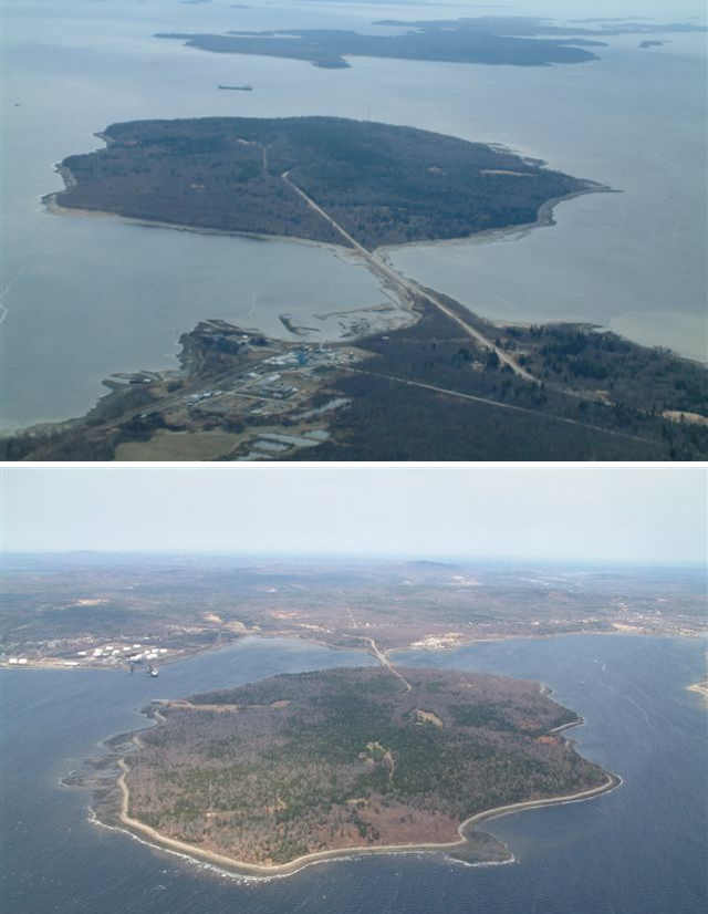
The Sears Island causeway has halted the flow of water around the island since the 980s (See a 1970s picture of causeway-free Sears Island from mainland. (courtesy  Maine Historic Preservation Commission).  Has this changed the sites of mercury deposition?

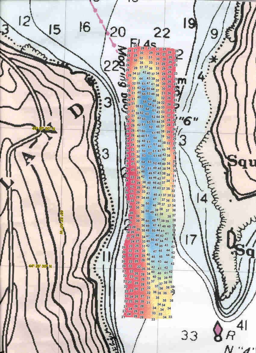
 The Jellison Channel between Sears Island and Cape Jellison was surveyed in 1999 by the NOAA vessel Rude (pronounced "Rudy"), at the request of Penobscot Bay Watch. The Rude produced this image of the channel floor (full size) The image shows that currents continue to sweep the floor of the channel clean of mud. Are those currents bringing mercury into Stockton Harbor?

Intertidal flats and beaches on the east or west sides of Sears Island

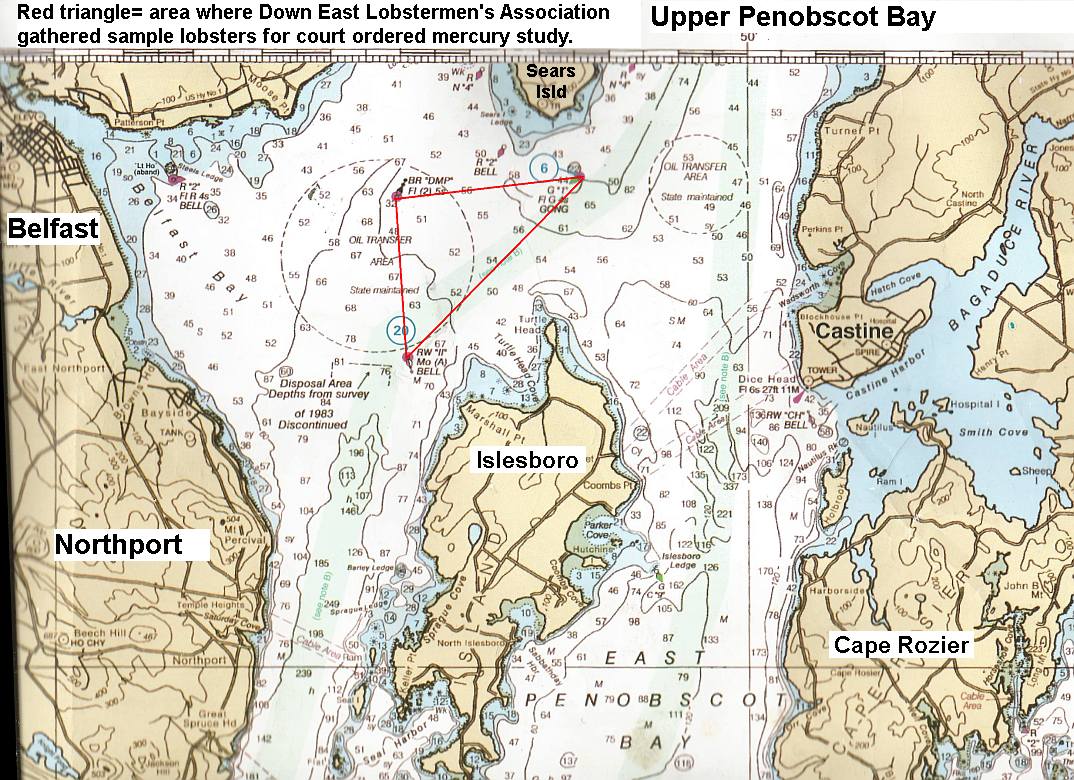
Penobscot River Mercury Study Phase 2: Upper Penobscot Bay.  Belfast lobsterman Mike Dassatt gathered sample lobsters from the upper Bay area under a special license from DMR  for mercury examination (Red triangle).
Click here for fullsized image
 The  report has yet to be released.   Dassatt described the lobsters  collected inside the red triangle (quotes are his words
"There is a  pretty heavy concentration of mercury" along the line between the II Buoy and the Gong 1 Buoy. (the long edge of the triangle). 

"But the very hottest  reach is the shoal edge above  the deeper water east of  the DMP buoy", (the shoal edge is the wiggly line inside the red triangle) Mike said that while he did not take sample lobsters from the exact bay floor the Army Corps of Engineers wants to dredge, which is northeast of the DMP buoy, he is confident that the same elevated mercury will be found in that area if they do test lobsters there for it. 

Marine fog deposition of upwelling mercury onto upland vegetation.
This has not been examined in Maine to the best of our knowledge. (See 2012 UCSC paper Total and monomethyl mercury in fog water from the central California coast, Peter S. Weiss-Penzias, et al. 2012 and these  "general public" articles
According to that study: "[U]sing a standard fog water collector, depositions of HgT [elemental mercury] and MMHg [methylmercury] via fog were found to range from 42–4600 and 14–1500 ng m−2 y−1, which accounted for 7–42% of HgT and 61–99% of MMHg in total atmospheric deposition (fog, rain, and dry deposition), estimated for the coastal area." 

There are several prominent upwelling areas in the upper Penobscot Bay that could carry out that action: The top of the channel   According to lobsterman Mike Dassatt,  if mercury tainted sediments are dumped in the Rockland Disposal Site  prevailing bottom currents will transport it up both sides of Islesboro and back to the upper bay. 

RECOMMENDATIONS  
1.  Sample or collect plant, animal & algae species, driftwood and sediments in  intertidal areas on both sizes and both ends of Sears Island.

2. Sample or collect samples from trees and other vegetation & fungi species and soils in a transect across  Sears Island to determine if mercury deposition from fog is significant.

3. Use mercury detection  paper test strips for initial onsite  test results

4. Test for mercury and methylmercury in Unity College lab. Compare results to  mercury test strips' results.

5. Use results and determine  if initial questions can be answered:  
*  Can mercury be detected in the plant and animal biota of Sears Island?
 * Can it be  measured? Is it moving through island or intertidal foodwebs?

Sep 28, 2013

Maine Lakes at Risk from LePage Administration

Maine Lakes at Risk from LePage Administration                                   Report Documents Damage to DEP’s Lake Protection Efforts

Tuesday September 24th, 2013

NRCM Press Release
The Natural Resources Council of Maine (NRCM) today released an investigative report documenting damage caused to the State of Maine’s lake protection efforts under the Administration of Governor LePage. 
Although Maine’s lakes are among our state’s most valuable natural resources, the NRCM report finds that the LePage Administration and current DEP leadership have put our lakes at increased risk by cutting DEP lake protection staff and resources, terminating education and technical assistance, purging DEP’s website of valuable public documents, disrupting the work of DEP scientific and technical staff members, and failing to enforce a Maine law that helps protect lake water quality.  
Troubled Waters: Damage to Maine’s Lake Protection Program Under the LePage Administration is based on information gathered from lake protection specialists across Maine and documents secured by NRCM through Freedom of Access Act requests.
“The report finds that Maine’s lake protection efforts have been curtailed, disrupted, and dismantled, and now are at the lowest levels in decades, raising serious questions about whether the DEP can protect the health and integrity of Maine lakes, as required by Maine law,” said NRCM Advocacy Director Pete Didisheim.
The decline in DEP’s lake protection programs comes at a time when the water quality of Maine lakes appears to be deteriorating. New research from the University of Maine shows that the clarity of Maine’s lakes has worsened since 1995. If this trend continues, the impact could be severe for Maine’s economy. Studies show that Maine’s lakes generate at least $3.5 billion in economic activity annually and help sustain 52,000 jobs.  
“Maine has some of the highest quality lakes in the nation, but the current administration is undermining the work that needs to be done to keep those lakes clean,” said Didisheim.
The report explains that over the past 40 years, with broad bipartisan support, Maine has adopted laws and programs that have helped protect the clean water in Maine lakes by reducing pollution, curbing the spread of invasive species, fostering school and lake association activities, and promoting best practices on shoreland properties. But that has changed over the past two years as the LePage Administration has drastically curtailed and disrupted DEP’s lake protection work. The report includes seven major findings and urges Maine lawmakers to begin now to reverse the damage. 

UMaine students find invasive Asian Shore crab on Great Wass Island

Bangor Daily News: Machias, Maine - A group of students from the University of Maine-Machias made a bittersweet discovery this week. They found an Asian shore crab on Great Wass Island in Beals, the northernmost point where the crab has been sighted. 

The excitement of their discovery was tinged with disappointment, however, because the Asian shore crab is an invasive species that threatens Maine’s coastal ecosystem.

The four students — Katie Barvenik, Bennett Ellis, Jacob Snyder and Wesley Turner — were participating in a field study as part of their marine ecology class with professor Brian Beal. They were taking samples — finding and counting marine life — on the rocky shore adjacent to the Downeast Institute for Applied Marine Research and Education, of which Beal is research director.
It was a cold, windy Tuesday morning, and the students were working in hip waders and jackets. Ellis turned over a rock, and crabs scurried for cover.

Three of the students — Barvenik, Ellis and Snyder — discussed the discovery in a conference room on campus Thursday.

“Picked it up, the rock, there’s about six or eight crabs under there,” said Ellis. “I started grabbing a couple of the bigger ones that were crawling away. And Katie reached over and grabbed a few small ones in her hand and saw one of them was an Asian shore crab.”

She told the other students immediately that she found an Asian shore crab. Snyder told her she was wrong. "I knew it immediately,” said Barvenik, who is from Portsmouth, N.H. “I knew what it was.” She recognized it because she has seen them before around Bath and also in southern New England.

“They’re pretty easy to distinguish,” added Ellis.

“Part of me was really excited,” said Barvenik. At the same time, however, she and the other students and Beal felt a sense of discouragement. “It’s cool to find it,” said Barvenik, “but it is an invasive species.

“It definitely was disheartening and exciting,” she added.

Beal, describing the study in his office on Friday, acknowledged the sense of “trepidation” at finding “another invasive species in this part of the world.”
At the time Beal thought the northernmost finding of the Asian shore crab was around Searsport. However, he checked with officials of the state Department of Marine Resources and learned the northernmost presence of the crab was established in Schoodic Peninsula, which is east of Mount Desert Island, in 2005. Great Wass Island is roughly about 27 miles further up the coast from Schoodic Peninsula. The Asian shore crab was first discovered in the U.S. in Cape May, N.J., in 1988 and since then has moved slowly north.

“It’s interesting,” said Beal, “because it seems to be following the same pattern as green crabs.” Both species appear to have migrated up against the net flow of Maine’s coastal waters, which flow in a southerly direction from Lubec to Kittery, he explained. The European green crab, another invasive species that is damaging Maine’s coastal ecosystem, and the Asian shore crab both have managed to “buck the tide” he noted.

The reason is most likely human intervention — accidental, said Beal. The Asian shore crab probably was conveyed into the region through the movement of marine products, he said. Crabs easily could have been transported in a pool of water in a boat or some other accidental means. The crab is very tiny, its shell only growing to about the size of a silver dollar. The one found by the students is about one inch.

“The point is, it certainly was in a natural environment for it,” said Beal, under a rock, in the shade, protected, surviving and feeding on the ecosystem.

The Asian shore crab feeds on plants and animals, noted Beal, who has witnessed its destruction of the shoreline ecosystem in southern New England. “That’s what makes it so well suited for any habitat,” the fact that it feeds on both plant and animal life.

The tiny invader is prey for lobsters, crabs, birds and other species, noted Beal. However, it reproduces prolifically, which is why it has spread.

“I’m not sure what we can do,” said Beal. The type of damage the invader potentially can cause is “kind of disheartening,” he said.

Sep 22, 2013

Federal fishery agency AGAIN defending Penobscot Bay's fish & shellfish habitat

In 1995 and now in 2013, the National Marine Fisheries Service has consistently defended the fish- and shellfish-important shallows near Sears Island in upper Penobscot Bay.

In the mid 1990s, NMFS thwarted an effort by the King Administration to get a permit from the US Army Corps of Engineers to build a woodchip port on Sears Island & dredge access to it. The scar of the ghostport is the only visible remains of that plan.

In 2013, NMFS is telling the Army Corps of Engineers that the Lepage administration plan to dredge the shoal separating Sears Island from the open harbor nearby Sears Island "represents significant new and permanent losses of shallow water habitats."

First the 1995 letter, then the 2013 letter.
* In this September 29, 1995 eight page letter, National Marine Fisheries Service regional director Dr. Andrew A. Rosenberg tells Lt Col J. Michael Bradbury of Army Corps of Engineers that NMFS opposes the port plan because:
"The proposed Sears Island cargoport would be one of the most damaging coastal development projects to occur in New England since modern environmental standards went into effect in the 1970's."....
"...The National Marine Fisheries Service is opposed to the proposed Sears Island cargo terminal because it would destroy and degrade a very large area of extremely valuable habitat."

* In this August 28, 2013 five page letter about Maine DOT's plan for dredging outer Searsport Harbor, NMFS Louis A. Chiarella tells John R. Kennelly of the Army Corps of Engineers that:
"Unfortunately we continue to have significant concerns regarding the proposed project's impacts on our trust resources." ....
"Because the existing shallow water areas that would be impacted by the dredging have not been dredged in the past, the proposed project represents significant new and permanent losses of shallow water habitats."....
"Because the maneuvering area contains areas identified as EFH [Essential Fish Habitat] for spawning, egg development, larvae, and young of year winter flounder, we have determined that the proposed project would permanently impact winter flounder EFH."

---------------------end excerpts---------------------

Not bad! The 2013 letter is very carefully & cautiously worded, but NMFS knows what it is doing, and is making sure everything they write has backup.
We, too, need to be NMFS' backup. Maine DOT will do whatever backroom dealing it can to try to force the expansion dredging to happen. If a federal agency's fish habitat protectors continue to stand their ground in defense of Penobscot Bay all these years, shouldn't we?

Sep 21, 2013

GAC Chemical current (2013) pollution licenses and a 1998 discharge issue's Discharge Monitoring Reports

GAC's current pollution licenses as of 2-13
MPDES (water)    Air pollution license

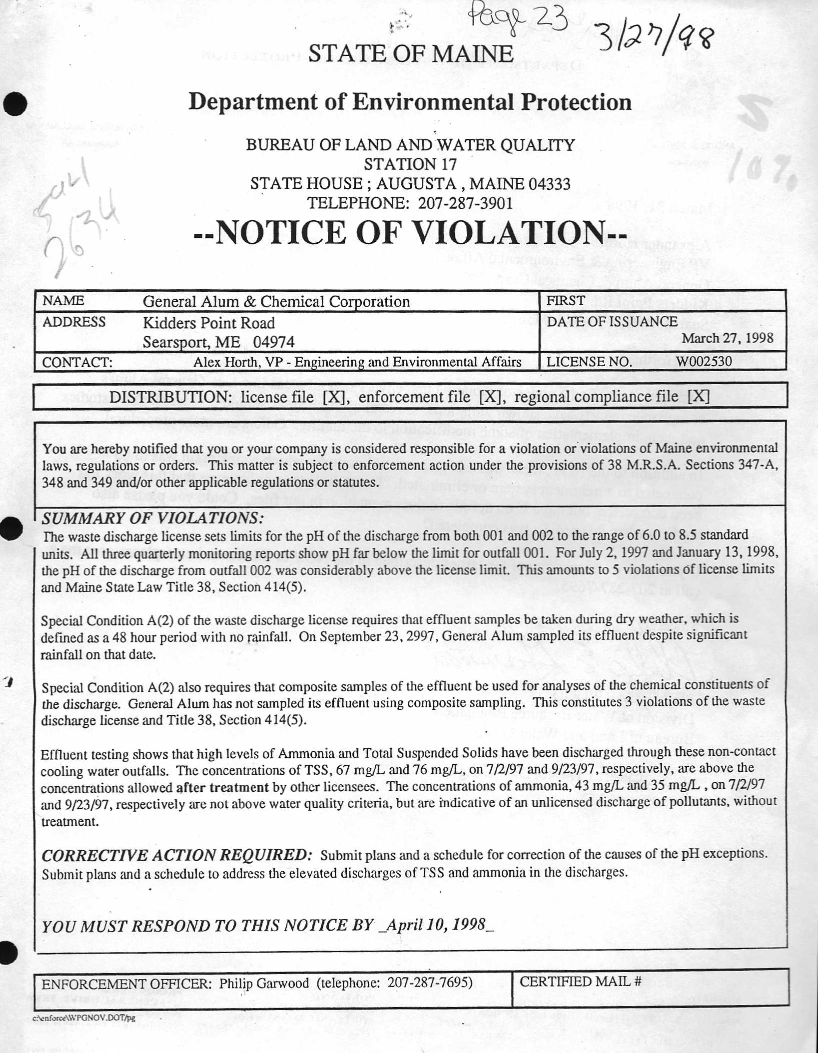
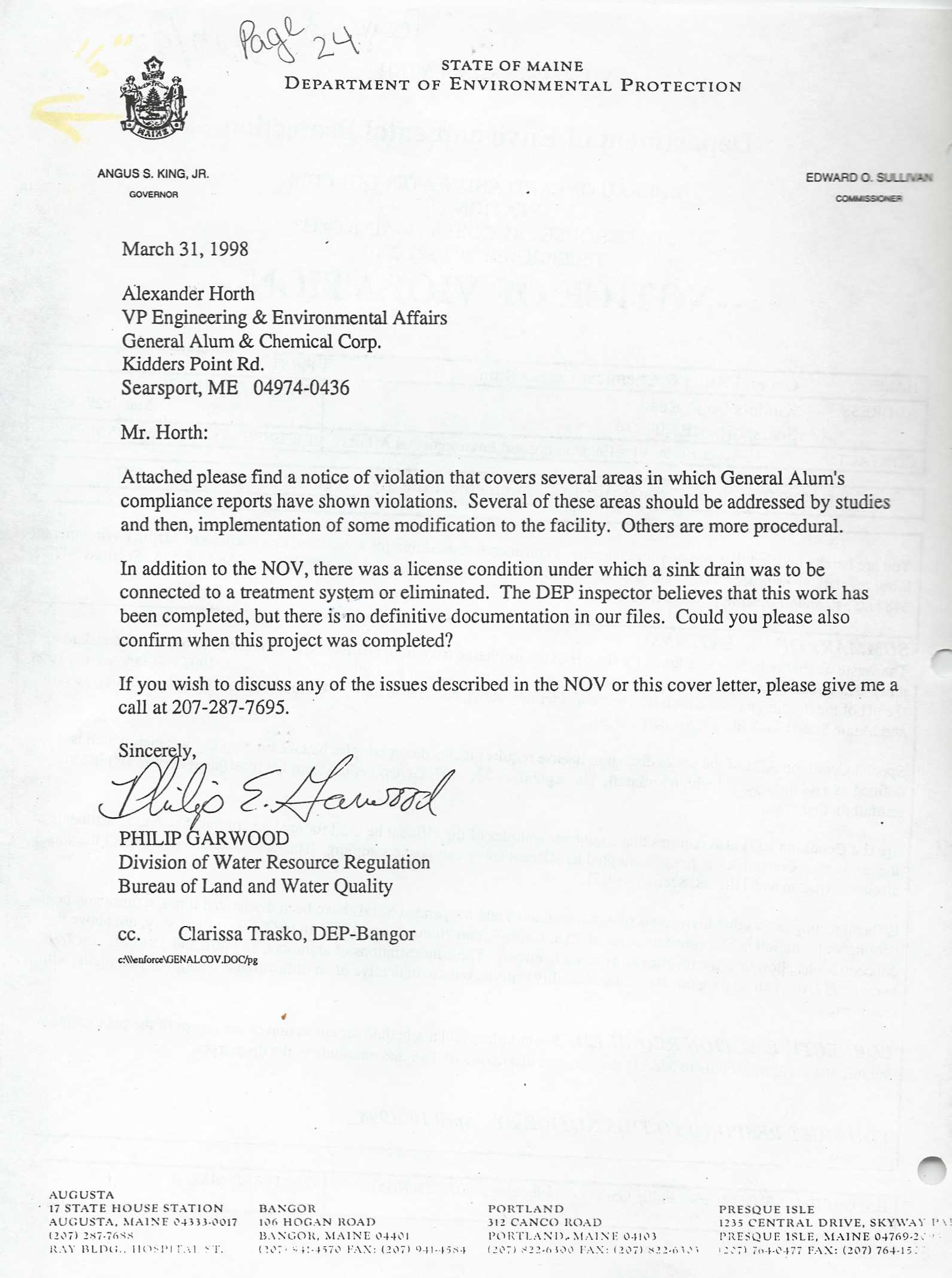
GAC Chemical, like all companies that discharge into the water and air of Penobscot Bay, must file regualr Discharge Monitoring Reports to the Maine Department of Environmental Protection

Past Pollution Discharge Issues
Discharge monitoring report  3/27/98
Discharge monitoring report  3/31/98
Company Response 4/20/89 Part 1   Part 2  Part 3


Kidder Point & Mack Point: news & info 1903-1976, Plus 2002 in newspapers and government reports of the time

News  & reports on Searsport's Kidder Point & Mack Point. 1903 to 1976.  From New England newspapers and government reports of the time. 
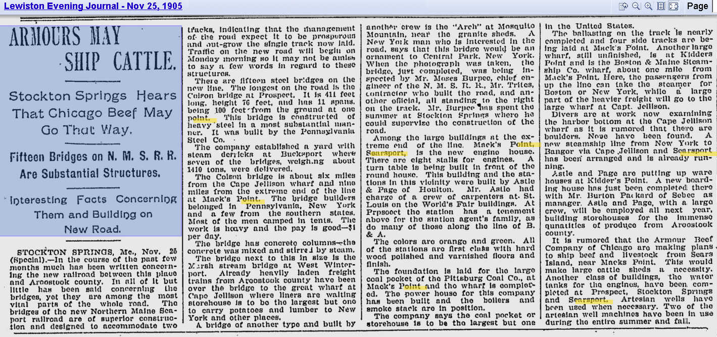
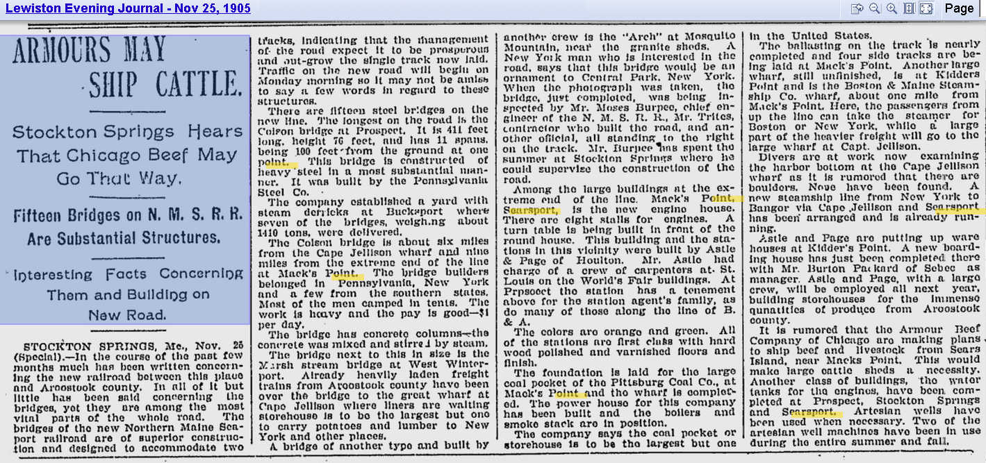
1903 Armours may ship cattle via Stockton Springs
1905  Boston Maine Steamship Co wharf being built on Kidder Pt (column 3)
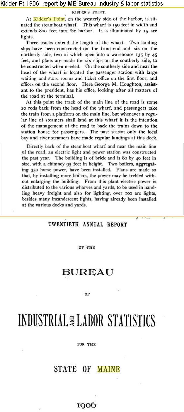
1906 Report on Kidder Point by Maine Bureau of Industry and labor
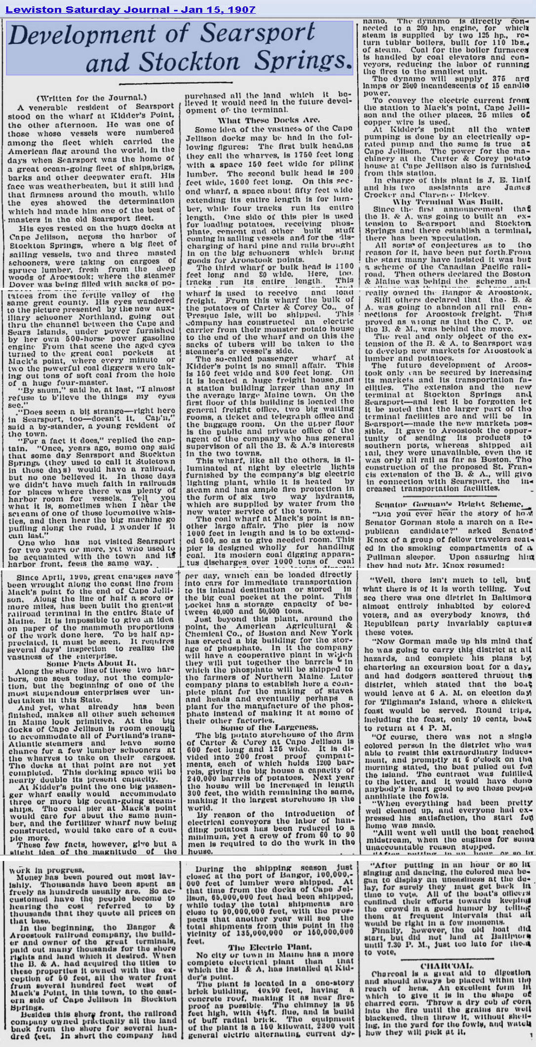
1907 Development of Searsport and Stockton Springs 1/15/1907
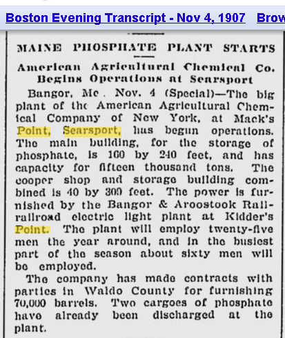
1907 American Fertilizer Co starts on Mack Pt, Powerplant on Kidder Pt   11/4/1907
1914 ME Railroad Board Ann Rpt on Kidder Pt Electric Plant 1914
1914 BAR RR closes Kidder Point power plant for Mack Point 2/29/1914
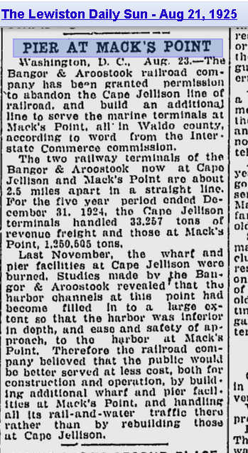
1925 BAR abandons Cape Jellison pier; expands Mack Point's  8/21/25
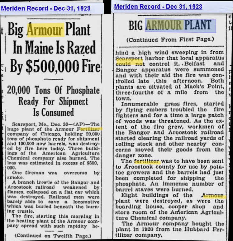
1928  Fire destroys giant Armor fertilizer plant in Searsport 12/31/28
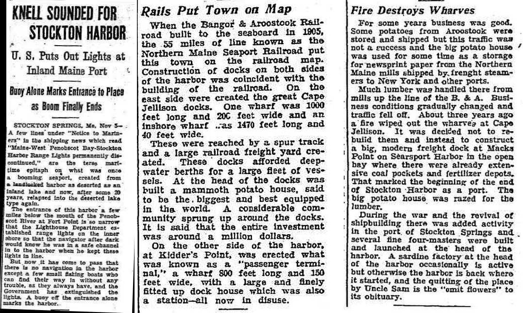
1928 Knell sounded for Stockton Harbor
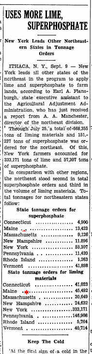
1941 Superphosphate use by states incl Maine
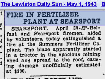
1943 Fire at Summers Fertilizer 5/1/43
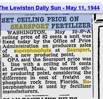
1944 Price ceiling set on wartime Searsport superphosphate production 5/11/44
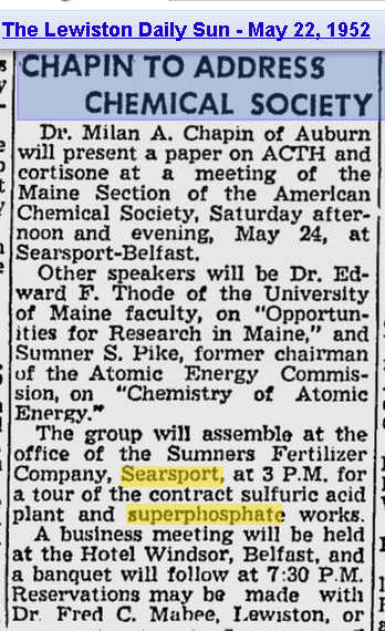
1952 Summers Fertilizer - Tour of superphosphate works 5/22/52
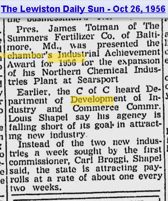
1956  Summers Fertilizer leader Totman gets award 10/26/56
1971 Summers Fertilizer leader's portrait presented to U Maine 4/21/71
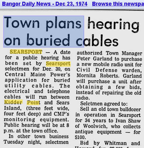
1974 Submerged power cables plan between Kidder Pt & Sears Isld 12/23/74
* 1976  Delta Chemical gasses Searsport, causes Fernview shipwreck
Got news of early or mid 20th century Penobscot Bay? Email it as attachment or send us the link

New! 1980s to 2000s. Under construction
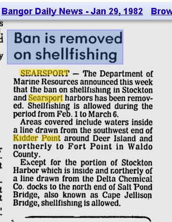
1982 State reopens cove off Kidder Point to shellfishing 1/29/82
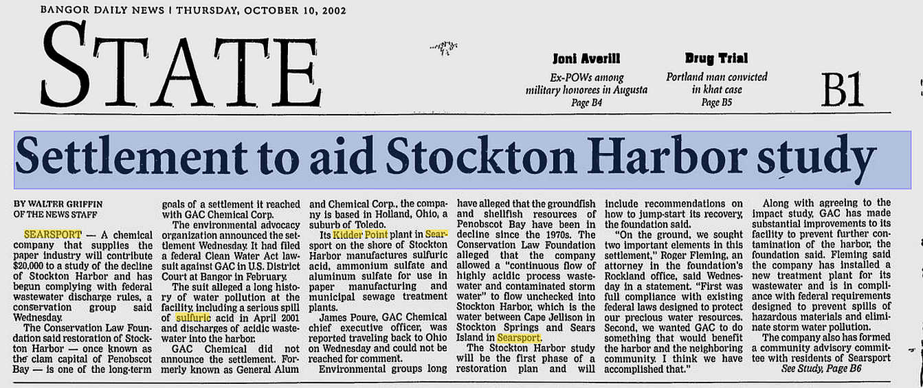
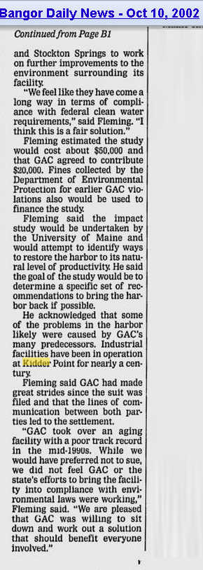
2002 CLF/GAC settlement cash to benefit Stockton Harbor Pg 1--Pg 2 10/10/02


Sep 18, 2013

Searsport Hbr Dredging: Lobster zone D to partly oppose; DMR to hold public hearing; NMFS writes sternly worded letter to ACOE

Searsport Harbor Dredging Updates
1. Lobster zone D to oppose expansion dredging;
2. DMR to hold public hearing 
3. NMFS writes Army Corps a sternly worded letter

(1) The Zone D Lobster  Council, made up of area lobstermen, does  lobstering oversight of DMR 's ever changing rules regs and laws. Its region stretches from Muscongus Bay around  Penobscot Bay  to Castine.

At the September 17th meeting at the Rockland Ferry Terminal, the Zone D Council heard about problems associated with the dredging proposal from Mike Dassatt of Downeast Lobstermen's Association, Becky Bartovics and Ron Huber. The Council agreed to write a letter opposing expansion dredging, for all the reasons we know of, while supporting the planned maintenance dredging with  precautionary conditions. More about Lobster Zone Councils

(2) DMR's rep at the meeting, Sarah Cotnoir, said she had been told by DMR commissioner Pat Keliher that DMR is going to hold a  public hearing on the Searsport dredge proposal.. NOT a meeting. He is responding to letters he's received requesting the hearing.   

At issue has been DMR's steady insistence during the last  two decades of holding only "public meetings" on dredging proposals. Not public hearings.  Even though state law specifically requires the DMR Commissioner to hold a public hearing if requested by five or more persons......This time, public requests for a public hearing, and the enormous size of the latest dredge proposal, which adds  a 900,000 cubic yard  expansion  to the  40,000 cubic yardstandard maintenance dredging that was planned initially.

3. National Marine Fishery Services says it will take another look.. On August 21st, the National Marine Fisheries Service's New England  Habitat Conservation chief  Lou Chiarella,  wrote to the Army Corps of Engineers that NMFS was reopening its review of the Sears Island project, due to additional information coming to their attention  habitat consultation process. Some highlights from the letter:  (Boldfaced  bits done by Bay Blog for ease of reading)

NMFS: "Unfortunately, we continue to have significant concerns regarding the proposed project's impacts on our trust resources. The information provided in your August 9, 2013 letter, as well as personal communications with your staff indicated the amount of impact to shallow water habitat from the proposed improvement dredging would be much greater than our understanding based upon the information contained within the Environmental Assessment (EA), dated December 2012."

 "Furthermore, because this new information was not available during the EFH consultation, and because the new information would affect the basis of our EFH  conservation recommendation, we are reinitiating a distinct EFH consultation for the proposed project, pursuant to 50 CFR 600.920(1), and providing additional conservation recommendations.

"Based on this new information, we have concluded that the proposed dredging would result in a substantial change in the depth of the area with significant effects on shallow water benthic habitats.."   ".....we have determined that the proposed project would permanently impact winter flounder EFH."..

."In summary, because we received additional information regarding this project that changes the basis for some aspects of our original consultation on May 6,2013, we are reinitiating EFH consultation."
End of excerpts.
----------------------------------------------------------------

A quickly changing situation, bay friends! Stay tuned.

Sep 17, 2013

Lobster zone council to hear from opponents of Searsport dredge plan tonight

Tonight the Zone D lobster council - Muscongus Bay and West Penobscot Bay - meets in Rockland at the ferry terminal. Some guests will be there to try to fire up the lobstermen about the dredge-hell that the Army Corps of Engineers and Maine DOT hope to unleash on Penobscot Bay.
 
Should those agencies succeed, great plumes would arise, watery expanding mushroom clouds of tainted sediments, spreading far and wide the industrial wastes laid down there in the upper bay in the 19th and 20th centuries, as the prevailing currents at each depth demand. What would be in those plumes?

* Coal tar wastes from gas works of the19th century. Burnt coal ash & clinker waste by the megaton.

* The greases, oils and petrol of the 19th, 20th and early 21st centuries' internal combustion age.

* The megatons of waste left behind by the mighty fertilizer factories of Mack Point and Kidder Point of the early to mid 20th century. (5 tons of waste for every ton of fertilizer produced)

* Dioxin & mercury contaminated effluvia of the 19th and 20th centuries from the rivers' papermills, that has come down and laid itself to rest in the upper bay's sediments.


* The sad and malodorous remains committed to the bay in the mid to late 20th century by Belfast poultry plants.

* Supporting it all, former virgin soils of the Penobscot River watershed, set free by 18th, 19th and 20th century logging and farming, travelling 100s of miles, now filling the mouth of Penobscot Bay, tinctured with the many flavors of the Maine Woods watershed plus all of the abovenamed unnatural pollutants.

There is no purpose to the expansion dredging. No Sears Island port wannabees needing more navigable space between mainland and Sears Island. Hence there is no need for the grandiose "expansion dredging" plans of Maine DOT that would set loose all that stuff in great silty toxic clouds, choking the bay-breathers, from zooplankton to barnacles to mummichogs to lobsters.


And, most dangerously for the bay's most profitable and productive

fishery, that dredge cloud would stop up our lobsters' scent receptors, making their survival in the cool dark waters of the bayfloor a matter of luck instead of smell-informed decisionmaking. "Odorem est Omnia!", Latin-speaking lobsters would contend, adding gloomily, "Nihil sit sine odore."

In short, that the maintenance dredging for the continued profitability of Mack Point be approved,with dredge spoil dumping subject to strict contamination and season limits, but the expansion dredge plan be pitilessly chopped away, for the cancerous growth that it would be

Sep 9, 2013

Delta Chemical's 1984 acid spill into Stockton Harbor. A soil & groundwater study

In May 1984, Delta Chemical spilled @ 1,500 gallons of sulfuric acid from their sulfuric acid plant on their land perched above Stockton Harbor. 

Consultant E.C. Jordan was hired to (1) assess hydrology of groundwater flow, (2) assess the extent of the sulfuric acid plume in the soil and groundwater and (3) see how much has gone offsite via groundwater.
Results summarized: 
Kidder Point's shore has from 2 feet to 15 feet of waste covering it. Shallow groundwater flows from spill site into tainted cove via intertidal seeps. This groundwater has high levels of sulfate and is very acidic - low pH. Acidity and sulfates decrease with distance from acid plant.


Sep 8, 2013

MDEP pollution team postpones GAC shore inspection FOR THIRD TIME.

Curiouser and curiouser....
Our Friday visit to Maine DEP's Bangor office to look at the pollution history of GAC Chemical  and polluters past on Kidder Point  had its highs and its lows.

The bad news: The agency has for the third time cancelled its site visit to examine GAC's shore in light of our complaints.  A sudden scheduling conflict; the field investigative team is needed elsewhere.  Improbable, given the number of times the agency visit to this polluted site has already been delayed. Did our unexpected introduction of the fertilizer waste problem into the Kidder Point cleanup discussion freak DEP out?

Was this a political postponement of the investigation? I.e. did a call from the head of "Maine's Chemical Company" to Governor Lepage lead to ruthlessly pro-industry Patty Aho Commissioner being tasked to throttle back  her employees' rush to examine that polluted shore? One wonders.  Meetings with the top GAC guy David Colter started well, too but petered out over the course of the year into canceled meetings and postponed cleanup plans.

The good news: We got access to about a thousand pages of well organized documents, charts, maps etc from two sub-bureaus, solid waste and remediation (polluted sites cleanup). The two officials that greeted us were professional and helpful.  Split among four of us, and a patient DEP receptionist/copy machine operator, we extracted about 180 pages of maps, charts, core sample data, pollution evaluations, enforcement letters/ replies and more. These will appear on the Friends of Penobscot Bay website as they get digitized.

The missing news: We saw DEP's attention was on the top layers of  alum production waste laid down after fertilizer production shut down in 1970.  But where did the 11 million tons of chemical waste from  fifty years of  fertilizer production on Kidder Point and Mack Point go?

Made by sulfuric acid drenching of phosphate ore, every ton of  superphosphate leaves five tons of  useless, unhealthily radioactive and highly acidic waste "phosphogypsum" behind.  Phosphogypsum (PG) is a problem powdery waste. Too much radium, uranium and radon for use in inhabited areas, according to US EPA. But every day more thousands of tons are produced around the world. So  much that  it is piled in enormous stacked  pyramids around the world, some of them visible from outer space  thanks to our fertilizer-using planetary civilization.

Searsport's fertilizer's  main market was the state's potato farms. Phosphate ore and sulfur arrived at Mack Point by ship; fertilizer went from Searsport to the tater-growing County by rail. Potatoes came back down the rail to Searsport for export.

Kidder Point & Mack Point both hosted a series of fertilizer companies:
1907 American Agricultural Chemical Company built plant and pier. Mack Pt
1907-1914 B&A RR runs electric power plant on Kidder Point  for AACC, etc.
1909  Hubbard (later Armour) Fertilizer sets up  Mack Pt
1919 Summers Fertilizer  Kidder Pt
1944 Northern Chemical Kidder Point
1966 W.R. Grace  Kidder Pt
1970 Delta Chemical  Kidder Pt
1994 to present: General Alum and Chemical(GAC)  Kidder Point

Superphosphate was made there. Lots of it.
In 1962 alone, Searsport would have generated 225,000 tons of waste while making 45,000 tons of superphosphate. Where is it?  Over fifty years, around 11 million tons of phosphogypsum would have been discarded in Searsport. Where is that? 
It is logical that the abovementioned  companies would deposit this toxic material nearby as possible.  It is most likely lining Kidder Point, Mack Point and even Sears Island  and was probably dumped into abandoned quarries like those in Northport. The amount of postponing by both the company and by MDEP suggests something is wrong on the shores of Stockton Harbor.

GAC Chemical and  Maine DEP would do better to speedily investigate the site and get the necessary remediation done and over with. Stockton Harbor, with its entrance only yards from the mouth of Penobscot River, is a very important part of Penobscot Bay's estuary system. A century of waste deposition and spillage into it from Kidder Point is a legacy that must be confronted and dealt with.

Time to  get the site investigation rescheduled AGAIN.

Sep 6, 2013

Phosphogypsum waste and the marine environment - science reports

Stockton Harbor's Kidder Point is host to industrial wastes from at least six fertilizer and chemical manufacturing companies that have operated there since the early 20th century.

The first five companies operated before  federal & state antipollution laws like the federal Clean Water Act and the Maine Site Location of Development Act were enacted in the 1970s. They collectively disposed of  tons of contaminated waste left over  from superphosphate fertilizer production. sulfuric acid production and alum production

PHOSPHOGYPSUM WASTE FROM  FERTILIZER PRODUCTION

VEGETATIVE COVER FOR PHOSPHOGYPSUM DUMPS: 
A ROMANIAN FIELD STUDY  "Metal uptake analyses (not presented here) showed higher concentrations of metals (up to 7 fold more) in plants grown on PG substrates, than in the same plants grown on normal soil. "Abstract The restoration of an uncontrolled phosphogypsum landfill was investigated for its effects on the
seasonal distribution of phytoplankton, ciliates, and copepods".  "Results showed drastic reduction of phosphate input and greater diversity of phytoplankton, ciliates, and copepods than before restoration. Pennate diatoms and new ciliates, considered bio-indicators of less-stressed marine ecosystems, proliferated in the A1 pond for the first time after restoration. Copepods appeared to feed on a wide range of prey."

IMPACT OF PHOSPHOGYPSUM AND OTHER FACTORY EFFLUENTS ON MEIOFAUNA COMMUNITIES OF BATROUN COASTAL REGION R. Mouawad 1, 2, G. Khalaf 1  and Y. Salameh 2 Meiofauna assemblages (nematodes) were sampled in summer 2007 and winter 2008 at ten stations along Batroun coastal region in North Lebanon, offshore from the fertilizer factory.

"A survey of the major meiofaunal taxa was made in order to study the impact of
chemical discharges (phosphogypsum) on meiofaunal population composition and density. There were significant changes in the community density and composition in the stations located in front of the plant (S5 to S8). Total meiofauna abundance was the lowest in the stations located in front of the plant."


Impacts of restoration of an uncontrolled phosphogypsum dumpsite on the seasonal distribution of abiotic variables, phytoplankton, copepods, and ciliates in a man-made solar saltern (Middle east). "Environmental Monitoring and Assessment 185 (2012) Accepted: 10 May 2012
"Abstract The restoration of an uncontrolled phosphogypsum landfill was investigated for its effects on the seasonal distribution of phytoplankton, ciliates, and copepods. Sampling was carried out monthly from September 2007 to August 2008 at four ponds of increasing salinity (A1, 41 psu; A5, 46 psu; A16, 67 psu; and C31, 77 psu) in the Sfax solar saltern (southeastern Tunisia). Physicochemical and biological analyses were carried out using standard methods.

Results showed drastic reduction of phosphate input and greater diversity of phytoplankton, ciliates, and copepods than before restoration. Pennate diatoms and
new ciliates, considered bio-indicators of less-stressed marine ecosystems, proliferated in the A1 pond for the first time after restoration. Copepods appeared to feed on a wide range of prey."

Assessment of phosphogypsum impact on the salt-marshes of the Tinto river (SW Spain): Role of natural attenuation processes by Aguasanta Miguel Sarmiento
About 120 Mton of phosphogypsum from the fertiliser industry were stack-piled on the salt-marshes of the Tinto river (Spain). This paper investigates the capacity of salt-marshes to attenuate contamination due to downward leaching from phosphogypsum. Solids and pore-waters were characterized at different depths of the pile to reach the marsh-ground. In superficial zones, metals were highly mobile, and no reduced sulphur was found. However, pollutant concentration decreased in the pore-water in deeper oxygen-restricted zones. Metal removal occurred by precipitation of newly formed sulphides, being this process main responsible for the contamination attenuation. Pyrite-S was the main sulphide component (up to 2528 mg/kg) and occurred as framboids, leading to high degrees of pyritization (up to 97%). The sulphidization reaction is Fe-limited; however, excess of acid-volatile sulphide over other metals cause precipitation of other sulphides, mainly of Cu and As. This decrease in metal mobility significantly minimises the impact of phosphogypsums on the salt-marshes.► Natural attenuation of contaminants occurs in phosphogypsums disposed on salt-marshes. ► Metals are highly mobile in superficial zones under oxidizing conditions. ► Mobility and toxicity strongly decrease in deep zones under oxygen-restricted conditions. ► Metal removal occurs by sulphate reduction and precipitation of metallic sulphides. ► Salt-marsh sulphate-reducing bacteria likely catalyse these natural processes. Publication Name: Marine Pollution Bulletin"

EPA about Phosphogypsum The United States Environmental Protection Agency has banned most applications of phosphogypsum "with a radium-226 concentration of greater than 10 picocurie/gram (0.4 Bq/g)."  "Due to the operational processes, which included the necessity to make sulfuric on site and the need for vast amounts of lead-lined chambers and vats to contain the corrosive acid, the sites left behind significant problems most notably with lead and arsenic contamination of soil and groundwater."


South Carolina Historic Superphosphate Fertilizer Industry.


Florida CHAPTER 62-673 PHOSPHOGYPSUM MANAGEMENT

Guidelines for  Management and Handling of Phosphogypsum Generated from Phosphoric Acid Plants [IN INDIA](Final Draft) CENTRAL POLLUTION CONTROL BOARD (Ministry of Environment & Forests) Parivesh Bhawan, East Arjun Nagar  DELHI -110 032 Website: www.cpcb.nic.in

European strategy for  use of phosphorus related chemicals (phosphogypsum)
"Phosphogypsum from the sulphuric acid dissolution should be re-used to the extent possible. If this is not practicable it has to be disposed of in a disposal facility appropriately equipped. A discharge into waters does not comply with BAT..."

A new approach to determine the phosphogypsum spread from the deposition site into the environment
Abstract
Phosphogypsum (PG), a waste product in phosphate fertilizer production, is characterized by technically enhanced natural radioactivity. The presented investigation was performed on a PG deposition site in Croatia. A new approach in the determination of the spread of PG particles from the deposition site into the environment based on the PG particle radioactivity measurements is suggested and explained. The stationary diffusion model was assumed and employed to describe long term PG particle transfer into the surroundings. The advantage of this method is that it requires a minimal number of measurement locations and offers a realistic and reliable distribution of PG particles. The mass concentration of PG particles decreased to the distance of about 3 m, at most up to 10 m from the deposition site edge. The results indicate that a unique mechanism of particle transport exists and the migration of PG particles by surface water is the dominant way of their spread. The particle current deduced from the measurements was very low, approximately 4.05 × 10⁻² kg/h, and the migration coefficient was approximately 1.69 × 10⁻⁵ m2/h. The obtained results confirmed the initial hypothesis of the stationarity of the migration process, reached within about 6 years."

Investigation of the radiological impact on the coastal environment surrounding a fertilizer plant. J Environ Radioact. 2013 Jun 13.
Abstract
This investigation was carried out in order to assess the marine environmental radioactive pollution and the radiological impact caused by a large production plant of phosphate fertilizer, located in the Lebanese coastal zone. Natural radionuclides (238U, 235U, 232Th, 226Ra, 210Po, 210Pb, 40K) and anthropogenic 137Cs were measured by alpha and gamma spectrometry in seawater, sediment, biota and coastal soil samples collected from the area impacted by this industry. The limited environmental monitoring program within 2 km of the plant indicates localized contamination with radionuclides of the uranium decay chain mainly due to the transport, the storage of raw materials and the free release of phosphogypsum waste.

Environmental impact and management of phosphogypsum 

Abstract
The production of phosphoric acid from natural phosphate rock by the wet process gives rise to an industrial by-product called phosphogypsum (PG). About 5 tons of PG are generated per ton of phosphoric acid production, and worldwide PG generation is estimated to be around 100–280 Mt per year. This by-product is mostly disposed of without any treatment, usually by dumping in large stockpiles. These are generally located in coastal areas close to phosphoric acid plants, where they occupy large land areas and cause serious environmental damage. PG is mainly composed of gypsum but also contains a high level of impurities such as phosphates, fluorides and sulphates, naturally occurring radionuclides, heavy metals, and other trace elements. All of this adds up to a negative environmental impact and many restrictions on PG applications. Up to 15% of world PG production is used to make building materials, as a soil amendment and as a set controller in the manufacture of Portland cement; uses that have been banned in most countries. The USEPA has classified PG as a “Technologically Enhanced Naturally Occurring Radioactive Material” (TENORM).
This work reviews the different environmental impacts associated with PG storage and disposal.