"Substantial deforestation" in all West Penobscot Bay towns between 1992 and 2011.
 Summary According to a report prepared earlier August 17, 2015 for Friends of Penobscot Bay, western bay towns Stockton Springs, Searsport, Belfast, Camden, Rockport, Rockland and South Thomaston lost about 30 square miles of forests between 1992 and 2011.
Full slideshow as PDF and as powerpoint *** Listen to 8/17/15 presentation on this report
Twelve square miles of those lost forests became impervious surfaces, e.g. buildings, roads, parking lots. The remainder has become either wetlands or grasslands.
Surprisingly with this 85% increase in developed land, came an average decline of 2% in west Penobscot Bay town populations.

Funding for the study was provided by the Azavea Foundation, dedicated to improving data access and usage in natural resource and social applications
===============================
Forest cover changes, Stockton Springs to South Thomaston, 1992 - 2011
Forest cover changes, Stockton Springs to South Thomaston, 1992 - 2011
White surfaces of map are unchanged More details here
=================================
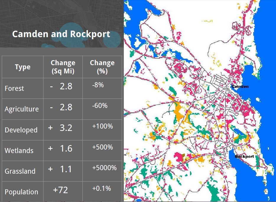
Increases in roads, buildings & parking lots from 1992 to 2011
Camden, Rockport Rockland Owls Head, South Thomaston

DETAILS
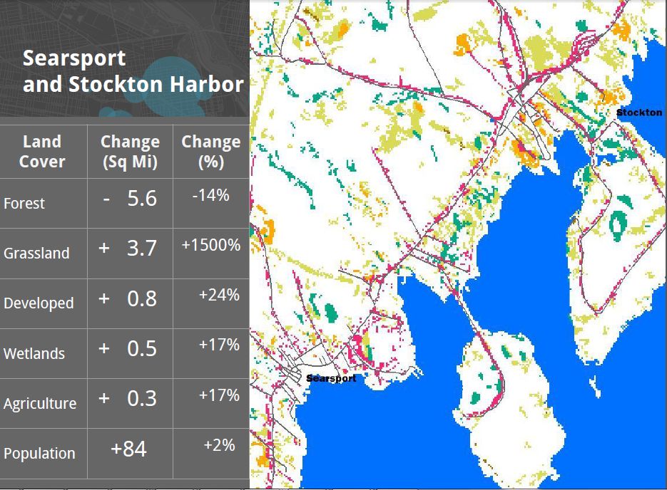
Population grew by 72, or 0.1 percent
White surfaces of map are unchanged
More details here
===========================================
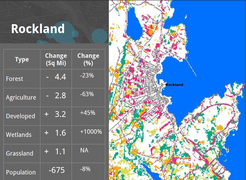
White surfaces of map are unchanged
More details here
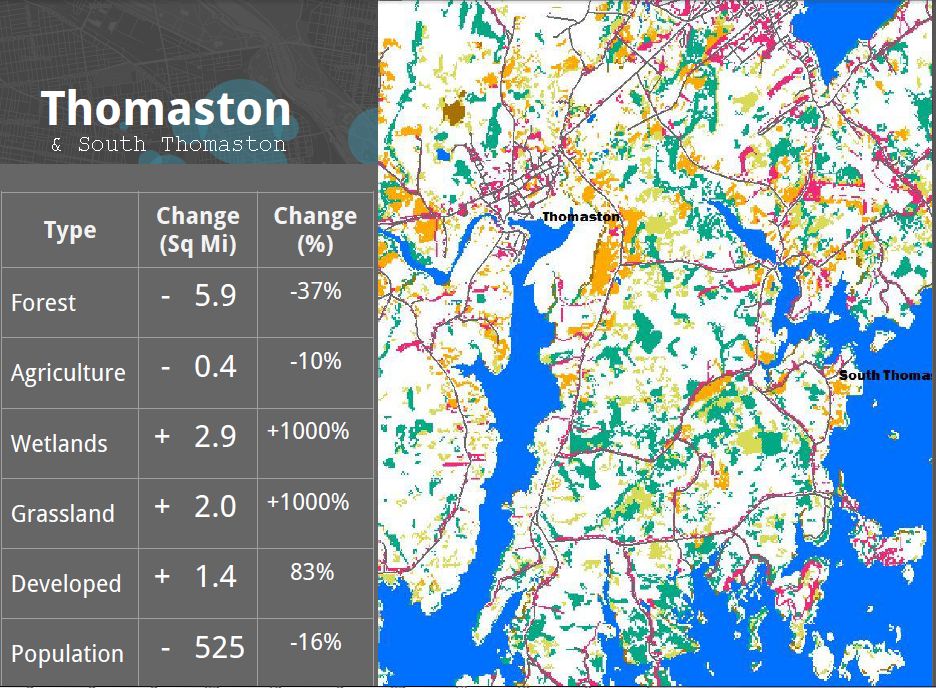
South Thomaston lost 40% of its forests. 6 sq miles. 80% increase in develop 1994-2011. An increase of 3 square miles of wetlands and 1 1/2 sq miles of developed land. 16% drop in population; a decline of 500 people.
 More details

The report was prepared by Kevin Frech, Azavea Intern, and recent Temple University graduate.


