July 24, 2007. The White House is currently delaying enactment of a final rule intended to protect the critically endangered North Atlantic Right Whale.
What's going on here? According to NOAA, the chief cause of accidental deaths of North Atlantic right whales is "ship strikes" i.e. being run over by oil tankers and other big vessels while drowsing away on the surface. Not lobster pot-warp entanglements, not fishing of any kind. The US and Canadian fishing fleets already have a brace of strictures on their operations to protect our cetacean relatives sharing the Gulf of Maine.
But big global trade vessels have big money, big lawfirms and big lobbyists to keep themselves as free of profit-threatening regulations as possible. These are the chief culprits. A little known administration bureaucracy, the "White House Office of Information and Regulatory Affairs" (OIRA) is holding things up. Under Executive Order 12866, issues by Clinton, all federal agencies have to run their new regulations past OIRA before it can go on the books and be enforced. OIRA looks at the regulation's costs and benefits. It is supposed to make its decisions swiftly
But in this case....Not! Read the details here as assembled by public interest watchdog group OMB Watch


Jul 21, 2007
Seal Island: ACOE, USFWS and other stakers recommend "Remedial Investigation & Feasibility Study

The latest communication from Army Corps of Engineers is promising:
"An RI/FS was recommended at this site due to past discovery of MEC and the MC risk associated with the COPECS"
Huh? Translated into plainer English below, but first the news: the Seal Island Site Inspection Report has been finalized "with concurrence of all stakeholders and regulators who participated with us in the process."
Okay. So what did they decide? In plainer English:
"A Remedial Investigation & Feasibility Study was recommended at this site due to past discovery of munitions and explosives of concern and the munitions constituents risk associated with chemicals of potential ecological concern" (see acronyms list, coming soon)

This is bad and good news:
Bad News: An initial quick& dirty onceover of the bombing range has revealed enough UXO to warrant developing a remediation plan. So yes, this outer Penobscot Bay gunnery range of an island is indeed contaminated.
The MK 15: most common UXO at Seal Island
Good news: The agencies and stakeholders have concurred that a plan should now be drawn up; a detailed plan for seeking out and removing or neutralizing UXO or MEC therefrom this former bombing range, which is identified on nautical charts as federal Danger Area 334.10.
The scuttle at a recent brownbagger in Army Corps of Engineers in Baltimore is that Army and DoD were talking last year about extending the scope of the area of concern to the waters the ranges out to the 125 contour (safe diving depth) eligible for cleanup; instead of the area within 100 yards of shore, (the present accepted limit.) This will be followed up on...
Now the heat is on the conservation/environmental community to act on behalf of Marine Maine down there, i.e. ensure the dangerous polluting munitions on the seafloor off Seal Island, steadily leaking into state waters and also washing ashore on nearby islands as the Gulf of Maine's currents tumble the underwater cache of UXO about is looked at, and appropriate remediation taken.
What's needed: Regional NGOs must step up to the plate.
Penobscot Bay is well-freighted with conservation and environmental non government organizations of all stripes. Commercial fisherfolk groups, coastal and island land trusts, regional environmental outfits. A shifting mosaic of grassroots groups in Maine coastal towns and cities rising and falling as they take on their particular NIMBY Nightmares.
It is historically been dififcult to impossible to draw Natural Resources Council of Maine down below the low tide line; those vast natural areas that make up Maine's state territorial sea must do without Brownie Carson's bands of merry men and women that fight the green fight so well on Maine's land and in Maine's freshwater rivers and lakes. Lukewarm interest so far. from Toxics Action Center.
So far. Time will tell. Get updated Seal Island info
Jul 11, 2007
Sears Island Joint Use Committee takes first steps. updated
Sears Island's Joint Use Planning Committee met July 11th.
See media coverage. The purpose of the two hour meeting, according to the agenda sent out by email, was to introduce JUPC members to each other, agree on ground rules for future JUPC meetings, and examine a draft “Scope of Work” paper from Maine DOT. The meeting was held at the Searsport town office from 10 am to noon.
According to a reliable source at the meeting, it went as follows:
Searsport town official Dianne Smith opened the meeting, praising the the attendees for their perserverance. “We've come farther than I ever thought we'd get,” she said.
Maine DOT commissioner David Cole spoke up “we're making history” he said. He said the Sears Island Committee was “one of the best I've ever worked with.”
James Gillway, Searsport town mgr, said that people have spoken to him and want the question settled.
Sierra Club representative Joan Saxe's cell phone loudly went off, annoyingly going through 8 or 9 rings before she could dig it out of her bag.
Senator Damon spoke up, noting that he had entered into the process late, but said he'd written to Governor Baldacci recently, praising “the tremendous amount of work” regarding “a tremendous asset and a tremendous natural resource.” He said he believed the two could be combined. “Every bit of our natural resources is important, and a port too.” he said.
The meeting participants ( see list below) agreed to adopt the groundrules of their predecessor group Sears Island Planning Initiative Steering Committee.
Then Duane Scott of Maine Department of Transportation presented his “Scope of Work” proposal. Calling it “a foundation” to work from he identified the following work priorities
(1) finalizing the buffer easement language
(2) fixing boundaries between the industrial zone and the natural zone
(3) Creating a new legal “Easement Deed”
(4) Deciding on Public Access Issues
(5) Develop a plan to provide revenue for the island for Searsport
(6) Mitigation options
Discussion followed.
Robert Grindrod,representing Montreal Maine railroad (formerly called Bangor and Aroostook Railroad) said setting out and fixing the boundaries must be done first. “
Grindrod says fix boundaries first. “Can't do anything without that.” he said.
DOT Commissioner Cole says with the 341 acres allocated to port usage “we have a core area to work with.”
Senator Damon said that the boundaries “shouldn't unduly constrain the permitting process”
Maine DOT's Duane Scott then talked about a state “mitigation bank”.
He said there were ten or eleven sites with “excess compensation credits”
Working with the feds as well ACOE, but he believed that the state could potentially have acquired
credit by agreeing not to develop the 600 acres of the island now to be kept free of industry.
Cole then read from a letter to the group from Aroostock County legislator and former paper industry official Rose Peletier, asking that SIJUPC members submit a thumbnail biography. “We can all learn from each other” Pelletier wrote.
Cole also noted that JUPC member Anne Crimaudo of Protect Sears Island is a former business executive who once helped save up trade agreements with China.
The question arose of committee transparency to the public.
“The DOT” Cole said, was being "as open as we can." Dianne Smith asked what do as a JUPC member if contacted by the media. Cole said “You speak for the committee.”
Bangor Daily News Journalist Tom Groening asked, “So who do I go to?”
Go to the state Sears Island website , Cole said. And to Duane Scott of Maine DOT.
Diane Smith wondered if sections of the meeting should be open to public participation?
Sandy Blitz said this sort of meeting should have a public session first then the meeting be limited to committee members for the rest of the meeting.
Grindrod expressed concern that if the public is let into the process “We'll be starting over.” he said. It would be “extremely unwise.”
See media coverage. The purpose of the two hour meeting, according to the agenda sent out by email, was to introduce JUPC members to each other, agree on ground rules for future JUPC meetings, and examine a draft “Scope of Work” paper from Maine DOT. The meeting was held at the Searsport town office from 10 am to noon.
According to a reliable source at the meeting, it went as follows:
Searsport town official Dianne Smith opened the meeting, praising the the attendees for their perserverance. “We've come farther than I ever thought we'd get,” she said.
Maine DOT commissioner David Cole spoke up “we're making history” he said. He said the Sears Island Committee was “one of the best I've ever worked with.”
James Gillway, Searsport town mgr, said that people have spoken to him and want the question settled.
Sierra Club representative Joan Saxe's cell phone loudly went off, annoyingly going through 8 or 9 rings before she could dig it out of her bag.
Senator Damon spoke up, noting that he had entered into the process late, but said he'd written to Governor Baldacci recently, praising “the tremendous amount of work” regarding “a tremendous asset and a tremendous natural resource.” He said he believed the two could be combined. “Every bit of our natural resources is important, and a port too.” he said.
The meeting participants ( see list below) agreed to adopt the groundrules of their predecessor group Sears Island Planning Initiative Steering Committee.
Then Duane Scott of Maine Department of Transportation presented his “Scope of Work” proposal. Calling it “a foundation” to work from he identified the following work priorities
(1) finalizing the buffer easement language
(2) fixing boundaries between the industrial zone and the natural zone
(3) Creating a new legal “Easement Deed”
(4) Deciding on Public Access Issues
(5) Develop a plan to provide revenue for the island for Searsport
(6) Mitigation options
Discussion followed.
Robert Grindrod,representing Montreal Maine railroad (formerly called Bangor and Aroostook Railroad) said setting out and fixing the boundaries must be done first. “
Grindrod says fix boundaries first. “Can't do anything without that.” he said.
DOT Commissioner Cole says with the 341 acres allocated to port usage “we have a core area to work with.”
Senator Damon said that the boundaries “shouldn't unduly constrain the permitting process”
Maine DOT's Duane Scott then talked about a state “mitigation bank”.
He said there were ten or eleven sites with “excess compensation credits”
Working with the feds as well ACOE, but he believed that the state could potentially have acquired
credit by agreeing not to develop the 600 acres of the island now to be kept free of industry.
Cole then read from a letter to the group from Aroostock County legislator and former paper industry official Rose Peletier, asking that SIJUPC members submit a thumbnail biography. “We can all learn from each other” Pelletier wrote.
Cole also noted that JUPC member Anne Crimaudo of Protect Sears Island is a former business executive who once helped save up trade agreements with China.
The question arose of committee transparency to the public.
“The DOT” Cole said, was being "as open as we can." Dianne Smith asked what do as a JUPC member if contacted by the media. Cole said “You speak for the committee.”
Bangor Daily News Journalist Tom Groening asked, “So who do I go to?”
Go to the state Sears Island website , Cole said. And to Duane Scott of Maine DOT.
Diane Smith wondered if sections of the meeting should be open to public participation?
Sandy Blitz said this sort of meeting should have a public session first then the meeting be limited to committee members for the rest of the meeting.
Grindrod expressed concern that if the public is let into the process “We'll be starting over.” he said. It would be “extremely unwise.”
Jul 6, 2007
Maine Fisheries & Community Based Resource Management : Can ecologically sensitive foxes really guard the marine henhouse?
Maine's mainstream marine conservation organizations have teamed up with several commercial fishing organizations to garner themselves collectively more than two million dollars to promote out what could be either an ecological and sociological triumph or a disaster.
The plan would put decisionmaking about exploitation of the NW Gulf of Maine's cod, haddock, pollock and other groundfish largely into the hands of committees made up of fishermen from Maine coastal communities.
Called Community Based Resource Management, the concept has its supporters and detractors.
But look what these folks below were just given to promote this:
Island Institute $396,328 Purpose
Penobscot East Resource Center $563,000 Purpose
The Ocean Conservancy $769,000 Purpose
Gulf of Maine Research Institute $467,000
Will they earn their pay?
Island Institute failed in its effort "This grant will focus on gaining approval by the New England Fishery Management Council (NEFMC) of an alternative to amend the Multispecies Fishery Management Plan."
Penobscot East's cash, too, fruitlessly sought "adoption of a plan by the New England Fishery Management Council for implementation of an area-based pilot project in the Downeast area of the Gulf of Maine"
For in June, the NEFMC said NO to the II's and PE's proposals. So there's $959,328.00 down the drain with nothing to show for it. Though one assumes some splendid private conferences at the finest of resorts, replete with catered chow, took place. Doubtless a few Individual Retirement Accounts got plumped up, and some handsome salaries paid out. But as far as CBFM goes, the New England Fishery Management won't even be looking at it before 2009, and no action could take place before 2012. It is safe to assume that the 2 million bucks will have petered out long before then, though the requisite coffee table book or two will have been published.
One thing is certain: unless these insular groups opens up to the broader community, CBRM is doomed to be as much a waste of time and money as the recent Maine Bay Management Initiative and the Task Force on Maine Aquaculture
So what IS Community-Based Fisheries Management?
You could try the explanation by Penobscot East. But I don't think you'll come out of it much the wiser. (manage cod like clams? huh?) So here's my take at it:
It's the benign version of the fox-guarding-the-chick-coop scenario.
In this case, the concept is of having ecologically sensitive foxes (local groundfish committees) guard the chicken coops (marine fish habitats), with the farm owner (Uncle Sam) stopping in from time to time and making sure the inventory shrinkage (commercial fishing) is within reasonable bounds and is not damaging the chicken coop (habitat) or its feed troughs (prey species) and drinking tanks (water quality.)
The idea loosely parallels the lobster fishing zone council concept, which set up local decisionmaking bodies at regional and community levels along the Maine coast in the 1990s. The groundfish area management committees (AMCs) would be established in those same towns and cities. But this time, each holder of a groundfishing license will have to choose which Gulf of Maine fishing grounds they ply their trade in.
But there are as many differences as similarities between lobsterfishing and groundfishing, ecologically, technologically and economically. So the articles, lectures, reports, websites and other literature on Community-Based Fisheries Management that these groups listed above are presently offering up for public consumption are big on rationales and broad concepts, but vague on details.
Stay Tuned...
The plan would put decisionmaking about exploitation of the NW Gulf of Maine's cod, haddock, pollock and other groundfish largely into the hands of committees made up of fishermen from Maine coastal communities.
Called Community Based Resource Management, the concept has its supporters and detractors.
But look what these folks below were just given to promote this:
Island Institute $396,328 Purpose
Penobscot East Resource Center $563,000 Purpose
The Ocean Conservancy $769,000 Purpose
Gulf of Maine Research Institute $467,000
Will they earn their pay?
Island Institute failed in its effort "This grant will focus on gaining approval by the New England Fishery Management Council (NEFMC) of an alternative to amend the Multispecies Fishery Management Plan."
Penobscot East's cash, too, fruitlessly sought "adoption of a plan by the New England Fishery Management Council for implementation of an area-based pilot project in the Downeast area of the Gulf of Maine"
For in June, the NEFMC said NO to the II's and PE's proposals. So there's $959,328.00 down the drain with nothing to show for it. Though one assumes some splendid private conferences at the finest of resorts, replete with catered chow, took place. Doubtless a few Individual Retirement Accounts got plumped up, and some handsome salaries paid out. But as far as CBFM goes, the New England Fishery Management won't even be looking at it before 2009, and no action could take place before 2012. It is safe to assume that the 2 million bucks will have petered out long before then, though the requisite coffee table book or two will have been published.
One thing is certain: unless these insular groups opens up to the broader community, CBRM is doomed to be as much a waste of time and money as the recent Maine Bay Management Initiative and the Task Force on Maine Aquaculture
So what IS Community-Based Fisheries Management?
You could try the explanation by Penobscot East. But I don't think you'll come out of it much the wiser. (manage cod like clams? huh?) So here's my take at it:
It's the benign version of the fox-guarding-the-chick-coop scenario.
In this case, the concept is of having ecologically sensitive foxes (local groundfish committees) guard the chicken coops (marine fish habitats), with the farm owner (Uncle Sam) stopping in from time to time and making sure the inventory shrinkage (commercial fishing) is within reasonable bounds and is not damaging the chicken coop (habitat) or its feed troughs (prey species) and drinking tanks (water quality.)
The idea loosely parallels the lobster fishing zone council concept, which set up local decisionmaking bodies at regional and community levels along the Maine coast in the 1990s. The groundfish area management committees (AMCs) would be established in those same towns and cities. But this time, each holder of a groundfishing license will have to choose which Gulf of Maine fishing grounds they ply their trade in.
But there are as many differences as similarities between lobsterfishing and groundfishing, ecologically, technologically and economically. So the articles, lectures, reports, websites and other literature on Community-Based Fisheries Management that these groups listed above are presently offering up for public consumption are big on rationales and broad concepts, but vague on details.
Stay Tuned...
Jul 1, 2007
Sears Island: SIPISC to SIJUPC
Sears Island Planning Initiative Steering Committee has morphed into the Sears Island Joint Use Planning Committee. The new group will meet at Union Hall in Searsport Wednesday, July 11, from 9-noon. While the some of the stakeholders have changed, the stakes remain as high as ever!
Earlier posts about the Sears Island port approval process Click Here
Sears Island almost became an LNG port in 2004
SIPISC reached an agreement in April, subsequently approved by legislature and governor, to split the island into a 600 acre natural area and a 341 acre commercial port zone. The SIPISC-ians okayed building an education center and parking lot on the island in the "natural " portion. They also authorized the state to solicit container port companies to develop and operate the port zone.
The JUPC meeting is expected to spend time developing its internal decisionmaking processes and establishing the exact borders between the two zones. Will the port proponents submit a proposal from a port wannabe corporation.
Members of the Sears Island Joint Use Planning Committee are:
Sandy Blitz, ex dir East-West Highway Association
Sara Bradford, 1st selectman Stockton Springs
David Cole, Maine DOT Commissioner
Anne Crimaudo, Protect Sears Island
Scott Dickerson, MCHT
Jim Freeman, president Friends of Sears Island, Maine Earth First!er
James Gillway, Searsport town mgr, former police chief
Robert Grindrod, Montreal Maine railroad former B&A
Rosaire Pelletier, Aroostook legislator
Bruce Probert, Searsport resident career exec retired from Sprague
Joan Saxe, Maine Sierra Club
Dianne Smith, Town of Searsport
Eliza Townsend, Maine Dept of Conservation
Bob Ziegelaarm Maine Port Authority, Telford Aviation
Steve Miller, Islesboro Island Land Trust
Alternates are
Becky Bartovics , Penobscot Bay Alliance and
James Therriault, Sprague Eneregy
Earlier posts about the Sears Island port approval process Click Here
Sears Island almost became an LNG port in 2004
SIPISC reached an agreement in April, subsequently approved by legislature and governor, to split the island into a 600 acre natural area and a 341 acre commercial port zone. The SIPISC-ians okayed building an education center and parking lot on the island in the "natural " portion. They also authorized the state to solicit container port companies to develop and operate the port zone.
The JUPC meeting is expected to spend time developing its internal decisionmaking processes and establishing the exact borders between the two zones. Will the port proponents submit a proposal from a port wannabe corporation.
Members of the Sears Island Joint Use Planning Committee are:
Sandy Blitz, ex dir East-West Highway Association
Sara Bradford, 1st selectman Stockton Springs
David Cole, Maine DOT Commissioner
Anne Crimaudo, Protect Sears Island
Scott Dickerson, MCHT
Jim Freeman, president Friends of Sears Island, Maine Earth First!er
James Gillway, Searsport town mgr, former police chief
Robert Grindrod, Montreal Maine railroad former B&A
Rosaire Pelletier, Aroostook legislator
Bruce Probert, Searsport resident career exec retired from Sprague
Joan Saxe, Maine Sierra Club
Dianne Smith, Town of Searsport
Eliza Townsend, Maine Dept of Conservation
Bob Ziegelaarm Maine Port Authority, Telford Aviation
Steve Miller, Islesboro Island Land Trust
Alternates are
Becky Bartovics , Penobscot Bay Alliance and
James Therriault, Sprague Eneregy
Jun 18, 2007
Bombs Away From Penobscot Bay - Seal Island cleanup priority rises
The Seal Island parties of interest met last Monday. It was a small party, though: US Army Corps of Engineers, US Fish and Wildlife, Maine DEP. While invited to attend as observer, I was unable to make it to Portland.
Word from Ted Wolfe in Maine DEP's Division of Remediation is that his agency
"...shares your concern regarding any potentially unexploded ordinance in the waters surrounding the island. " Wolfe is confident however, that "as the site moves through the established investigative process, these issues will be discussed."
Also noted was the success that Maine DEP and US Fish and Wildlife (specifically the Maine Coastal Islands National Wildlife refuge, of which Seal Island is part) had in convincing the Corps of Engineers to uptick Seal Island's priorities score in the review process, virtually ensuring that a cleanup of some sort will indeed be carried out.
Word from Ted Wolfe in Maine DEP's Division of Remediation is that his agency
"...shares your concern regarding any potentially unexploded ordinance in the waters surrounding the island. " Wolfe is confident however, that "as the site moves through the established investigative process, these issues will be discussed."
Also noted was the success that Maine DEP and US Fish and Wildlife (specifically the Maine Coastal Islands National Wildlife refuge, of which Seal Island is part) had in convincing the Corps of Engineers to uptick Seal Island's priorities score in the review process, virtually ensuring that a cleanup of some sort will indeed be carried out.
Next up: developing a Remedial Investigation/Feasibility Study An RI/FS is a geophysical survey performed to characterize a suspected UXO area, develop a sampling strategy to characterize areas suspected of containing UXO, and use the info garnered to come up with a site-specific response action. The decision as to whether or not the seafloor around Seal Island will be cleaned up will take place during this process. RI/FS's are also used for organizing cleanups at nuclear wastes sites.
The draft Remedial Investigation/Feasibility Study will then made available for public comment to get input on the potential response and on reasonably anticipated future uses. After the Corps of Engineers has responded to the public comments, the response action is finalized in a Record of Decision (ROD) or Decision Document (DD), and, presuming funds available, gets carried out.
Citizens need to be involved in this process. The agencies welcome such participation.
The draft Remedial Investigation/Feasibility Study will then made available for public comment to get input on the potential response and on reasonably anticipated future uses. After the Corps of Engineers has responded to the public comments, the response action is finalized in a Record of Decision (ROD) or Decision Document (DD), and, presuming funds available, gets carried out.
Citizens need to be involved in this process. The agencies welcome such participation.
Jun 15, 2007
Seal Island clean up: out of sight, out of money, out of mind.

The congressionally funded interagency group planning the cleanup of bomb waste from two marine islands off Maine used for bombing practice during WW2 and Korean War, may have the will, but not the way, to actually search for and clean up the suspected thousands of rounds of cannon shells and rockets that trainee pilots rained upon, not these islands themselves, but the hundreds of acres of seafloor surrounding them. To this day, aging bombs and rockets continue to wash ashore from this ghostly undersea cache.
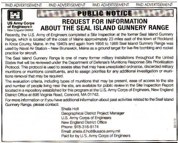
But the 'Cleanup' as presently planned ignores this toxic hoard. See the official public notice
The word from the two program managers running the planning project - Sheila Holt of US Army Corps of Engineers and Ted Wolfe of Maine DEP - is that despite the suspected presence of 100s of bombs and rockets on the seafloor around the island, and the near total absence of ordnance remaining on the island itself, the Seal Island munitions cleanup will be restricted to topside. or at most the intertidal areas.
Above the tideline only? Why? After all, several generations of student bomber-trainees frequently missed the slender W-shaped island during their practice bombing runs.
The agencies' explanation -- waters too deep round the island for scuba-diving UXO hunters-- doesn't...ahem... hold water.
At least one third of the seafloor (about 2 square miles) in the munitions danger area is less then 120 feet deep, the diving depth limit set out in the federal Munitions Response Site Protocol.
Regardless, the plan being worked out for possible adoption this month would set a no-dive precedent for cleanup of ex-bomb range islands in marine waters. Duck Island, in the Maine part of the Isles of Shoals archipelago, comes next, and then other marine islands that were used for bombing practices off the US coast.
BOTTOM LINE?
A cleanup program that excludes mapping and cleaning up marine bomb waste from seafloors adjacent to island bomb ranges is unacceptable.
WHAT YOU CAN DO
Contact the federal and state leaders of the project. (See contact info below).
Explain that it is
their duty under the Protocol to evaluate and clean up submerged unexploded ordnance in the public waters around Seal Island. The plan should not be finalized until it includes this activity.
Remind them that
* At least a third of the seafloor within the Seal Island Danger Area is shallower than 120 feet, the official safe scuba diving limit set by the federal government for UXO cleanups;
* UXO continues to wash ashore the island from these waters.
* Fishermen continue to report encounters with unexploded ordnance in the vicinity.
Who to contact:
Sheila Holt
Geographical District Project Manager
U.S. Army Corps of Engineers
New England District 696 Virginia Road Concord , MA 01742-2751
Phone: 978-318-8174
Email: shiela.d.holt AT usace.army.mil
&
Ted Wolfe
Program manager
Military Munitions Response Program
Bureau of Remediation and Waste management
Maine Department of Environmental Protection
Phone: 207-287-2651 or 287-8552
E-mail: Theodore.E.Wolfe AT maine.gov
Getting your concerns on the record quickly is critical. Be brief and to the point. The draft plan goes before the cleanup committee on Monday June 11th, The two officials above need to have things emailed to them before the close of that day, if not sooner.
Jun 9, 2007
Seal Island munitions "cleanup" plan leaves 100s of bombs behind.
Updated June 14, 2007.Out of sight, out of money, out of mind.
The congressionally funded interagency group planning the cleanup of bomb waste from two marine islands off Maine used for bombing practice during WW2 and Korean War, may have the will, but not the way, to actually search for and clean up the suspected thousands of rounds of cannon shells and rockets that trainee pilots rained upon, not these islands themselves, but the hundreds of acres of seafloor surrounding them. To this day, aging bombs and rockets continue to wash ashore from this ghostly undersea cache.
But the 'Cleanup' as presently planned ignores this toxic horde. See the official public notice
The word from the two program managers running the planning project - Sheila Holt of US Army Corps of Engineers and Ted Wolfe of Maine DEP - is that despite the suspected presence of 100s of bombs and rockets on the seafloor around the island, and the near total absence of ordnance remaining on the island itself, the Seal Island munitions cleanup will be restricted to topside. or at most the intertidal areas.
Above the tideline only? Why? After all, several generations of student bomber-trainees frequently missed the slender W-shaped island during their practice bombing runs. To this day, scores of bay-area fishermen can recount encounters with sunken ordnance during their careers.
The agencies' explanation -- waters too deep round the island for scuba-diving UXO hunters-- doesn't...ahem... hold water.
At least one third of the seafloor (about 2 square miles) in the munitions danger area is less then 120 feet deep, the diving depth limit set out in the federal Munitions Response Site Protocol.
Regardless, the plan being worked out for possible adoption this month would set a no-dive precedent for cleanup of ex-bomb range islands in marine waters. Duck Island, in the Maine part of the Isles of Shoals archipelago, comes next, and then other marine islands that were used for bombing practices off the US coast.
BOTTOM LINE?
A cleanup program that excludes mapping and cleaning up marine bomb waste from seafloors adjacent to island bomb ranges is unacceptable.
WHAT YOU CAN DO
Contact the federal and state leaders of the project. (See contact info below).
Explain that it is their duty under the Munitions Response Site Protocol to evaluate and clean up submerged unexploded ordnance in the public waters around Seal Island. The plan should not be finalized until it includes this activity.
Remind them that
* At least a third of the seafloor within the Seal Island Danger Area is shallower than 120 feet, the official safe scuba diving limit set by the federal government for UXO cleanups;
* UXO continues to wash ashore the island from these waters.
* Fishermen continue to report encounters with unexploded ordnance in the vicinity.
Who to contact:
Sheila Holt
Geographical District Project Manager
U.S. Army Corps of Engineers
New England District 696 Virginia Road Concord , MA 01742-2751
Phone: 978-318-8174
Email: shiela.d.holt AT usace.army.mil
&
Ted Wolfe
Program manager
Military Munitions Response Program
Bureau of Remediation and Waste management
Maine Department of Environmental Protection
Phone: 207-287-2651 or 287-8552
E-mail: Theodore.E.Wolfe AT maine.gov
Getting your concerns on the record quickly is critical. Be brief and to the point. The draft plan goes before the cleanup committee on Monday June 11th, The two officials above need to have things emailed to them before the close of that day, if not sooner.
Jun 8, 2007
Seal Island Bomb Range cleanup planners to meet Monday in Portland.

Seal Island is about 6 miles east of Matinicus Island. The mile-long W-shaped island had thousands of artillery shells and rockets rained upon it by trainee pilots during World War Two and the Korean war. About Seal Island
An interagency group meets Monday in Portland, using funds that
Congress recently appropriated for a federal/state joint effort to survey first this old marine gunnery range, home now to seals and seabirds, for unexploded ordnance (UXO) and other military wastes, and, using the Munitions Response Site Prioritization Protocol, decide what form of cleanup, if any, to do. About UXO. (DoD website) .
This protocol "is used to assess sites that may have unexploded ordnance, discarded military munitions or munitions constituents, and to assign priorities for any additional investigation or munitions removal that may be required."
According to MDEP military munitions cleanup specialist Ted Wolfe, a brush fire that swept the island several years ago cooked off most of the unexploded ordnance; wave action, however, continues to bring additional UXO ashore from the many bombs and rockets that fell short of the island during training exercises. Area fishing history is rich with stories of encounters with UXO around Seal Island.
Despite this identification of the island's nearshore waters as a continuing source of explosive ordnance, cleanup planning has focused solely on UXO wastes above the tideline; the depth of water around the island apparently makes removal of submerged UXO problematic.
A Plan Development Team will give a presentation to the June 11th meeting of state and federal agencies in Portland. According to project manager Sheila Holt of the Army Corps of Engineers, the planning process has moved along swiftly; there are high hopes that the evaluation and cleanup of Seal Island's miltary wastes will serve as a prototype for further marine gunnery range cleanups in other ocean locations around the United States.
The next assessment site will be Duck Island, Maine, Isles of Shoals; it, too was used as a naval aircraft bombing target area.
May 28, 2007
Rockland Harbor Lobsterfishery - Saved from Marina Sprawl


Amazing but true: Maine Department of Environmental Protection actually PROTECTED a nearshore lobster ground and scenic shoreline from marina sprawl. And this despite the vigorous efforts of Governor Baldacci's brother Robert to sway the agency's permit reviewer on behalf of the lawfirm representing the pier wannabe, Samorock LLC.
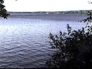
A unique bit of Maine's coastal waters, the north end of Rockland Harbor is rich with lobsters, free of marinas, and has only a tiny scattering a private piers. The shallow waters are filled with eelgrass meadows, kelp forests, coralline algae, lobster burrows.mussel beds and more.
Just as important, large areas are free of moorings - the bane of bottom habitat. (the heavy chains at the lower end of the mooring sweep round and round the mooring stone, clearing away kelp and eelgrass, and flattening lobster, shrimp and seaworm burrows)
Mooring fields, as cover much of Rockland Harbor and other increasingly crowded harbors along the midcoast, have contributed to the desertification of otherwise highly bio-productive protected shallow waters. With this removal of living seafloor habitats comes a diminution of lobster productivity.
So praise to Maine DEP and especially to Jim Cassida and ex-MDEP-er Lisa Kay Keene, for taking the lobstermen's concerns seriously and for upholding the laws and regulations protecting our irreplaceable coastal scenery from ruination.
Kudos too, of course to Arthur Johnson and the other lobstermen who stood up for their fishing ground. If they hadn't, the pier proposal very likely would have been approved, and this would have become a thing of the past!
A hearty bronx cheer, on the other hand, to Maine's Historic Preservation Commission, Maine Natural Heritage Program, Maine Department of Marine Resources, Maine Department of Inland Fish and Wildlife, US Army Corps of Engineers, Friends of the Rockland Breakwater Lighthouse for kowtowing to big business and declaring that marina sprawl in the north end would have no ecological or other impacts.
Apr 25, 2007
Sears Island - end of one committee, start of another!
On April 27, 2007, (Friday morning), the Sears Island Planning Initiative committee holds its final meeting at Searsport Town Hall. From 9 a.m. to 3 p.m. The future of Maine's biggest natural undeveloped non-park island may well hinge on what gets decided then and there, as a brand new committee, sworn to abide by the findings of its now-nearly-defunct predecessor, rises phoenix-like from the ashes of what is feared could be disharmony over two alternatives.
Two key purposes to the meeting, according to a recent email from the quartet that has been running the year long committee: Jonathan Reitman, the hired facilitator, Karin Tilberg, Office of the Governor, Dianne Smith, Town of Searsport, Sue Inches, State Planning Office.
(1) the group of stakeholders that has taken part in this year of meetings will take a last stab at "harmonizing" the still divergent points of view that split them. Two "draft consensus agreements" have been emailed to committee members. Will one, the other or a mixture emerge? Or none?
Daunting: the committee includes cargo port builder wannabes, upper bay town governments, earth first!, land trusts, several grassroots activist groups, shipping and piloting companies, and more.
But don't worry if you can't create a useable synthesis on your own; a subcommittee has been working up such a document and will present it at the Friday meeting. Reitman says that it "harmonizes and reconciles all previous drafts". Really? Hope springs eternal...
(2) A 'Joint Use Planning Committee', with "balanced representation of port development and conservation perspectives" is being set up to further these harmonized, reconciled goals --whatever they be. Nominees are being sought. Reitman says: "If any of you have potential nominees for that group who would represent a particular perspective and who are willing to serve, please send those names to Jonathan as soon as possible (jreitman@blazenetme.net)."
However, the notices makes it clear that to be on the committee, one must support the planned consensus, which may be summarized, perhaps overkindly, as:
"A Sears Island port if necessary, but not necessarily a Sears Island port."
Risky, what? Who decides if a port is necessary on this wild island off Searsport, or simply desirable to some group of interests?
Two key purposes to the meeting, according to a recent email from the quartet that has been running the year long committee: Jonathan Reitman, the hired facilitator, Karin Tilberg, Office of the Governor, Dianne Smith, Town of Searsport, Sue Inches, State Planning Office.
(1) the group of stakeholders that has taken part in this year of meetings will take a last stab at "harmonizing" the still divergent points of view that split them. Two "draft consensus agreements" have been emailed to committee members. Will one, the other or a mixture emerge? Or none?
Daunting: the committee includes cargo port builder wannabes, upper bay town governments, earth first!, land trusts, several grassroots activist groups, shipping and piloting companies, and more.
But don't worry if you can't create a useable synthesis on your own; a subcommittee has been working up such a document and will present it at the Friday meeting. Reitman says that it "harmonizes and reconciles all previous drafts". Really? Hope springs eternal...
(2) A 'Joint Use Planning Committee', with "balanced representation of port development and conservation perspectives" is being set up to further these harmonized, reconciled goals --whatever they be. Nominees are being sought. Reitman says: "If any of you have potential nominees for that group who would represent a particular perspective and who are willing to serve, please send those names to Jonathan as soon as possible (jreitman@blazenetme.net)."
However, the notices makes it clear that to be on the committee, one must support the planned consensus, which may be summarized, perhaps overkindly, as:
"A Sears Island port if necessary, but not necessarily a Sears Island port."
Risky, what? Who decides if a port is necessary on this wild island off Searsport, or simply desirable to some group of interests?
Apr 24, 2007
Maine eels! Protect them lest they go extinct!
Come to the state legislature Wednesday April 25th at 1pm. and speak about "An Act To Protect Native Diadromous Fish during Their Migration"
Eels are vanishing from Maine waters. Maine DEP knows that power turbines and other impacts are the reason why, but shirks its responsibility to protect. This bill both clamps shut major loopholes that let the power industry get away with turning eels to mincemeat AND gives citizens the right to stand up for the eels.
Details below from Friends of Merrymeeting Bay Contact Ed Friedman @ 666-3372 or email at edfomb@gwi.net
"PLEASE COME & TESTIFY Wednesday April 25th 1pm.
WHAT: Joint Public Hearing before two legislature committees at once: Marine Resources and Natural Resources.
WHERE: Room 214, Cross Office Building Augusta
Bill summary from FOMB: This bill requires that dams in this State in all classifications of fresh and estuarine surface waters must provide safe and effective upstream and downstream passage for indigenous diadromous fish. Diadromous fish are those that migrate from fresh to sea water or sea water to fresh water and are known as anadromous and catadromous fish, such as alewives, shad and salmon. It also provides a process for any person to bring a civil action against violators of the requirements.
WHY The BEP is headed towards a probable abdication of its responsibilities in their response to our petitions. It's up to the legislature to hear our cry and that of our fish and fishermen.
Eels are vanishing from Maine waters. Maine DEP knows that power turbines and other impacts are the reason why, but shirks its responsibility to protect. This bill both clamps shut major loopholes that let the power industry get away with turning eels to mincemeat AND gives citizens the right to stand up for the eels.
Details below from Friends of Merrymeeting Bay Contact Ed Friedman @ 666-3372 or email at edfomb@gwi.net
"PLEASE COME & TESTIFY Wednesday April 25th 1pm.
WHAT: Joint Public Hearing before two legislature committees at once: Marine Resources and Natural Resources.
WHERE: Room 214, Cross Office Building Augusta
Bill summary from FOMB: This bill requires that dams in this State in all classifications of fresh and estuarine surface waters must provide safe and effective upstream and downstream passage for indigenous diadromous fish. Diadromous fish are those that migrate from fresh to sea water or sea water to fresh water and are known as anadromous and catadromous fish, such as alewives, shad and salmon. It also provides a process for any person to bring a civil action against violators of the requirements.
WHY The BEP is headed towards a probable abdication of its responsibilities in their response to our petitions. It's up to the legislature to hear our cry and that of our fish and fishermen.
Apr 18, 2007
Penobscot Bay Foghorn Duet - Now on CD
Listen to the haunting call-and-chant of two great lighthouse horns guarding the rocky entry to Penobscot Bay's Rockland Harbor one cool thick-fogged spring morning hour. Enjoy a minute-long mp3 sample.
Joining the foghorns in song, a departing fishing boat and arriving ferry meld their own cries with those of gulls and songbirds, underlain by the wash and gurgle of the Gulf of Maine beating time on the stony Owls Head shore below. An hour long hybrid symphony of humanity reaching out to Nature, and Her eternal reply.
Order an hour of eternity, while helping protect Penobscot Bay from pollution and marina sprawl: click here for ordering details
Joining the foghorns in song, a departing fishing boat and arriving ferry meld their own cries with those of gulls and songbirds, underlain by the wash and gurgle of the Gulf of Maine beating time on the stony Owls Head shore below. An hour long hybrid symphony of humanity reaching out to Nature, and Her eternal reply.
Order an hour of eternity, while helping protect Penobscot Bay from pollution and marina sprawl: click here for ordering details
MDEP nixes Samoset pier! Rockland Breakwater lobstering saved!
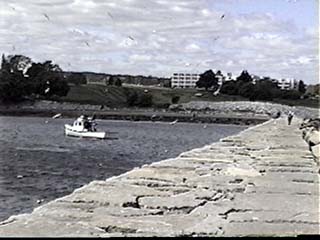
Rockland harbor lobstering, recreational fishing saved from resort pier plan.
Maine Department of Environmental Protection has rejected a proposal by Samorock to build a 550 foot pier in the scenic and fishery-rich waters adjacent to the Rockland Breakwater. The agency cited impacts to irreplaceable scenic resources, and noted the proposal's potential impacts to existing lobstering, recreational fishing and swimming uses of the site.

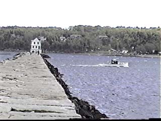
Maine DEP permit reviewer James Cassida wrote today: " The denial was issued by the Department on April 12th."
Rockland harbor lobsterman Arthur Johnson said "A lot of fishermen depend on Rockland harbor for their living. This is prime fishing area and next to a National Historic Landmark. This area should be protected forever from development of this type."
This marks the second time opponents of Samoset's pier plans have prevailed.
The city of Rockland's harbor commission has received a proposal to zone the harbor waters near the breakwater as a lobster fishing area. This would prevent future attempts at encroachment by marina sprawl wannabes.
Samoset has threatened to block public access to the historic breakwater if it didn't get its way. It is also seeking a zoning change from the city of Rockland allowing it to double the density of condominiums it has proposed to build near the breakwater.
Fat chance on either!
Apr 12, 2007
Sturgeon are surging!. On Aril 25th help them and all Maine's migratory fishes.
Friends of Marymeeting Bay urges your help in supporting a bill tto bring to a decent end the struggle to free from river blocking dams, the eels, shad and salmon that naturally migrate in and out of the Kennebec, Penobscot, and other Maine rivers, as do many other species.
On April 25 at one pm in the state house, it all comes to a boil, with a joint
Marine Resources and Natural Resources Committees hearing 4/25 at 1pm on
LD 1528: An Act To Protect Native Diadromous Fish during Their Migration.
If passed, Maine state law will read:
38 MRSA §465, sub-§5. All waters. Dams in all classifications of fresh and estuarine surface waters must provide safe and effective upstream and downstream passage for indigenous anadromous and catadromous migratory fish, including eels. For every day this fish passage is not in effect, the dam owner may be automatically fined not less than $1,000 by the department or other appropriate state agency.
The official bill summary reads: "This bill requires that dams in this State in all classifications of fresh and estuarine surface waters must provide safe and effective upstream and downstream passage for indigenous diadromous fish. Diadromous fish are those that migrate from fresh to sea water or sea water to fresh water and are known as anadromous and catadramous fish, such as alewives, shad and salmon. It also provides a process for any person to bring a civil action against violators of the requirements."
Contact Ed Friedman of Friends of Merrymeeting Bay for more info. edfomb AT gwi.net
On April 25 at one pm in the state house, it all comes to a boil, with a joint
Marine Resources and Natural Resources Committees hearing 4/25 at 1pm on
LD 1528: An Act To Protect Native Diadromous Fish during Their Migration.
If passed, Maine state law will read:
38 MRSA §465, sub-§5. All waters. Dams in all classifications of fresh and estuarine surface waters must provide safe and effective upstream and downstream passage for indigenous anadromous and catadromous migratory fish, including eels. For every day this fish passage is not in effect, the dam owner may be automatically fined not less than $1,000 by the department or other appropriate state agency.
The official bill summary reads: "This bill requires that dams in this State in all classifications of fresh and estuarine surface waters must provide safe and effective upstream and downstream passage for indigenous diadromous fish. Diadromous fish are those that migrate from fresh to sea water or sea water to fresh water and are known as anadromous and catadramous fish, such as alewives, shad and salmon. It also provides a process for any person to bring a civil action against violators of the requirements."
Contact Ed Friedman of Friends of Merrymeeting Bay for more info. edfomb AT gwi.net
Apr 7, 2007
Rockland Breakwater - DEP's draft denial and the final comment countdown!
It's only four days until the Maine DEP pounds the last nail into the coffee of the undead Samoset Pier. Help them swing the mallet by sending them your comments by close of business April 11, 2007. Email them to
James.Cassida(AT)maine.gov Use subject line: Samorock Pier application.
Below is an article by Melissa Waterman from the latest issue of Free Press Online summing up where things stand. Let Jim know that the pier would unacceptably and permanently degrade the water quality of the lobster-rich ecosystem of the northern end of Rockland Harbor.
DEP Issues Draft Denial of Samoset’s Pier Application
— by Melissa Waterman
Maine’s Department of Environmental Protection (DEP) has issued a preliminary denial of Samoset Resort’s application to construct a 12-foot-wide, 550-foot wooden pier, 50-foot ramp and 140-float system off its property in Rockland. According to Jim Cassida, Licensing Coordinator within the Bureau of Land and Water Quality in the Maine Department of Environmental Protection, “This is a draft denial, typical in larger projects. It allows all interested parties to review and comment. It’s the final opportunity for the applicant to overcome the objections contained in the draft denial.”
At the request of Samorock LLC, which owns the Samoset, DEP has extended the comment period on the draft to April 11. A final decision will not be issued until some time after that comment period is over. Appeals of final decisions go to the Board of Environmental Protection. “It is rare for an appeal to happen, but I fully expect an appeal in this case,” said Cassida.
The draft denial concluded that the proposed activity would “unreasonably interfere with existing scenic, aesthetic, recreational, and navigational uses,” and “would unreasonably harm a significant wildlife habitat.”
Following are excerpts from the findings in the preliminary denial:
“After reviewing the evidence in the record and viewing the project site, the Department finds that there is at least one practicable alternative to the project that would be less damaging to the environment. In particular, the applicant could use the existing marina facilities within Rockland Harbor as well as their existing ramp and float located on the breakwater. The applicant could provide a shuttle service to the marina facilities within Rockland Harbor and a harbor shuttle to transport residents and guests of the Samoset Resort to and from their boats located on a mooring within the established mooring area in Rockland Harbor.… Given that the construction of the proposed pier, ramp and float would result in a permanent loss of wetland area, as well as additional impacts to the wetland; and that the applicant has access to the water through existing marina facilities within close proximity to the development site, the Department finds that the applicant has not adequately demonstrated avoidance of impacts to the coastal wetland....
“IF&W [Inland Fisheries & Wildlife] stated that the construction of a pier, ramp and float system at this location will result in a loss of habitat functions and values. However, IF&W views that loss of habitat functions and values as not having an unreasonable impact to wildlife habitat.... The Maine Department of Marine Resources (DMR) commented that some loss of habitat functions and values may occur through displacement of the traditional lobster fishing area. However, DMR concluded that the proposal for a pier at this location would not have an unreasonable adverse impact on marine habitat.... Given that the construction of the proposed pier would result in a loss of habitat functions and value; and that the applicant has boating access to the water through its already existing structure and could have access through facilities within the Rockland anchorage, the Department finds that the applicant has not adequately demonstrated avoidance of impacts to marine wildlife and fisheries habitat.”
“…The Department has determined that two of the scenic vistas examined will be significantly adversely affected through construction of the proposed 740-foot pier, ramp and float. The scenic impact will occur to views from the Marie H. Reed Memorial Park, which serves as the primary access point for the public to the Rockland breakwater and the harbor/beach area at the base of the proposed pier....
“In consideration of these criteria the Department finds that the applicant has failed to demonstrate that the proposed pier, ramp and float will not dominate the landscape from the public viewpoint at both Marie H. Reed Park and the beach/harbor area at the base of the proposed pier structure. For the users of the coastal wetland, such as people walking along the intertidal area, and boaters, the pier would be a significant visual intrusion, traversing the entire width of the intertidal area. While persons walking the intertidal area would be able to pass beneath the dock, the dock would dominate the landscape and partially obstruct and/or fragment the view along the intertidal area towards the Rockland breakwater and across Rockland Harbor, significantly detracting from the visual and aesthetic quality of the resource and thereby interfering with this use of the coastal wetland. Additionally, the proposed pier, ramp and float will displace some traditional fishing area resulting in an impact on this traditional use and navigation within this portion of Rockland Harbor.”
James.Cassida(AT)maine.gov Use subject line: Samorock Pier application.
Below is an article by Melissa Waterman from the latest issue of Free Press Online summing up where things stand. Let Jim know that the pier would unacceptably and permanently degrade the water quality of the lobster-rich ecosystem of the northern end of Rockland Harbor.
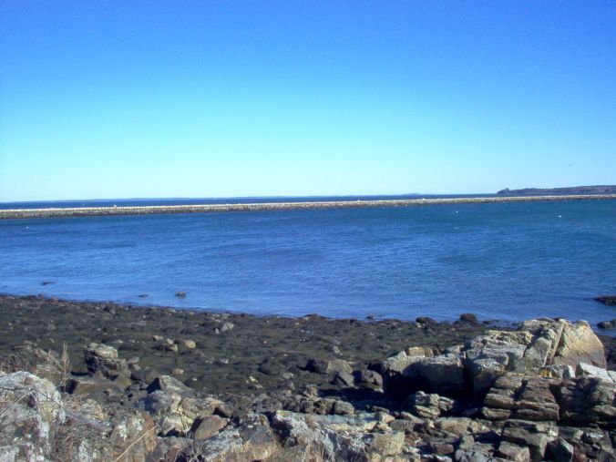
DEP Issues Draft Denial of Samoset’s Pier Application
— by Melissa Waterman
Maine’s Department of Environmental Protection (DEP) has issued a preliminary denial of Samoset Resort’s application to construct a 12-foot-wide, 550-foot wooden pier, 50-foot ramp and 140-float system off its property in Rockland. According to Jim Cassida, Licensing Coordinator within the Bureau of Land and Water Quality in the Maine Department of Environmental Protection, “This is a draft denial, typical in larger projects. It allows all interested parties to review and comment. It’s the final opportunity for the applicant to overcome the objections contained in the draft denial.”
At the request of Samorock LLC, which owns the Samoset, DEP has extended the comment period on the draft to April 11. A final decision will not be issued until some time after that comment period is over. Appeals of final decisions go to the Board of Environmental Protection. “It is rare for an appeal to happen, but I fully expect an appeal in this case,” said Cassida.
The draft denial concluded that the proposed activity would “unreasonably interfere with existing scenic, aesthetic, recreational, and navigational uses,” and “would unreasonably harm a significant wildlife habitat.”
Following are excerpts from the findings in the preliminary denial:
“After reviewing the evidence in the record and viewing the project site, the Department finds that there is at least one practicable alternative to the project that would be less damaging to the environment. In particular, the applicant could use the existing marina facilities within Rockland Harbor as well as their existing ramp and float located on the breakwater. The applicant could provide a shuttle service to the marina facilities within Rockland Harbor and a harbor shuttle to transport residents and guests of the Samoset Resort to and from their boats located on a mooring within the established mooring area in Rockland Harbor.… Given that the construction of the proposed pier, ramp and float would result in a permanent loss of wetland area, as well as additional impacts to the wetland; and that the applicant has access to the water through existing marina facilities within close proximity to the development site, the Department finds that the applicant has not adequately demonstrated avoidance of impacts to the coastal wetland....
“IF&W [Inland Fisheries & Wildlife] stated that the construction of a pier, ramp and float system at this location will result in a loss of habitat functions and values. However, IF&W views that loss of habitat functions and values as not having an unreasonable impact to wildlife habitat.... The Maine Department of Marine Resources (DMR) commented that some loss of habitat functions and values may occur through displacement of the traditional lobster fishing area. However, DMR concluded that the proposal for a pier at this location would not have an unreasonable adverse impact on marine habitat.... Given that the construction of the proposed pier would result in a loss of habitat functions and value; and that the applicant has boating access to the water through its already existing structure and could have access through facilities within the Rockland anchorage, the Department finds that the applicant has not adequately demonstrated avoidance of impacts to marine wildlife and fisheries habitat.”
“…The Department has determined that two of the scenic vistas examined will be significantly adversely affected through construction of the proposed 740-foot pier, ramp and float. The scenic impact will occur to views from the Marie H. Reed Memorial Park, which serves as the primary access point for the public to the Rockland breakwater and the harbor/beach area at the base of the proposed pier....
“In consideration of these criteria the Department finds that the applicant has failed to demonstrate that the proposed pier, ramp and float will not dominate the landscape from the public viewpoint at both Marie H. Reed Park and the beach/harbor area at the base of the proposed pier structure. For the users of the coastal wetland, such as people walking along the intertidal area, and boaters, the pier would be a significant visual intrusion, traversing the entire width of the intertidal area. While persons walking the intertidal area would be able to pass beneath the dock, the dock would dominate the landscape and partially obstruct and/or fragment the view along the intertidal area towards the Rockland breakwater and across Rockland Harbor, significantly detracting from the visual and aesthetic quality of the resource and thereby interfering with this use of the coastal wetland. Additionally, the proposed pier, ramp and float will displace some traditional fishing area resulting in an impact on this traditional use and navigation within this portion of Rockland Harbor.”
Mar 5, 2007
Catching lobsters with a dragger on the Maine coast.
Catching Lobsters with a groundfish trawler along the Maine coast
Click this link for photographs from two successive "tows" of dragging gear by the Maine/New Hampshire trawl survey in the waters of outer Penobscot Bay--from the initial haul-in of the net to the dumping out of the (primarily) lobster catches.
(Excerpted from Maine Department of Marine Resources annual trawl surveys of the state's marine waters. 2000 footage.)
Click this link for photographs from two successive "tows" of dragging gear by the Maine/New Hampshire trawl survey in the waters of outer Penobscot Bay--from the initial haul-in of the net to the dumping out of the (primarily) lobster catches.
(Excerpted from Maine Department of Marine Resources annual trawl surveys of the state's marine waters. 2000 footage.)
Mar 3, 2007
Chilloa-ing effect on free speech at Maine Fishermen's Forum
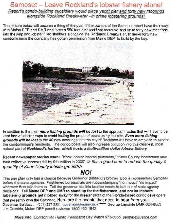
Struggle to protect nearshore fishing grounds divides forum organizers. Opponents of efforts by the Samoset Resort to gain state permission to build a 550 foot yacht pier in a nearby Rockland Harbor commercial lobstering area brought their grievances to the Maine Fishermen's Forum in the form of a flyer featuring a photo of a lobsterman fishing the area that would be "taken" by the Samoset for its pier, floats, dozens of moorings and its no-fishing yacht access lanes.
The popular Fishermen's Forum brings hundreds of Maine lobstermen and other fishworkers together each year for three days of networking and seminars on the industry, marine science and fishery regulations
The flier about the breakwater controversy was liberally distributed throughout the Forums' display table areas on several days.
On Saturday, copies of it reached Samoset officials, and shortly after that, a grim-faced Chilloa Young, forum organizer, stalked through the halls with Maine SeaGrant official Paul Anderson sheepishly in tow, seizing about half of the offending literature before it was taken up by fishermen browsing over the dozens of display tables.
Asked if she had vetted all fliers at the Forum, or was quashing the lobstermen's complaint at the bidding of the resort, Young said that only those that paid for display space could distribute fliers at the event. (Needless to say, a small but significant percentage of the fliers at the Forum were from groups that had NOT paid for space, but being inoffensive to the owners of the facility, remained on display.)
The flier's distributors learned an important lesson: the bright red headlines of the second wave of fliers made them easy prey for the censors. The black and white version distributed Thursday apparently escaped their attention.
The incident showed both the clout of the well-connected Samoset resort's owners, who are being represented before state environmental agencies by the governor's brother Robert Baldacci, and the timidity of the commercial fishing industry's boosters in Maine, who frequently look the other way when big development projects gnaw away important inshore fishing grounds. Tsk tsk Chilloa and Paul...Whose side are you on, anyway?
The popular Fishermen's Forum brings hundreds of Maine lobstermen and other fishworkers together each year for three days of networking and seminars on the industry, marine science and fishery regulations
The flier about the breakwater controversy was liberally distributed throughout the Forums' display table areas on several days.
On Saturday, copies of it reached Samoset officials, and shortly after that, a grim-faced Chilloa Young, forum organizer, stalked through the halls with Maine SeaGrant official Paul Anderson sheepishly in tow, seizing about half of the offending literature before it was taken up by fishermen browsing over the dozens of display tables.
Asked if she had vetted all fliers at the Forum, or was quashing the lobstermen's complaint at the bidding of the resort, Young said that only those that paid for display space could distribute fliers at the event. (Needless to say, a small but significant percentage of the fliers at the Forum were from groups that had NOT paid for space, but being inoffensive to the owners of the facility, remained on display.)
The flier's distributors learned an important lesson: the bright red headlines of the second wave of fliers made them easy prey for the censors. The black and white version distributed Thursday apparently escaped their attention.
The incident showed both the clout of the well-connected Samoset resort's owners, who are being represented before state environmental agencies by the governor's brother Robert Baldacci, and the timidity of the commercial fishing industry's boosters in Maine, who frequently look the other way when big development projects gnaw away important inshore fishing grounds. Tsk tsk Chilloa and Paul...Whose side are you on, anyway?
Feb 19, 2007
Lower Penobscot River Watershed Coalition meets Feb 26, Bangor.
Like Penobscot Bay, the tidal Penobscot River plays an important role in the fish and wildlife ecology of the Gulf of Maine. The Lower Penobscot Watershed Coalition is meeting February 26th from 10:00am – 2:00pm, at the Fish &Wildlife Building, 650 State Street, Bangor, ME to discuss protecting and restoring these values. The meeting is sponsored by Penobscot River Restoration Project Info: Gayle B. Zydlewski 207-862-3382. The draft agenda follows:
Review agenda
Introductions & Updates
Values of the Lower Penobscot Watershed that are worth preserving
What needs to happen to preserve these values
Overview of the Penobscot River Restoration Project
Discussion of Land Trusts and Watershed Councils
Elements of a Mission Statement
Discussion of organizational structure
Action items/next steps
Schedule next meeting
Other
Directions to Fish and Wildlife Bldg in Bangor:
Coming from I-95, take exit 187 (Hogan Road exit). If you are north bound, take a right onto Hogan Road and go to the Mount Hope intersection (third traffic light) and turn right. Approximately .3 miles take a left at the bus kiosk. This is the back entrance of the BMHI campus. Go past the large green barn. There will be a large parking lot on the right hand side of the road, and at the end of this is a three way-intersection. Turn right and look for the three-story rectangular brick building with a bronze deer sculpture in the front yard. That's the Fish & Wildlife Building. ASC is on the second floor.
If you are south bound, take a left on to Hogan Road and follow the directions.
Feb 7, 2007
Feb 14th legis ponder Kennebec migratory fish restoration, reimbursing Commercial Safety Councilors, limit mahogany quahog fishery to boat owners
Wednesday: Feb 14th 1:00 pm PH
Room 214, Cross State Office Building
Room 214, Cross State Office Building
Public Hearing on Marine related Bills
257-A/A to Allow Expense Reimbursement for the Commercial Fishing Safety Council
156-A/A to Require All Holders of Mahogany Quahog Licenses to Operate Their Own Vessels When Fishing for Quahogs (concept draft)
More info: Veronica Snow, Marine Resources Committee Clerk Tele: 207-287-1337
Subscribe to:
Posts (Atom)