FEBRUARY 6 1995. Wrote, faxed press release about Sears Island Cargoport marine impacts to BDN, PPH, RJ, WI, CFN.
Also sent fax to Lee Few,Virginia, concerning a proposal to produce aqueous ammonia at the General Alum plant. According to Rep Journal reporter, DEP (Bangor) can license but not regulate its production. It is used in sewage treatment plants, she said. Get her info.
=========================================
MARCH 7, 1995 Called John Barlow about Maine Maritime Academy grant request. He says the main thing is money to support a monitoring project in Pen Bay. There is a group that wants to something similar on Frenchman Bay. MMA has got gear and manpower.
Their need is $ for supplies fuel, and summer pay, as students and faculty are gone then. Physical monitoring whats going on with the water, nutrients and chemistry and a biomonitoring, etc..
MARCH 8, 1995 Call Val Whittier DEP Bangor to check on progress of the investigation of the General Alum unlicensed discharge. Busy signal on phone all day. Daffy report.
============================
March 30 1995 Went fishing on the Playboy. Early on, Charlie's suit developed a leak, and the day's fishing was scrubbed.
3/31/95 First day fishing as sole sternman. Weather foggy and cool.
Dress warm. Write letter to Longley. Make up a newsletter for distribution
** Jack Merrill, Maine Lobsterman's assn his address POB 994,Northeast Harbor, ME 04662, 207 276©5265. He's interested in going down to DC to talk Magnuson Act revisions. the end of next month.
==========================================
1996
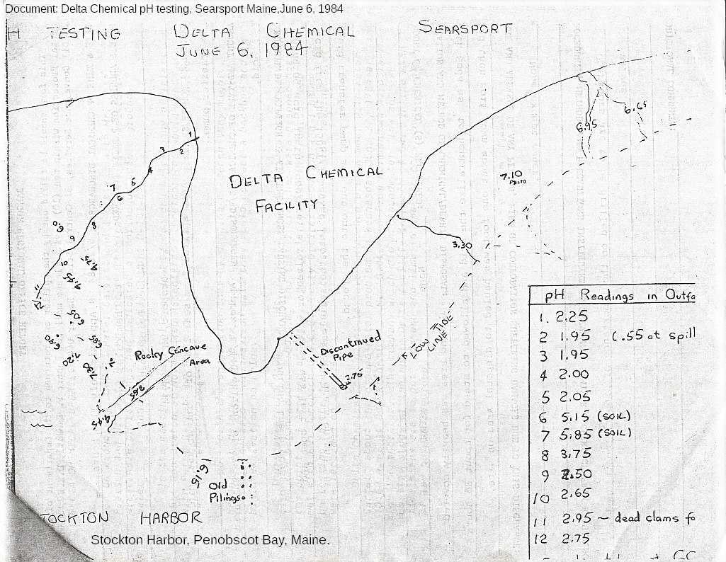
February 2, 1996 Called MDEP Bangor. ISSUE General Alum spoil banks along shore
Bangor DEP water bureau: Valerie Whittier, Clarissa Trasko, Jim Fohmes(?)
941-4570. Land Bureau
Question to Val Whittier DEP:
Is General Alum, or its predeccessor Delta Chemical, under any sort of consent
decree concerning its aluminum spoils on the shore of Long Cove and Stockton Harbor?
Reply Call from Valerie Whitter DEP She said it was grandfathered in under regs pre-existing modern environmental laws.
Karen Knuuti said she would fax some material on the bauxite mud. Doing the regulatory history of the spoil banks. The spoils are mostly bauxite mud, she says plus some carbon sludge some alum mud. Landfill begun before deposition laws, so it has grandfathered . Consolidated muck. pits and capped.
February 5, 1996 Called left msg for Knuuti. She called back; will send requested info by fax today. Received faxed MDEP material:
=========================================
2/7/96
Chlorine concerns as stated by Peter Washburn
Call back from Peter Washburn that the projected residual chlorine usually mg/Liter are identical measurement to mgL©1. If have five mg and two liters divide by two and gives
A different criteria for marine water quality discharge is below regulatory thresholds. Marine acute criteria is 13 microgram/liter marine chronic criteria 007.5 micrograms so Point 013 mg/l they'l say upon dilution
Typically they'll be given a Zone of Initial Dilution (ZID) and a mixing zone. Maine has no mixing zone policy
EPA applies this if don't have to meet any outfall criteria, a very small area, very fast mixing, turbulent.
Within the mixing zone, can exceed chronic criteria but not the acute criteria. Fish can move through the zone and leave. Argued about mixing zones in Bucksport
In the mixing zone can exceed chronic criteria, but outside it you can't. They'll say, we gotta mixing zone, can show you a model that we won't exceed 0.13 and outside they will meet criteria..
Important they do these mix zone analysis not too huge. Most.
Interested in why they need the temp increase ask how big is the mixing zone, if too big fish can get___
PUSH FOR They can dechlorinate at the end of the pipe. Pretty standard stuff. A See Maine Yankee.
Raise concerns about how to meet the marine criteria, the adequacy of the dilution analysis; how big is the mixing zone and should dechlorinate this stuff, its SOP.
Demonstrate the adequate dilution analysis. �
End Chlorine concerns as stated by Peter Washburn 2/7/96
===============================================================
PENOBSCOT BAYWATCH LOG APRIL 1996
Make a Road sign a high quality one, saying Sears Island 1 mile.
APRIL 6, 1996. Visited the General Alum site and picked up samples of aluminum spoils from near the shore of ssockton harbor adjacent to the plant. Picked up sample of carbon sludge surfacing (via frost heave?) outside the silt fences around the toxic waste landfill site behind the plant. Call Karen Knuuti after contacting BDN and Rep Jal? And maybe Peter Taber? Have samples, photographs, research papers and a press release.
General overview of 4/6/96 site investigation.
Followed the railroad track from the Sears Island Road toward the property and then dropped onto the Stockton Harbor shoreline and followed it around the bayward side of the plant.
Then went inland along its northern border, circled the managed toxic waste field and then back to the shore and back to the railroad track to the SearsIsland road. Picked up several hours later.
Transcript from tape notes made during the 4/8/96 site visit:
"On the railroad tracks toward General Alum . There has been a fire on either side of the tracks extending out several feet in the grasses, [Later saw this extended for a distance on the tracks on the other side of the Sears Island Road.] Still smell the charcoal.
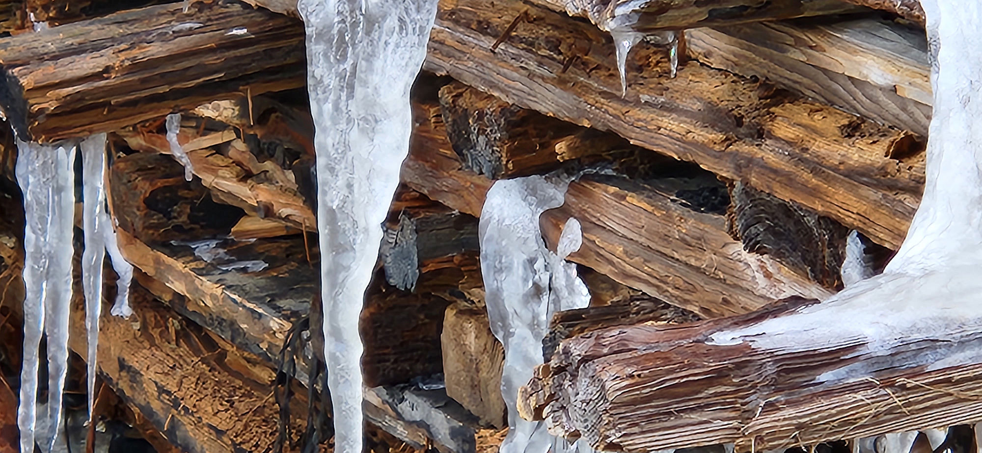
Make for the shore. Walking along the shoreline. The salt grasses look yellowed overwintered. Could not see any copepods or other small or larger living animals underneath the matted seagrass: too early in the year?
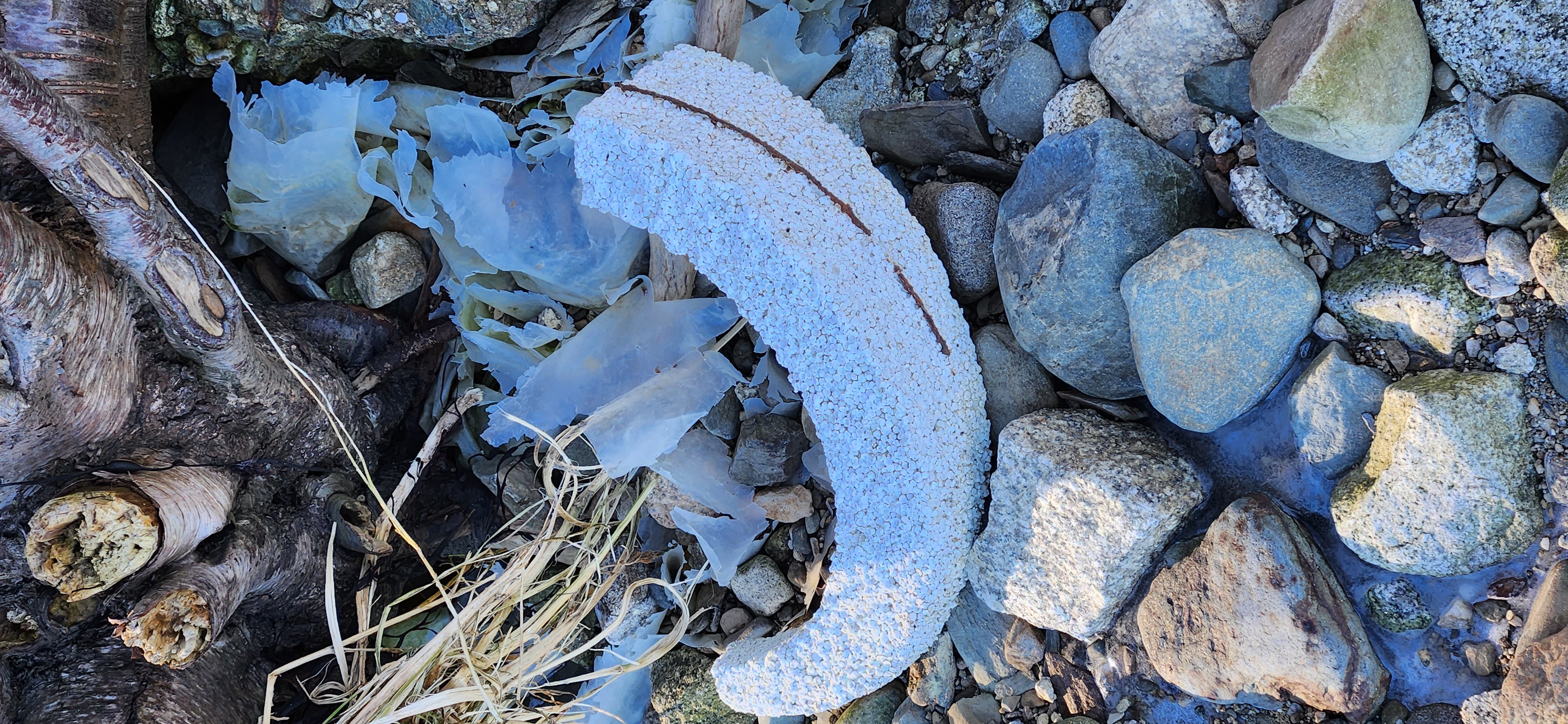
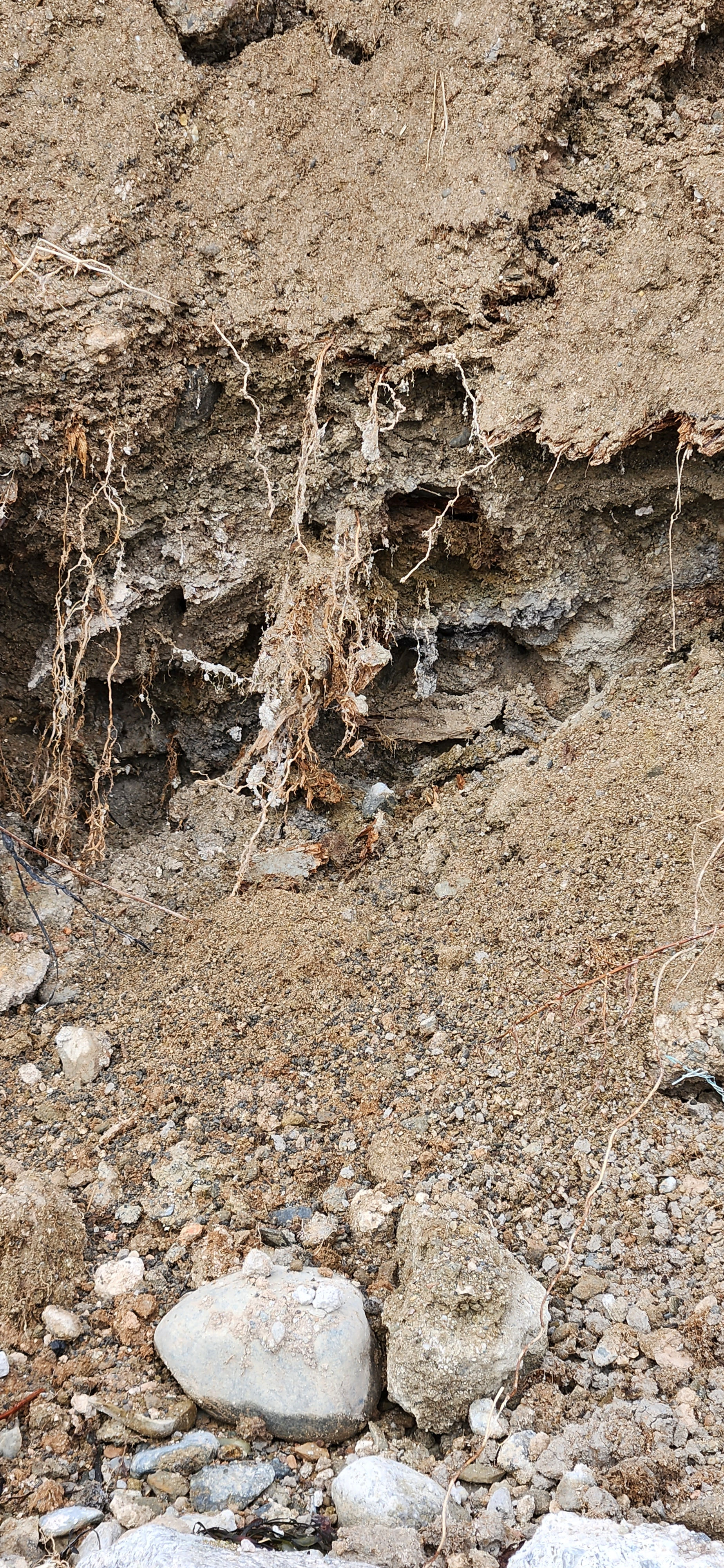
Plenty of light foam scum and red algae and dark green short curly kelp. At regular intervals of about one foot, small black patches (3-6 inches in diameter) of what looked like chopped up tea leaves from inside a teabag were washing up against the shore . Very gentle waves lapping at the
shoreline. Gravel and stone and sand; short dead grasses. A lot of brick and other debris.
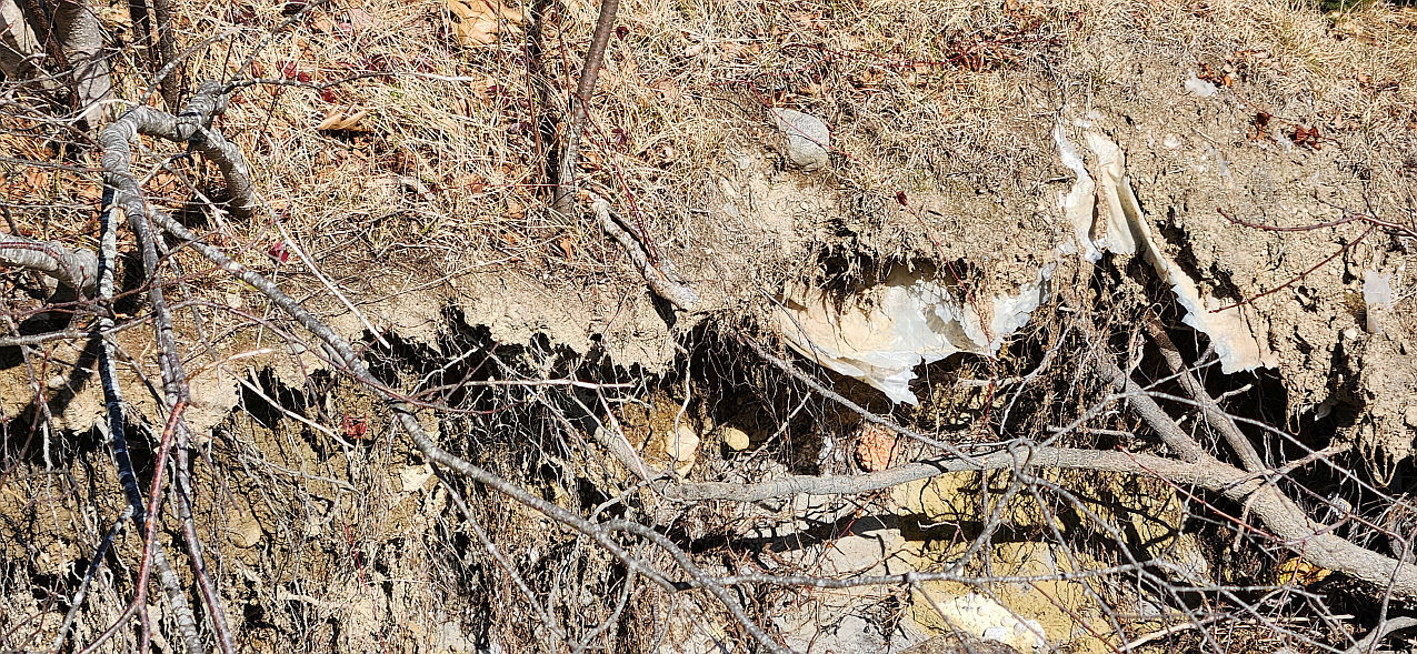
The upper shore is alum tailings fill, iron rebar and other debris poking out of it, covered with thin
layer of soil and grass, bright yellow chunks of sulfur slag here and there on the shore. Collected a sample.
The fill is definitely the whitish colored material. Dug out a sample from 6 inches deep on the way out from the site visit.)
Persistent foam on the shore as I near the old pumphouse dock jutting out from the shore on the point. There is a small stream on the Sears Island Road side of the point. Mussel shells and stones in the next stream have an orange coating. Got a sample of an orange mussel shell pair and a stone halfway between the first point and the pumphouse.
Another stream, draining out of the industrial area just before the pumphouse, has no discoloration.
Beyond the pumphouse is the area that had the white discharge covered stones first noted last year. Some stones still slightly whitened, white glaze or film.
Toward the next point, another small stream, some brown persistent foam coming out of the stream. Didn't get a foam sample. It appears to be the source of the foam seen closer to the SI Road.
[COULD BE THE ONE THAT DRAINS THE TOXIC WASTE SITE.
===============================================
GENERAL ALUM SITE VISIT continued PG 2 OF 3
Foam thickest on the shore here on the point of the shore by the mouth of the stream on the SI side of the stream mouth. Going around the next point, see 50 yards ahead the RR tracks again close to the water.
A good sized stream coming down. Elvers?
Approach the stream, it comes from under the railroad bed through a square cement culvert approximately 3 feet by three feet, an 8 inch drop down to the bay at this tide, If lowered the
culvert, could get alewives running through. Maybe they can at high tide.
There's foam but not very substantial. Green scum on the floors of the culvert. Cross the tracks and look at other side of the culvert. A good sized stream. Snowmelt or perennial? a lot of green mossy scum on the culvert.
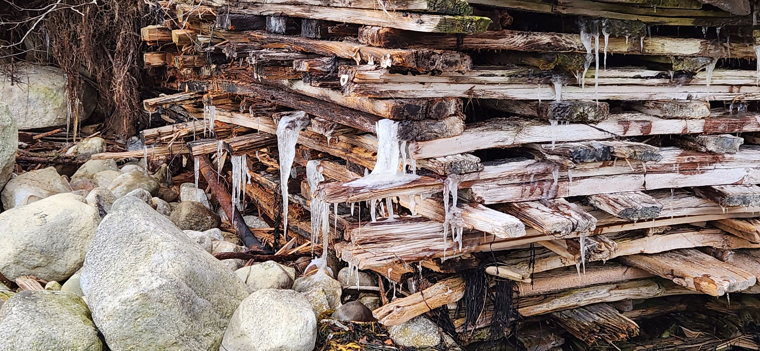
Get on tracks heading back toward the General Alum Plant. A second stream visible coming down and going under through a culvert. Coming down from the area of the toxic waste site. Go uphill toward the toxic waste site, through the screen of woods.
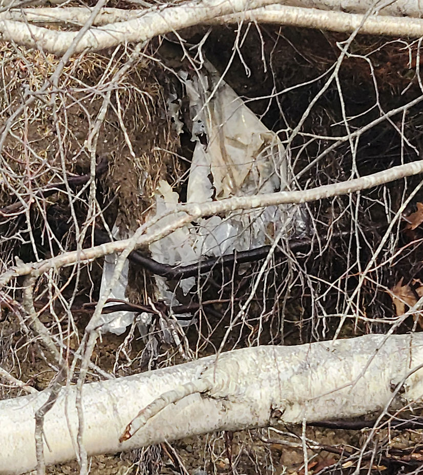
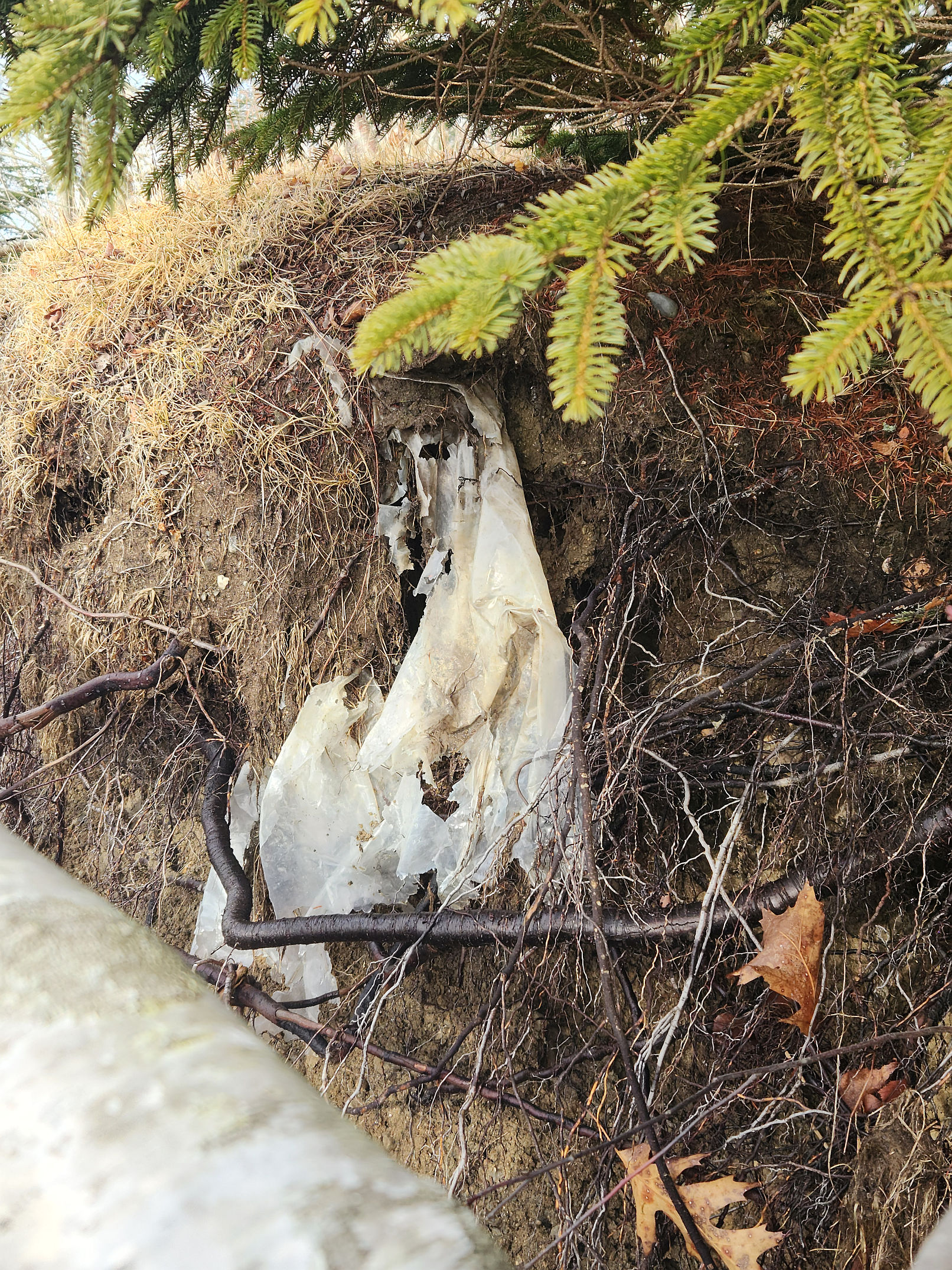
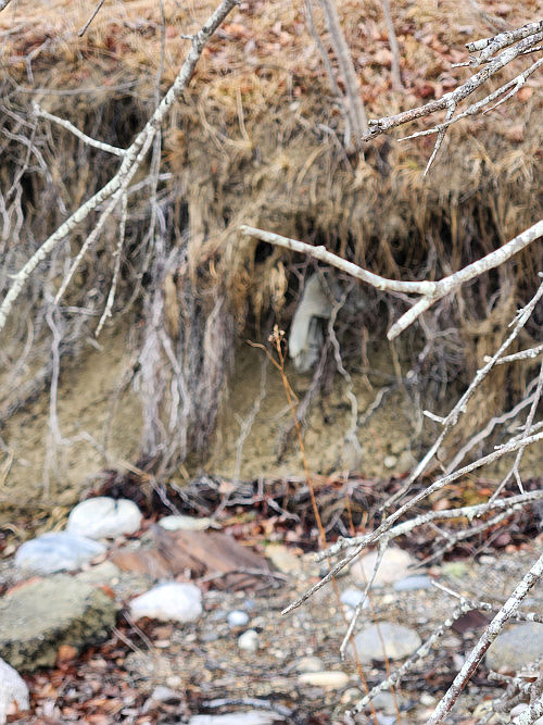
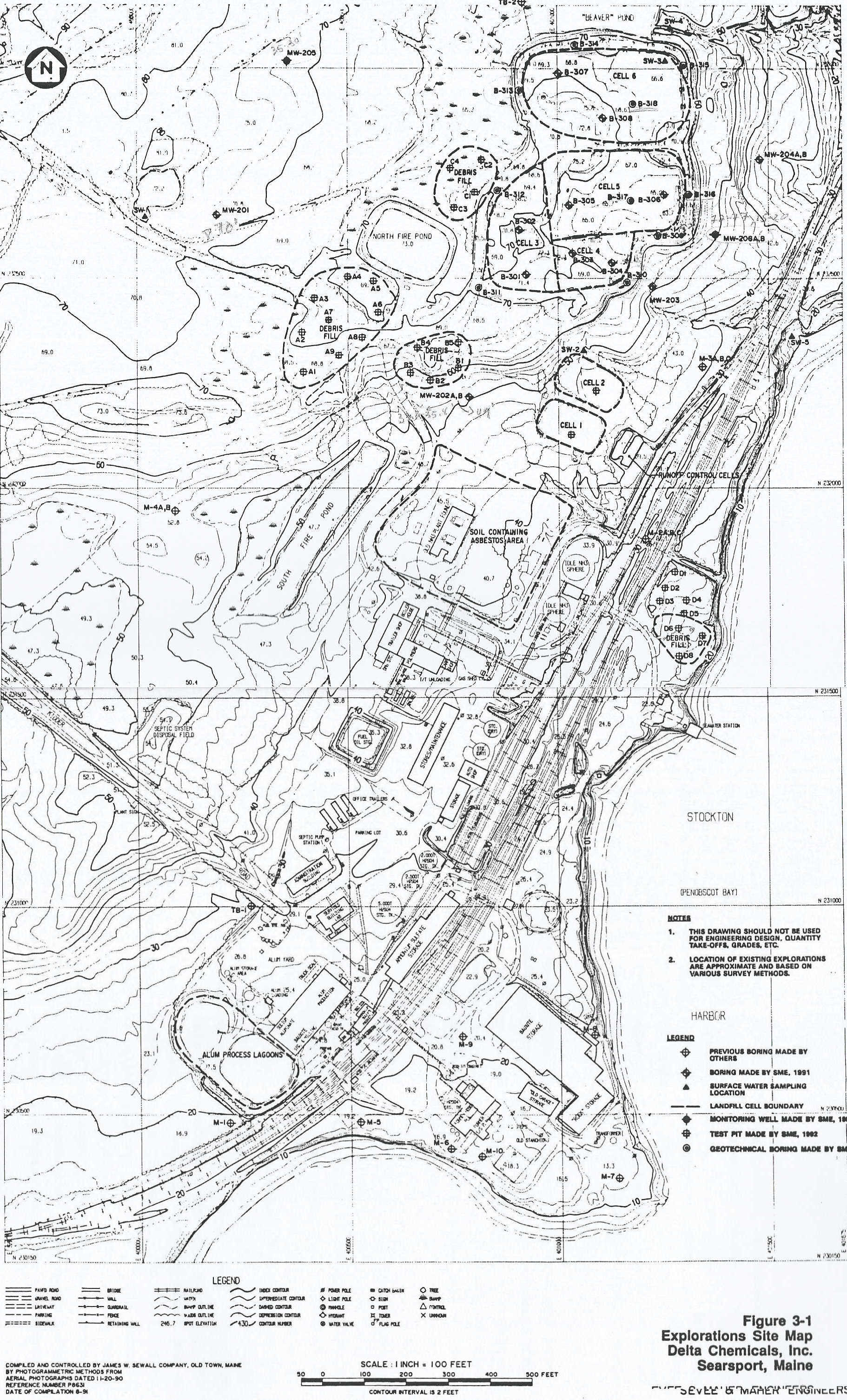
See two iron pipes with padlocked lids on them protruding from the ground. They are in the middle of a 50 square foot black marshy area. A metal tag on one of them says "Well # MW 204B, Date Installed: 09©26©91; total depth 19.9 TPVC; screened interval 5.5 © 17.5 BG "Sevvy and Meyer engineers, telephone 829©5016. For water samples leacheate."
Head up through trees towards waste site. Black silt fence visible. Beaver cut saplings from last year.
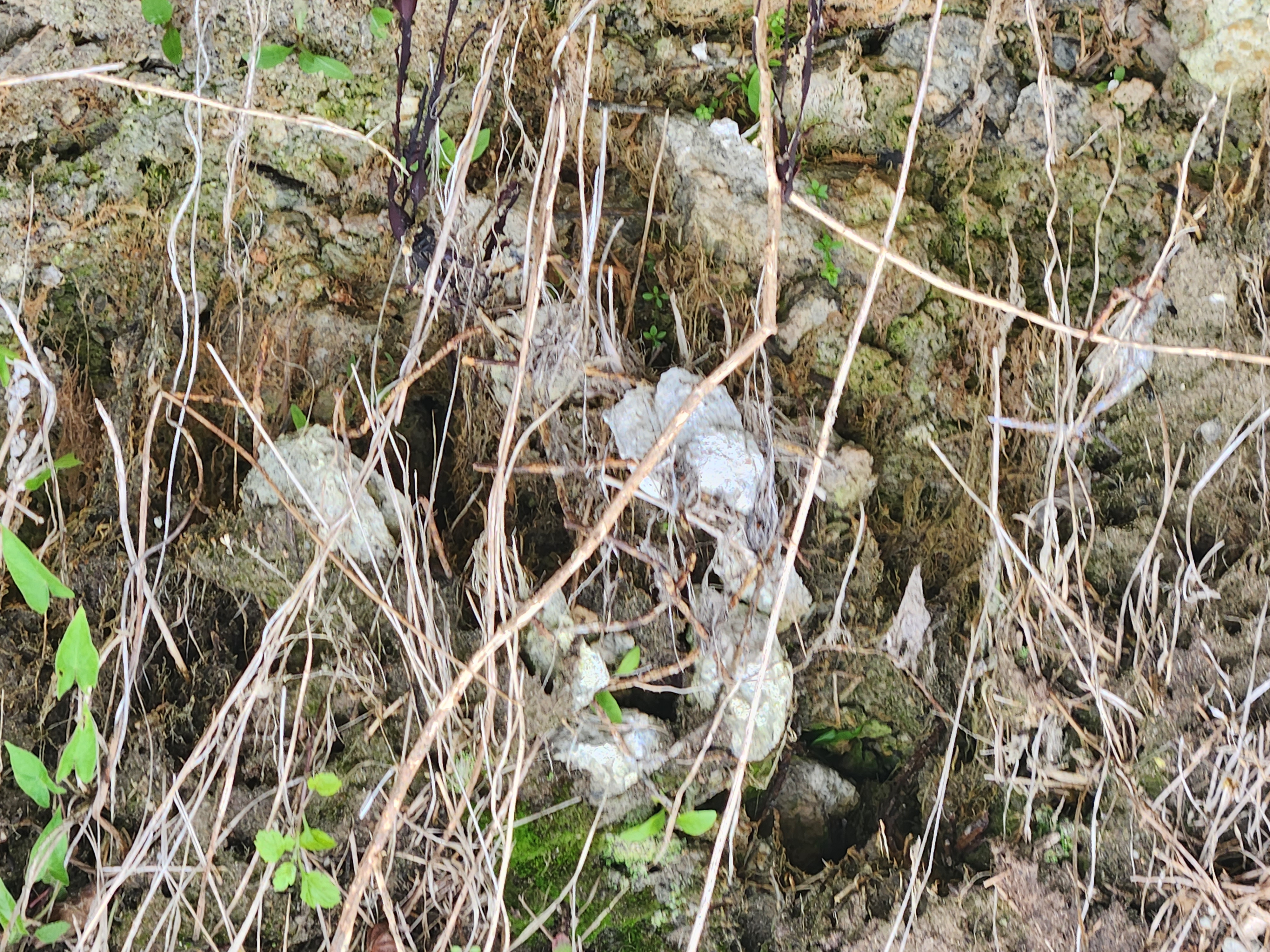
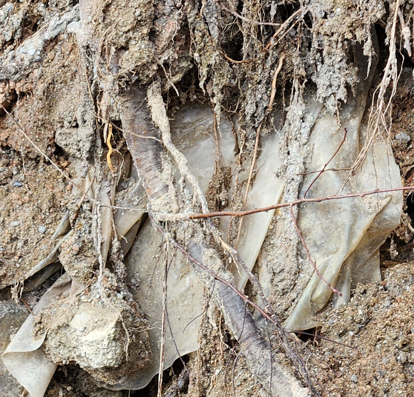
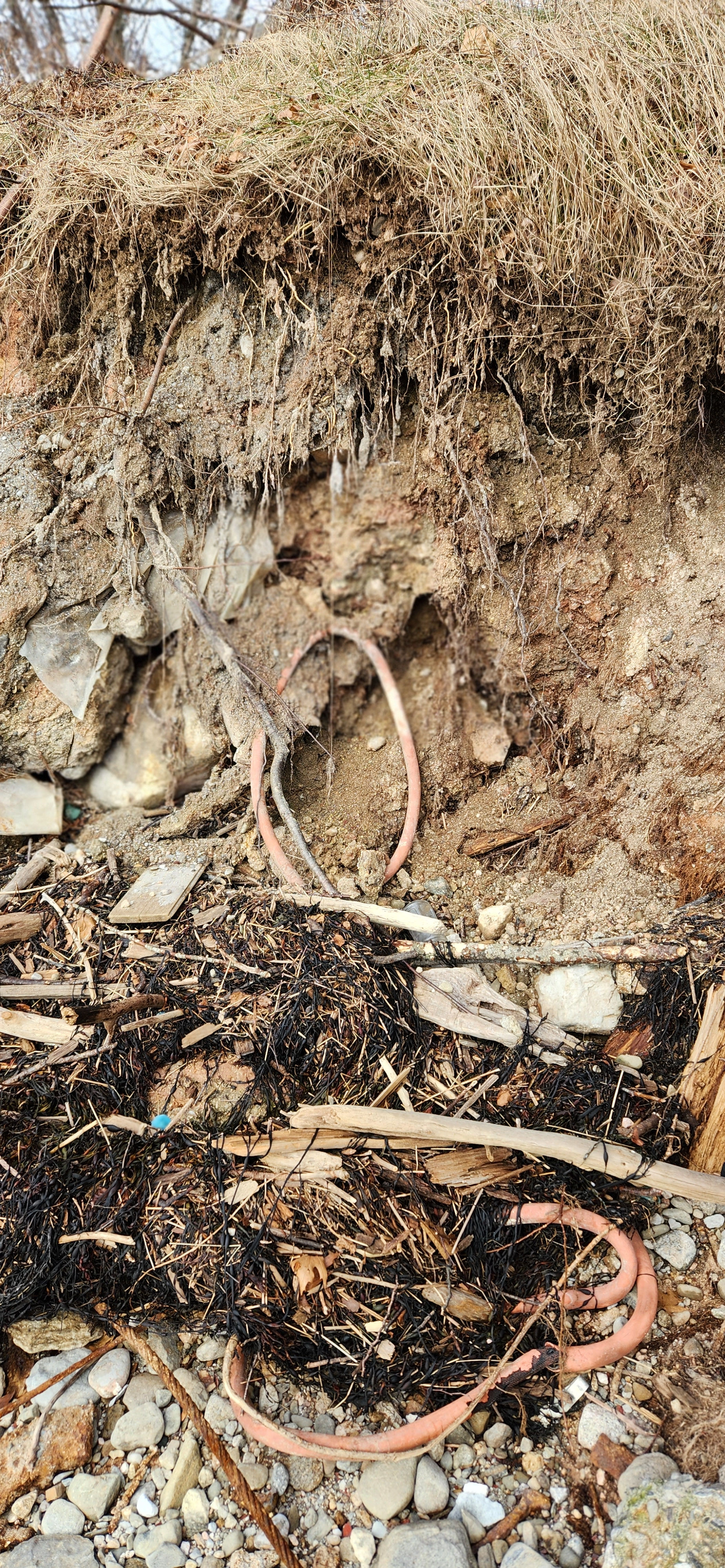
Silt fence has a 1" black pipe running along beside it, . Outside the fence, black sludge matter appears to be frost heaved up to the surface in numerous spots every couple feet.
View of the waste site. Filled over flat area, 5 white J shaped plastic pipes across the middle of the field. Field is about the size of two football fields? Covered with light layer of straw under it is sandy gravel.
Around the perimeter, a ten foot wide band of coarse mulch, then the fill of sand and stones, then a partially silted-in ditch, then the silt fence, then the black eruptions. Silt fence in pretty good shape ...has a few weak spots, its been recently re-straw-baled.
Walk counterclockwise around the waste field. from the side furthest from the plant there is a beaver dammed pond with two lodges, the source of at least one of the streams.
Hoses protruding from the field hang down onto the beaver pond shore. Big white hose comes out of the pile, like a clothes dryer air vent hose, accordion-style black perforated plastic with a white cloth skin over it.
See dog footprints. Some broken silt fence on the beaver pond side or filled over. Blackish duck flies away then more ....a total of 13 ducks.
A marsh at the far end of this side. Deer sign. Another channel's beaver lodges. A large heron, gray with orange beak takes off.
=======================================
GENERAL ALUM SITE VISIT PG 3 OF 3
Going around the back side of the waste site. silt fences: most in good shape. Some in need of fixing.
See above the beaver pond two artifical ponds. Both of them have aged asphalt shores. No signs of life. Pipes carry water from one pond to another, several pipes go down into the beaver pond. with old rusty valves.
2nd pond like the first: some drowned grasses, no other apparent life, kidney shaped pond. A third pond closer to the factory; marsh behind it and an old road leading to the site no longer in use. Upper 3rd pond drains to a 4th pond behind the facility.
Complete circuit of the waste site. On side closest to the plant another drainage goes down toward the plant, crosses the RR tracks after passing through silt fences.
Collected black sludge sample in plastic grocery bag on way back. Go down toward RR tracks, two more sampling pipes visible, padlocked rusty no label or sign on them. Vague scuzziness in the ditch between the site and the RR tracks.
Follow deer track back to the harbor. Tide is coming in; can only walk part of the way on
the beach. Passing the pumphouse, a 12" wide stream has a gray white film on the sand gravel bottom.
When disturbed, a little plume went out down the stream, leaving the sand and gravel clean looking, so it is a film.
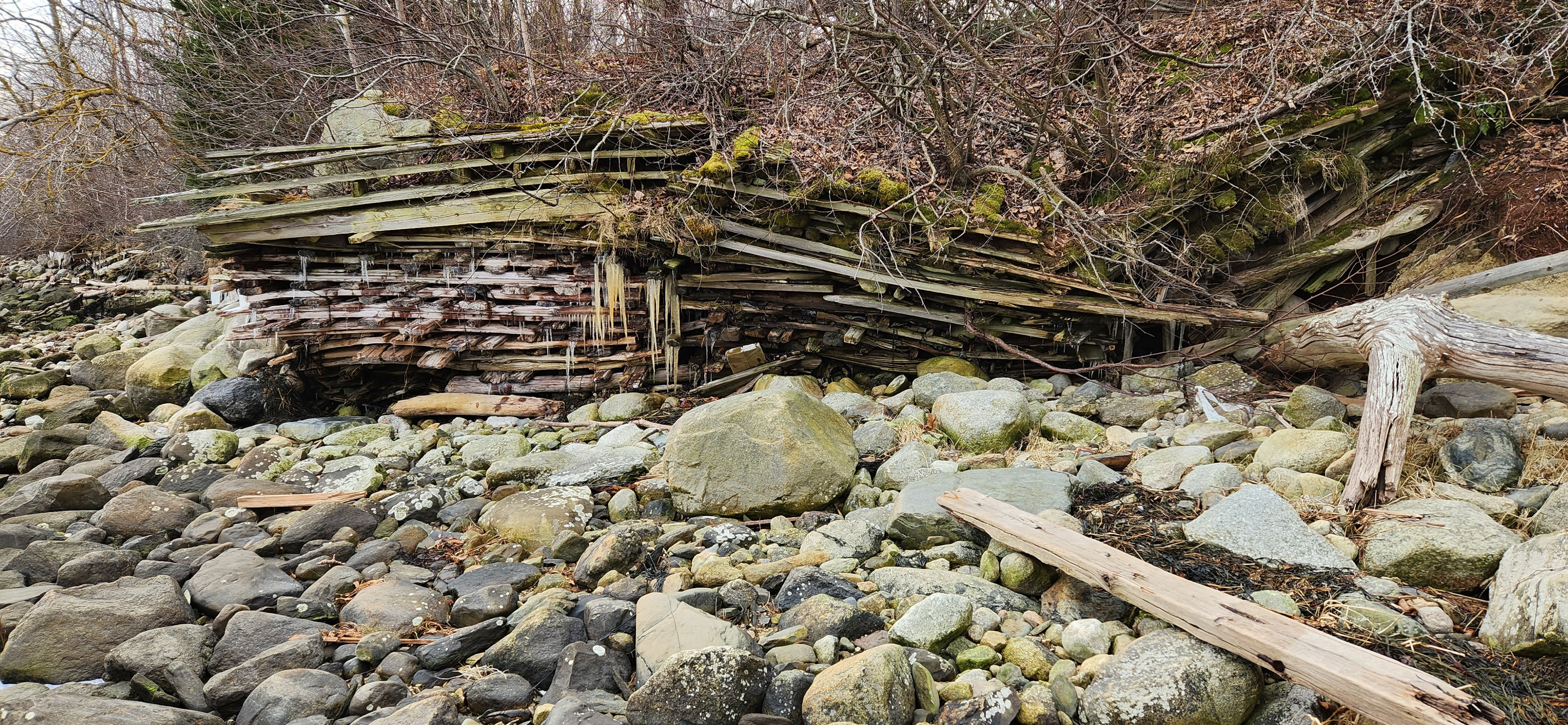
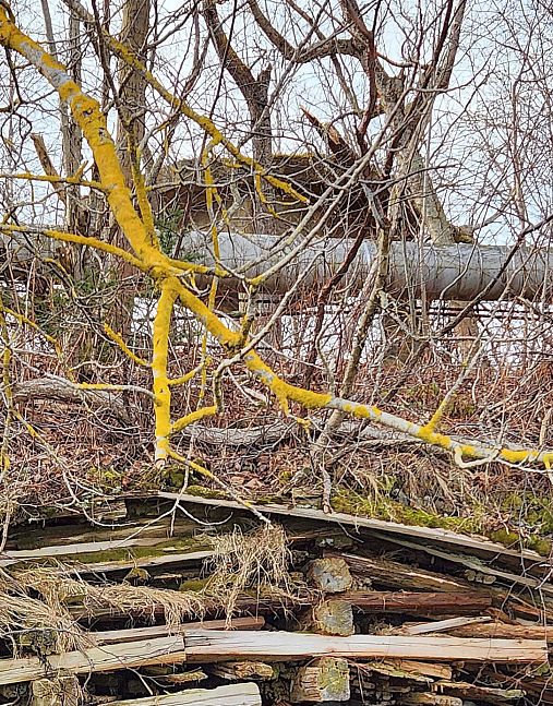
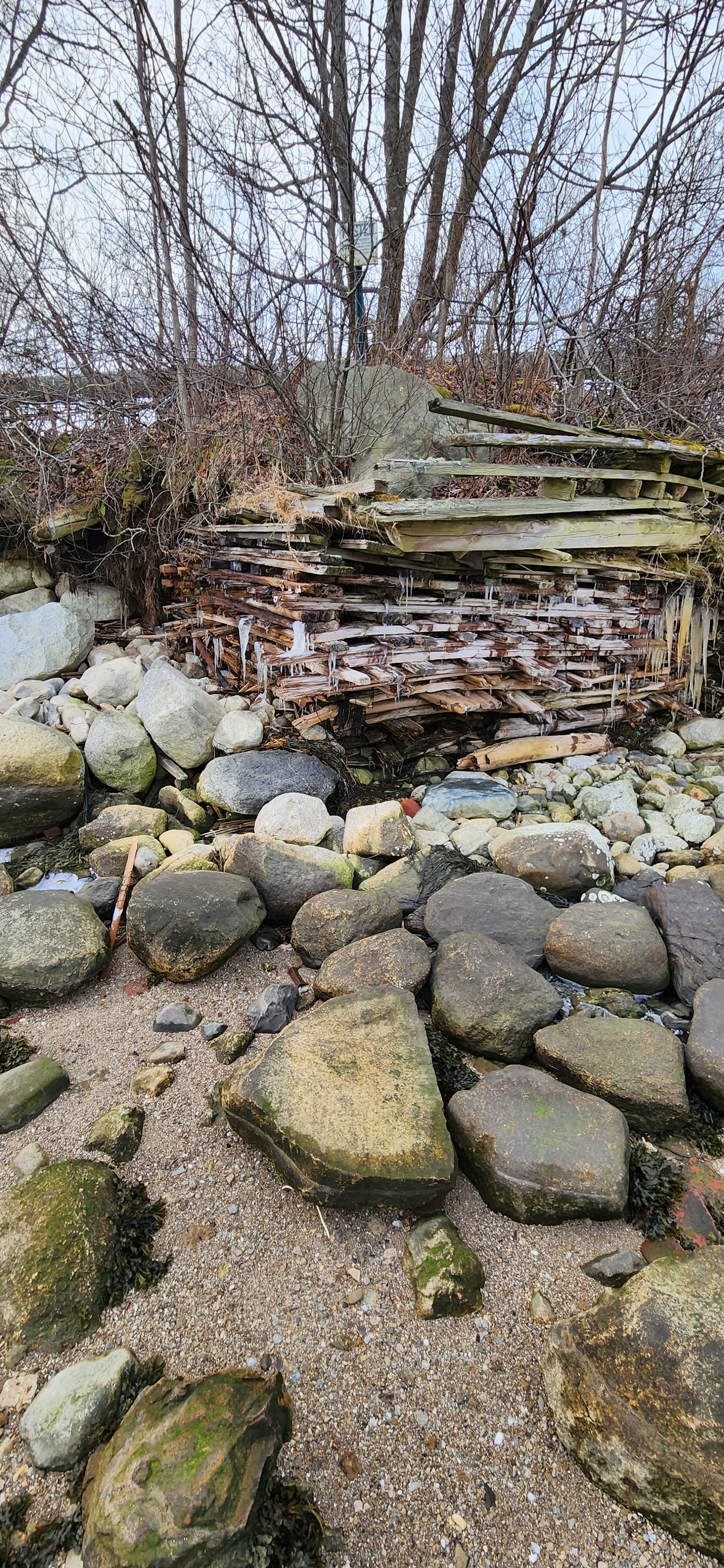
The crumbling wooden quonset hut is still being used for storage of squarish white plastic containers (3' by 3' ) marked "waste". A wooden chimney is still very warm. A dead gauge on the ruined quonset. A cool pipe covered with styrofoam.
Got some alum waste samples from the spoil bank below the quonset on the side facing the causeway. Then back onto the Sears Island road."
End of visit.
==========================================
April 7, 1996
To Rudy Engholm Northern Wing/ Lynda CLancy
Fr: Ron Huber, Coastal Waters Project
RE: Toxic waste leaking from General Alum\Delta Chemical licensed
dump site in Stockton Springs. FYI
On Saturday, April 6, I did a perimeter walk of General Alum\Delta Chemical's managed, consolidated toxic waste dump on the land behind the General Alum facility. It is about the size of a football field.
On the side closest to the Bay, the toxic black waste from their carbon sludge ponds that had been dug up and reburied in the consolidated dump a year or more ago is now erupting from the soil at regular intervals, outside the site's runoff control perimeter.
General Alum is the site that you photographed the white plume emanating a year or so ago. The eruption site is on the top of a forested slope that drains down to the railroad track and ultimately into Stockton Harbor.
There are at least 4 streams flowing from the industrial property site into Stockton Harbor.
I suspect the one with a small but constant amount of brownish persistent foam at the shore below the plant is the stream that this waste is draining into.
Most of the site is fairly well maintained. There are only a few areas where silt fences are broken or overfilled with silt. Straw bales have been recently emplaced to control runoff from breaks in the fencing.
Much of the waste field drains in a ditch inside the perimeter and through large hoses in several places coming out of the field into a sizeable beaver pond (four lodges) that angles around the side and back of the waste field, as well as several connected manmade ponds. 13 ducks and one heron flew up from the pond/marsh. Deer sign.
One concern is that the black sludge erupting through the surface outside the perimeter at regular intervals may pose a serious environmental or health risk.
It looks like a fairly recent phenomenon, and appears to be frost-heaved up from underground. I do not know of its exact composition, but the fact that it was buried in a toxic waste site is some cause for concern.
I brought back about a pound of it, along with a jarful of the granular aluminum tailings from the spoil site in front of the plant.
We plan to alert the appropriate authorities and organizations in the coming days to make sure that appropriate action as necessary is taken. Thought you'd like to know. If you have any suggestions, please contact me.
-RH
=====================================
4/7/96 Call to Ted Schettler, Harvard: He guessed that General
Alum's carbon sludge might be petroleum waste byproduct from
incinerators boilers.
(617)536©7033
Northern Wing Fax # 729©9678
Moving slowly getting stuff done send me a neat document synopsis
of reproductive health effects and the irony of it back in the
days when we were in the dioxin hearings.
On a radio program about our stolen futures on local npr
station, he took a shot at "scientific imperialism": Arrogant
sobs that believe that when they talk about science should inform
the debate but only scientists understand the data, so accept his
statements
Ted's doing a lot of environmental work some clinical practice
He documented all the science and collab with Mass PIRG with
specific TRI and TUR Toxic Use Reduction data. What's coming in
the front door the whole picture of lead merc a whole varieties.
Can be replicated same format several states TUR: have Exists
It was a law hacked out by biz industry and environmentalists
hammered out. Tox Use Reduction Institute at U MA�s Lowell
=========================================
April 8, 1996 * Call to John Hurst about the black sludge.
He says A couple of years ago the company made ammonia out of bunker C fuel
oil. Carbon is one of the waste byproducts
Bunker C has some interesting heavy metals in it. Power plant can
reuse the waste Bunker C
When they started the plant , Bunker C would come into
their holding pond. The carbon came from their experiment making
ammonia but the plant didn't make the ammonia they wanted so
ended making it and now they get it from a tanker offshore.
Don Harrelman (late) about ammonia is .........
The sulfuric acid by heating the sulfur..........
Contact DEP and let them take care of it. Then they have their own sample.
A legal sample can analyze it.
* Call to the Maine Maritime Academy. Barlow will be at the
meeting on Pen Bay health as a panelist. not really set up to
analyze heavy metals and organic chemicals analysis
really set up good for nutrient levels and oceanographic data.
I sent him a letter about other funding possibilities a letter
about...and updates?
Rather then spend a lot ot time onthe past lets move forward
Only concern is if we can set up fund and design
Want to present results impartial.
Biggest problem with fed funding. Need continual source of
funding to pay for the boat. Something that could be done
Need some time and money.
April 16, 1996 Alec Horth, VP engineering "Its not erupting material
as waste as the early 60's had a carbon to waste carbon material there have
been some minor where...
end of note
=========================================


