As far as the Gulf of Maine goes, Governor Paul LePage must begin by either supporting the rough and tumble economy of Maine's existing small ocean businesses - lobstering and other commercial & recreational fisheries offshore and onshore of Maine, and their supporting landbased economic partners. Or else LePage must support oncoming big absentee corporations businesses - utility companies, investment banks and more - brought by the new federal ocean windpower agency to lease waters off Maine critical to those fisheries.

What's at stake for Maine in Governor LePage's decision could be the the very survival of Maine lobstering itself against powerful federal pressure for a quick and dirty heavily subsidized offshore industrial windrush.
WHY? Larval lobsters are planktonic for a month or more after hatching in early summer.
Although they can swim, their movement is largely that of the currents in which they become entrained. As demonstrated in this University of Maine animation, Maine lobster larvae hatching from Canadian and Downeast broodstock travel down the Eastern Maine Coastal Current to Penobscot Bay waters, where the world's top American Lobster fishery unsurprisingly occurs. scallops and many finfish also spend their larval life travelling by ocean current from hatching place to settlement area.

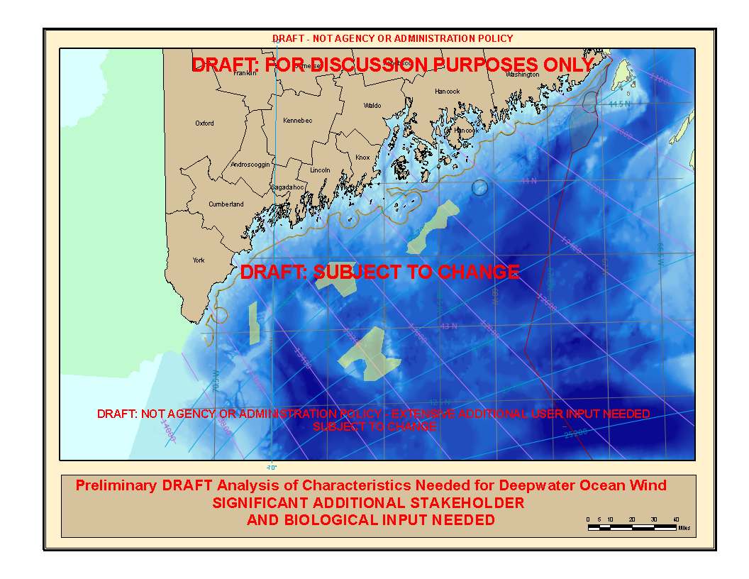
Depending on the size of ocean wind project set up there, more lobster larvae could be diverted south into the outer Gulf of Maine, instead of continuing west into SW Penobscot Bay 's rich lobstergrounds.
Two others ocean windpower planning areas are within the Western Maine Coastal Current, which travels from west Penobscot Bay to Massachusetts Bay along the Northern New England coast - one off Casco Bay and one between upper Jeffreys Ledge and the mainland. (Actual sites have more irregular shapes than shown see map below)

No comments:
Post a Comment