GAC aerial photographs
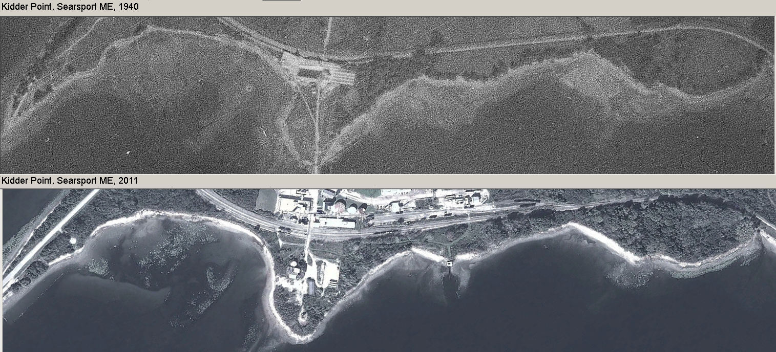
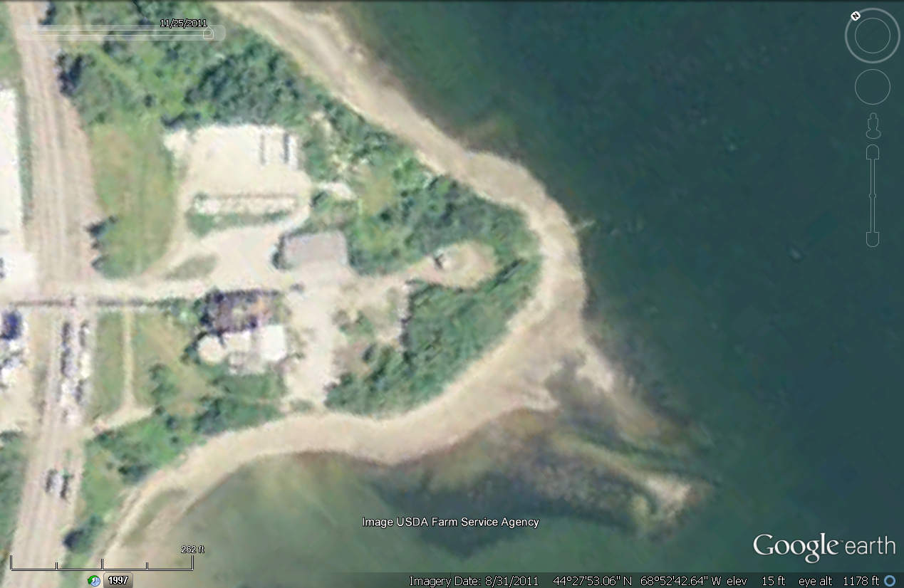
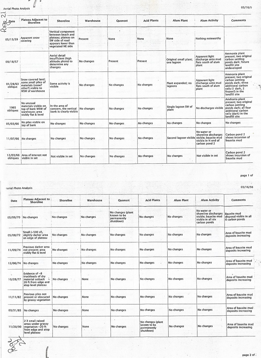
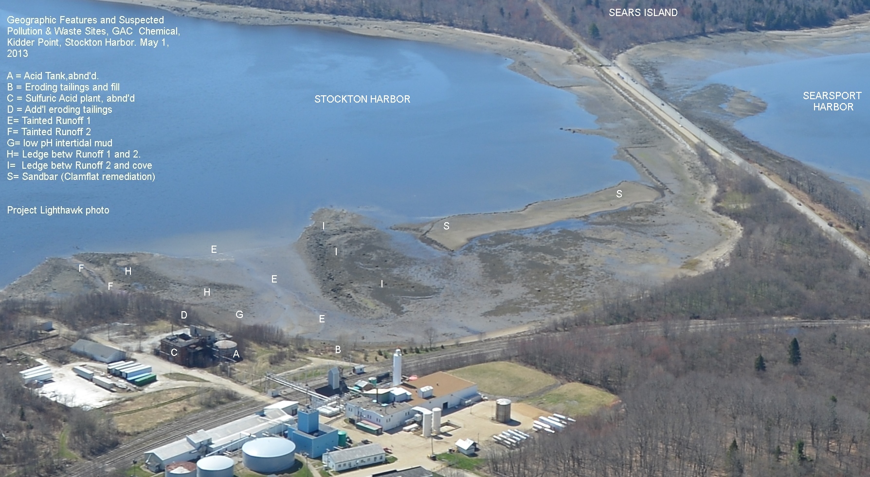
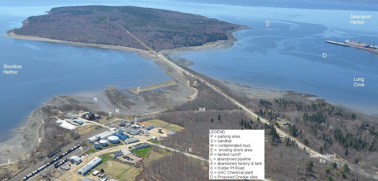
Use Back Button to Return Here aerial photos from 1940 and 2011. See expansion of the point into the harbor.
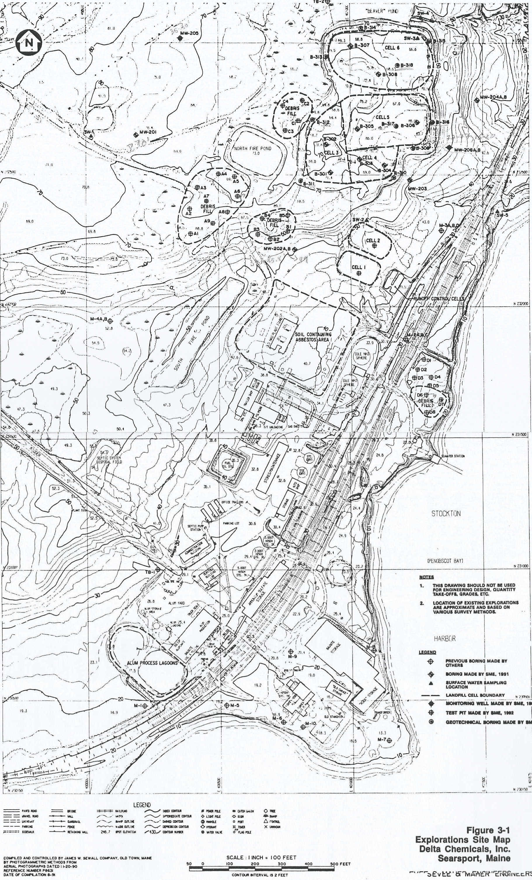
See a large 1993 map of then-Delta Chemical's waste sites and landfills .
* News &reports from 1903 -1974 about this site & nearby Mack Point
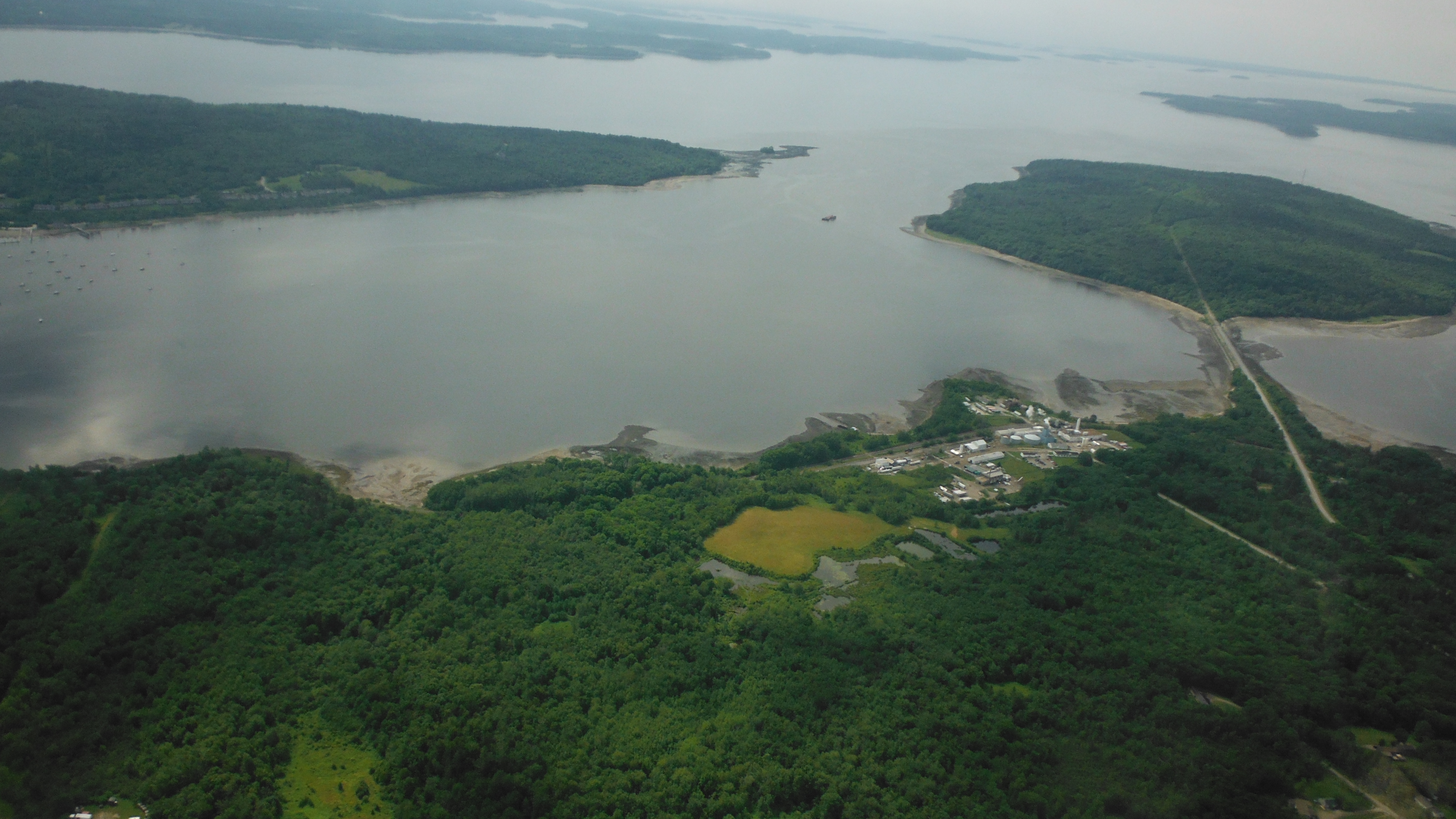
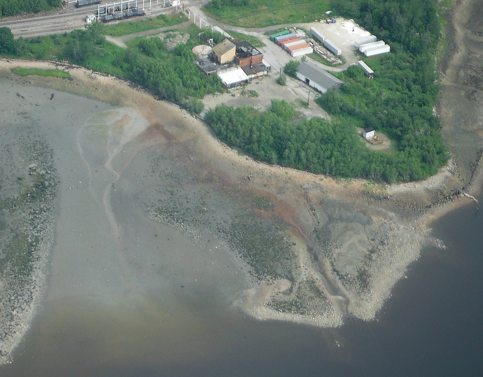
* Google earth aerials of site 1997-2011
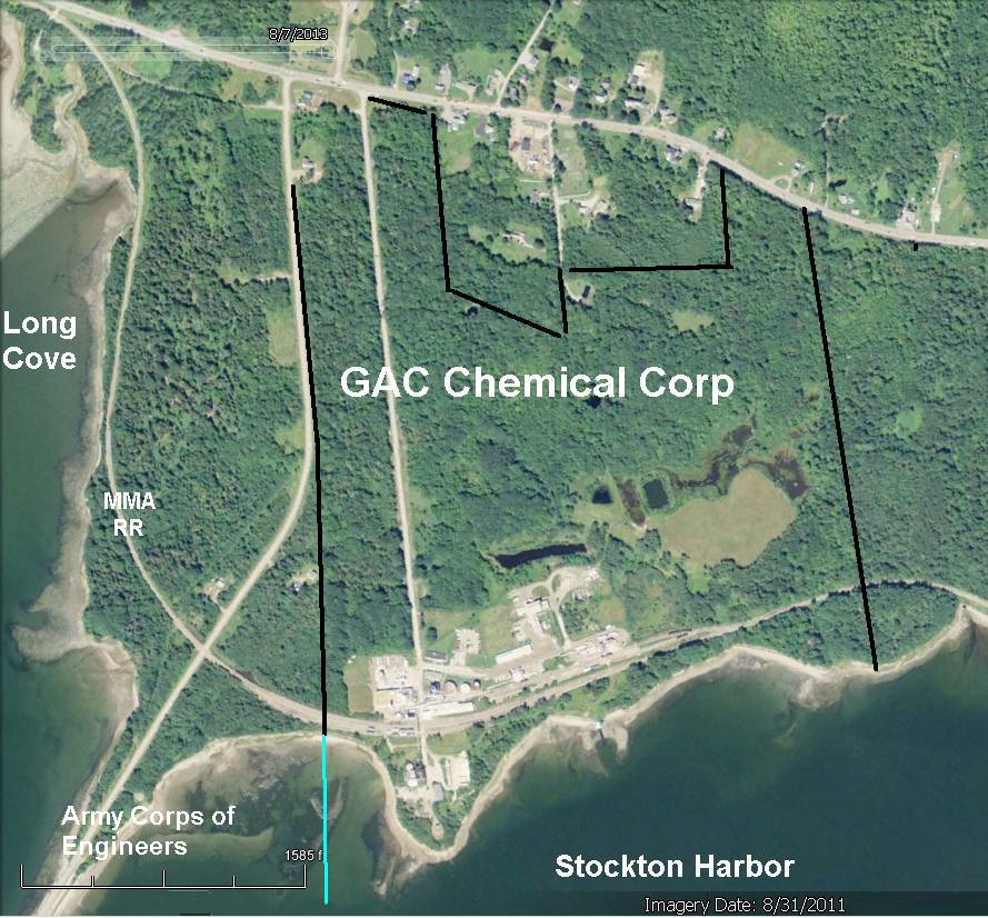
* 2011 GAC Chemical aerial w/company property lines.
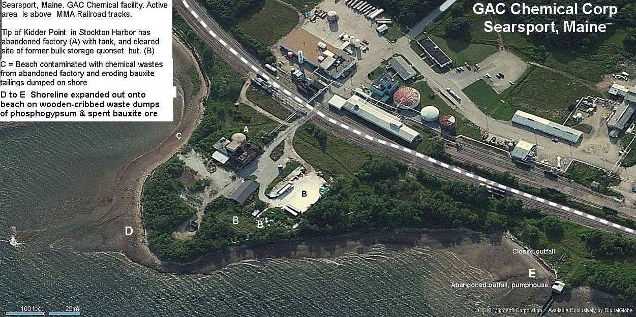
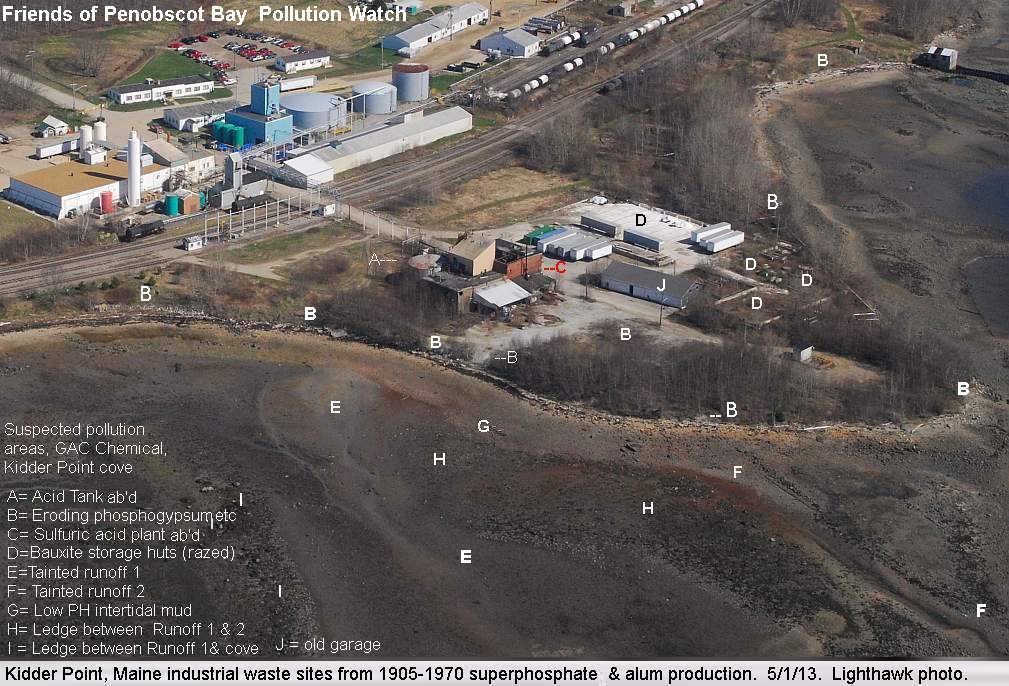
* (5) Kider Point waste fill areas
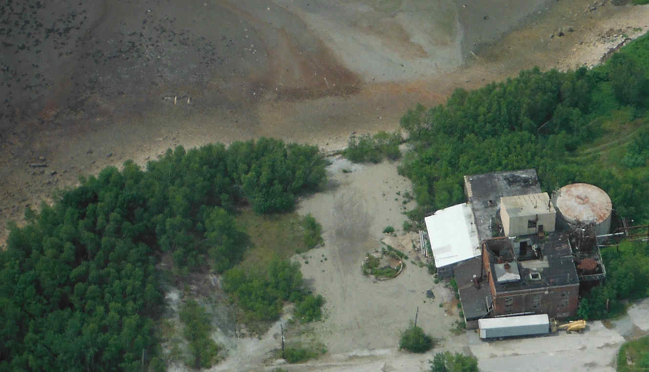
* 2004 Aerial with now-razed fertilizer-then-bauxite quonset hut. *** w/o quonset hut (2011). | FOPB GAC Shore visits
7/21/13 ** 3/10/13 ** 5/6/12 ** 4/22/12
Kidder Point Industrial Site History
Use back Button to return
* 1984 DEP consultant's 1984 sulfuric acid spill report.
* 1984 Surface sampling
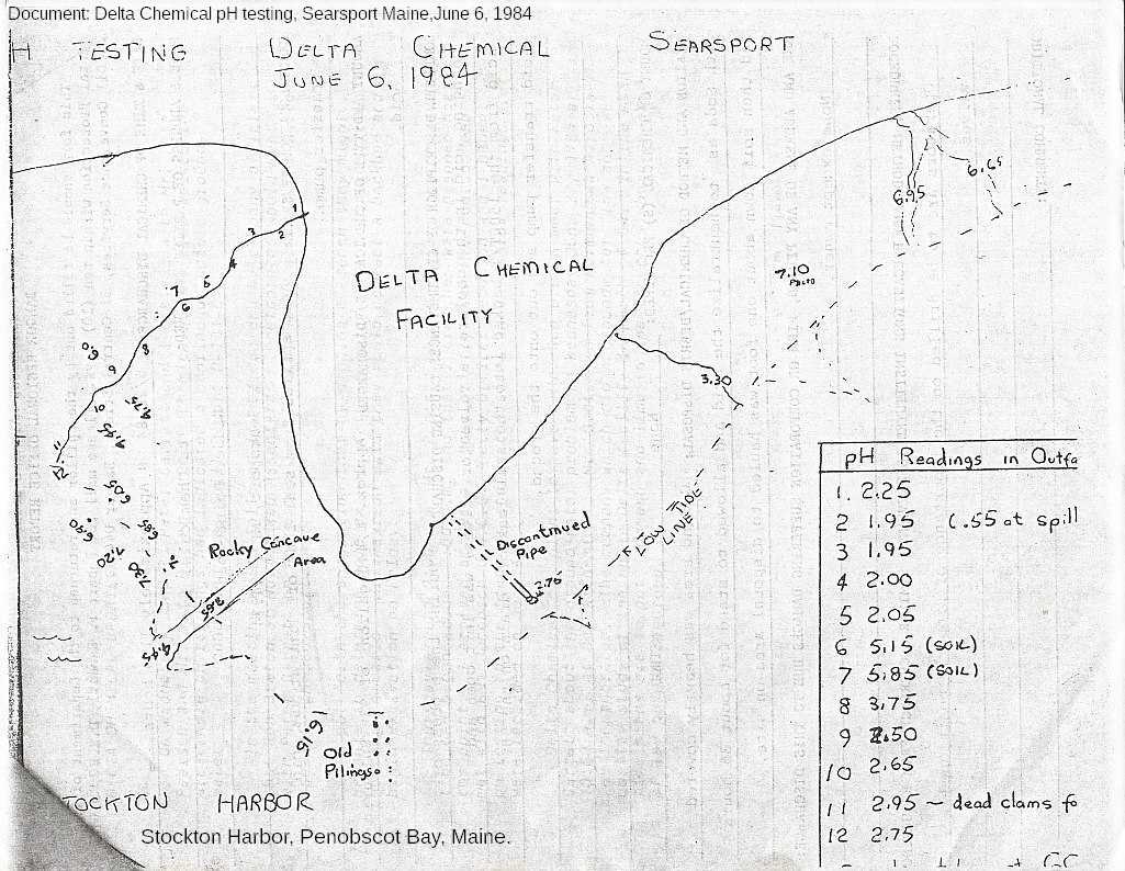
* 1984 pH testing of acid spill. Drawn map
* 1990 Testing of 'Alum Reactor Waste' 9/14/90
* 1993 DEP consultant's 1993 site summary
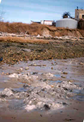
* 1998 photo of tainted mud (acid tank in background)
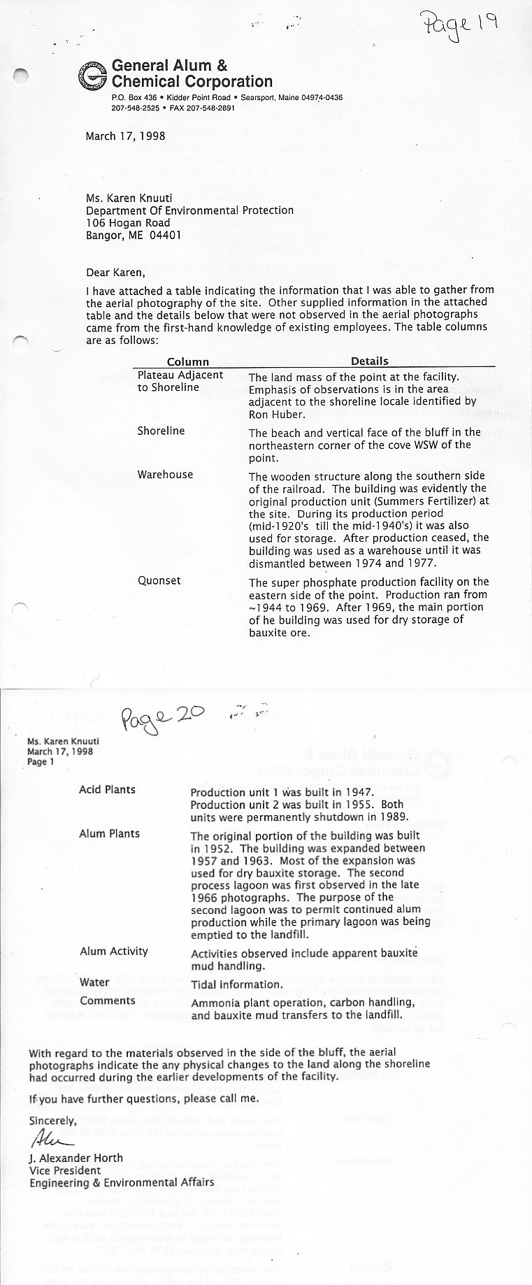
* 1998 site assessment by Delta Chemical 3/17/98 pt1
* 1998 site assessment 3/17/98 pt2
* 1998 media coverage of spill detection & cleanup
* 2002 draft settlement agreement CLF & GAC | |





No comments:
Post a Comment