| Name | Last modified | Size | Description | |
|---|---|---|---|---|
| Parent Directory | - | |||
| Sears Island Causeway Media Coverage causeway/2025-01-10 11:09- gac_1998/ | ||||
| 2024-02-23 02:16 | - | |||
| gac_2002/ | 2021-02-15 09:29 | - | ||
| gac_2013/ | 2024-12-22 13:46 | - | ||
| gac_2014/ | 2024-08-21 06:55 | - | ||
| gac_2020/ | 2023-12-23 19:16 | - | ||
| gac_2023/ | 2023-12-22 17:56 | - | ||
| gac_2024/ | 2024-03-26 12:14 | - | ||
| gac_2025/ | 2025-01-24 19:16 | - | ||
| gac_vrap/ | 2024-12-22 14:14 | - | ||
| gacshore_011224_pump..> | 2024-01-12 15:15 | 227K | ||
| gacshore_011224_pump..> | 2024-01-12 15:15 | 114K | ||
| kidders_pt/ | 2025-01-22 20:30 | - | ||
Data Link https://penbay.org/gac/
1970s * Stockton Harbor 1975 Hydrographic Study
* Sears Island Causeway Media coverage 1975 - 1992
1990s
* Large 1993 map of then-Delta Chemical's waste sites and landfills .
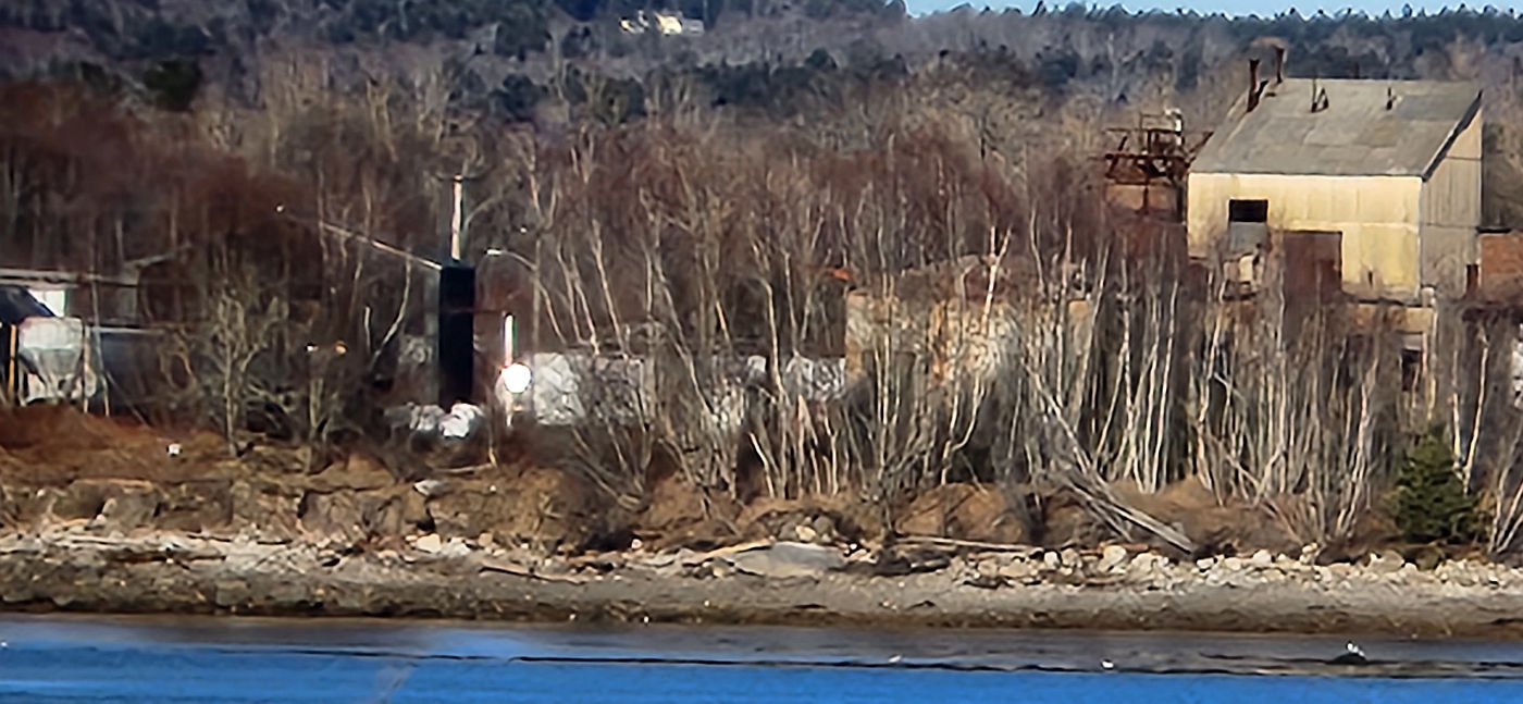
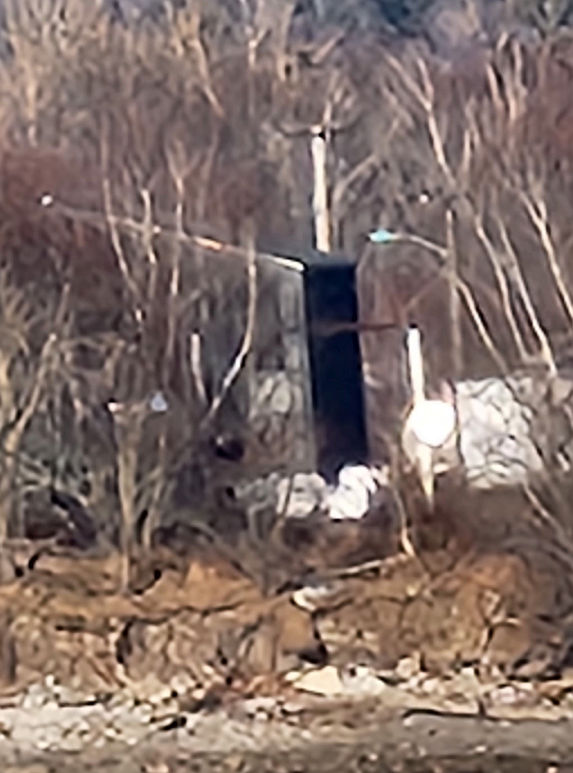
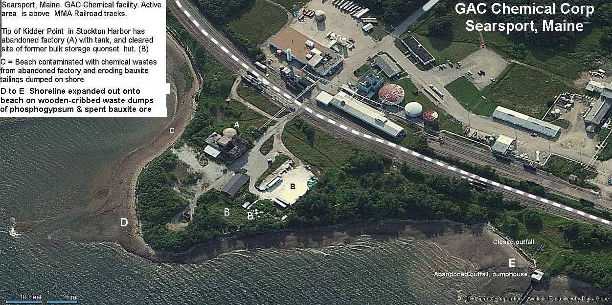
* 1993 A short history of the Kidder Point Industrial Site 1993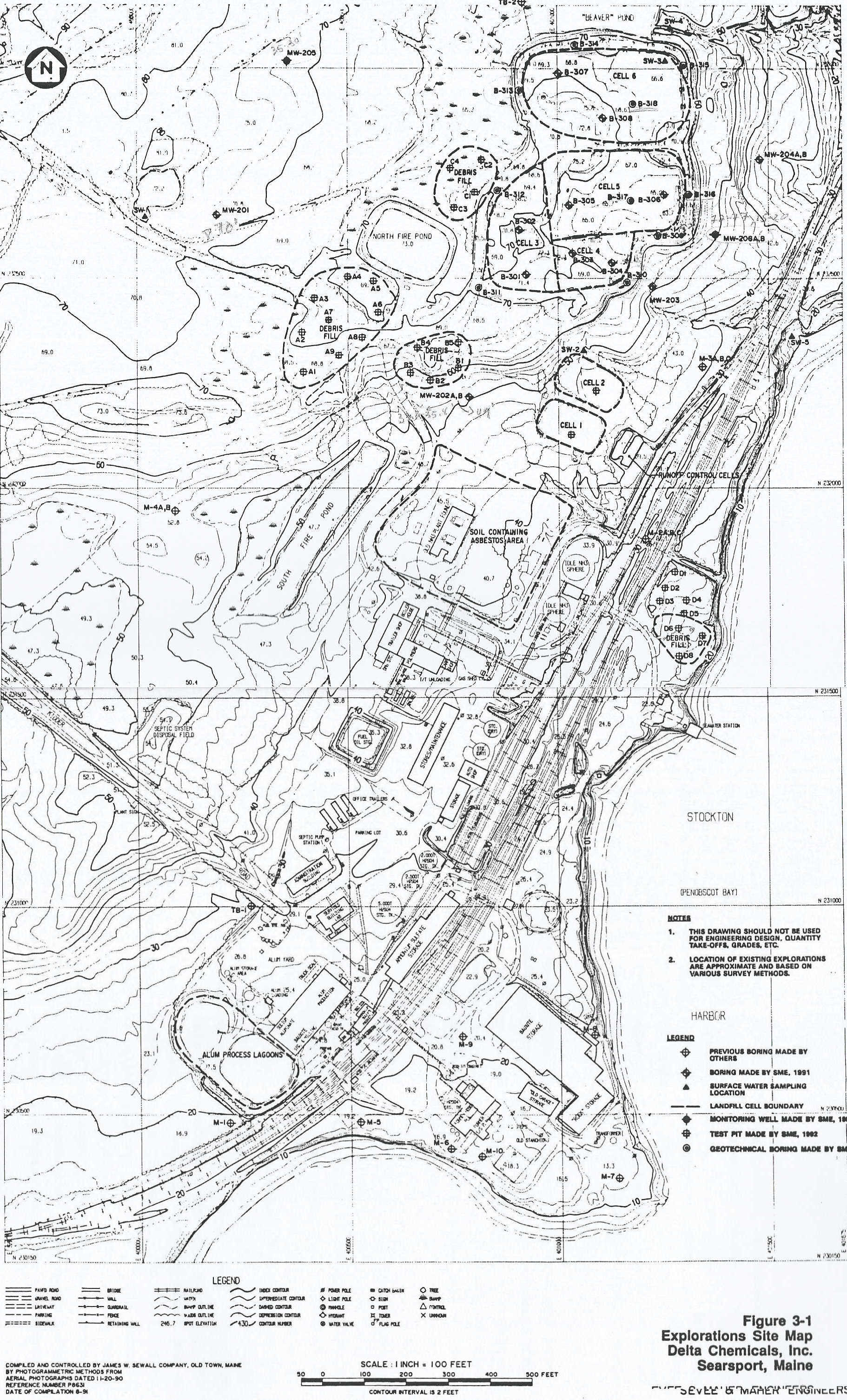
* 1984-2002 Kidder Point pollution history 1984 to 2002.Delta Chemical to General Alum
Check out the pH readings
Conservation Law Foundation sues & settles with GAC 2001 and 2002
* February 11 2002 CLF files its suit
* March 22, 2002 GAC & CLF's reach consent agreement. (final draft version)
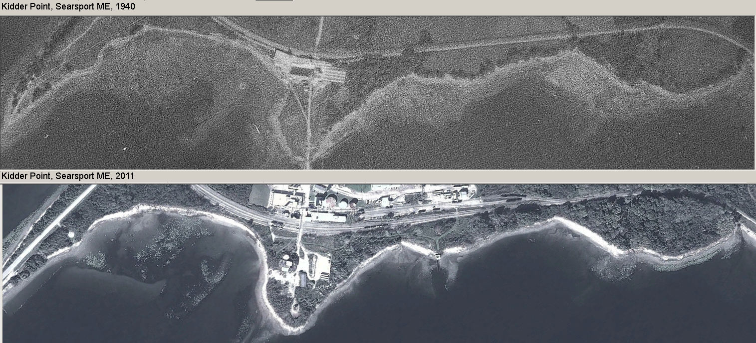
GAC aerial photographs
Use Back Button to Return Here aerial photos from 1940 and 2011. See expansion of the point into the harbor.
* News &reports from 1903 -1974 about this site & nearby Mack Point
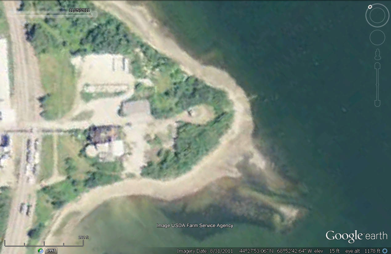
* Google earth aerials of site 1997-2011
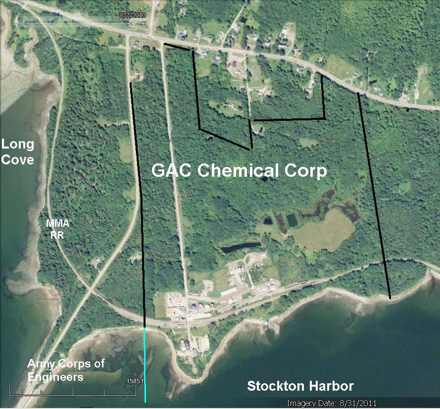
* 2011 GAC Chemical aerial w/company property lines.
* (5) Kidder Point waste fill areas
* 2004 Aerial with now-razed fertilizer-then-bauxite quonset hut. *** w/o quonset hut (2011).
*
No comments:
Post a Comment