ELMR data (Estuarine Living Marine Resources)
https://penbay.org/gom/elmr_data_1994_bluehillbay_penbay_muscongus.jpg
https://penbay.org/gom/noaa_elmr_distr_abund_1994_northatlantic.pdf
Virtually fly the Gulf of Maine https://penbay.org/gom/fly_gom.mpg
ROCKPORT
Harbor maps
https://penbay.org/rockport/rockport_rockland_hbr_watersheds.jpg
https://penbay.org/rockport/rockport_harbor_chart_lg.jpg
https://penbay.org/rockport/Rockport_hbr_bathy_chart_sm_vert.jpg
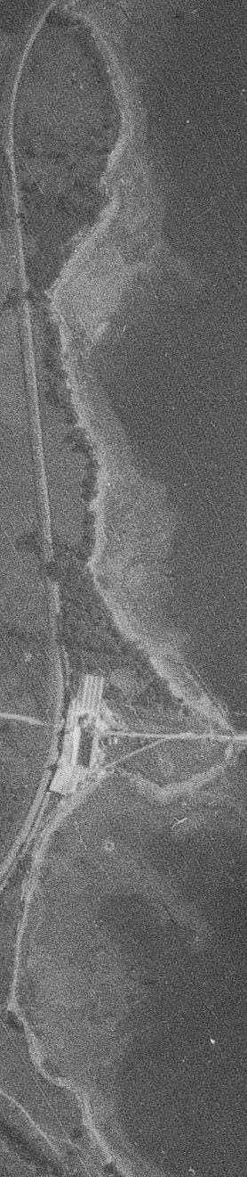
https://penbay.org/rockport/rockporthbr_quartzcliff_topo.jpg
http://penbay.org/rockport/rockport_hbr_quartz_cliffs_1sm_071714.jpg
Underwater photos/video
https://penbay.org/rockport/rockport_hbr_101912_biofoulingpictures/
Sewer expansion
https://penbay.org/rockport/rockport_sewer_expansion2.jpg
http://penbay.org/rockport/rockport_sewer_expansion.jpg
http://penbay.org/rockport/rockport_sprawl_map_capt.jpg
http://penbay.org/rockport/rockporthbr_quartzcliff_topo.jpg
Aerial
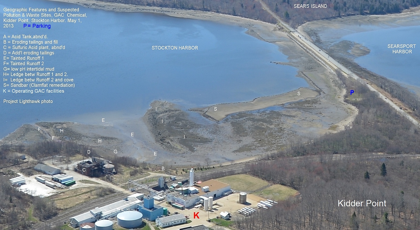
GAC Chemical aerial photo 5.1.13 Waste plumes at low tide
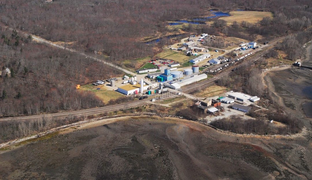
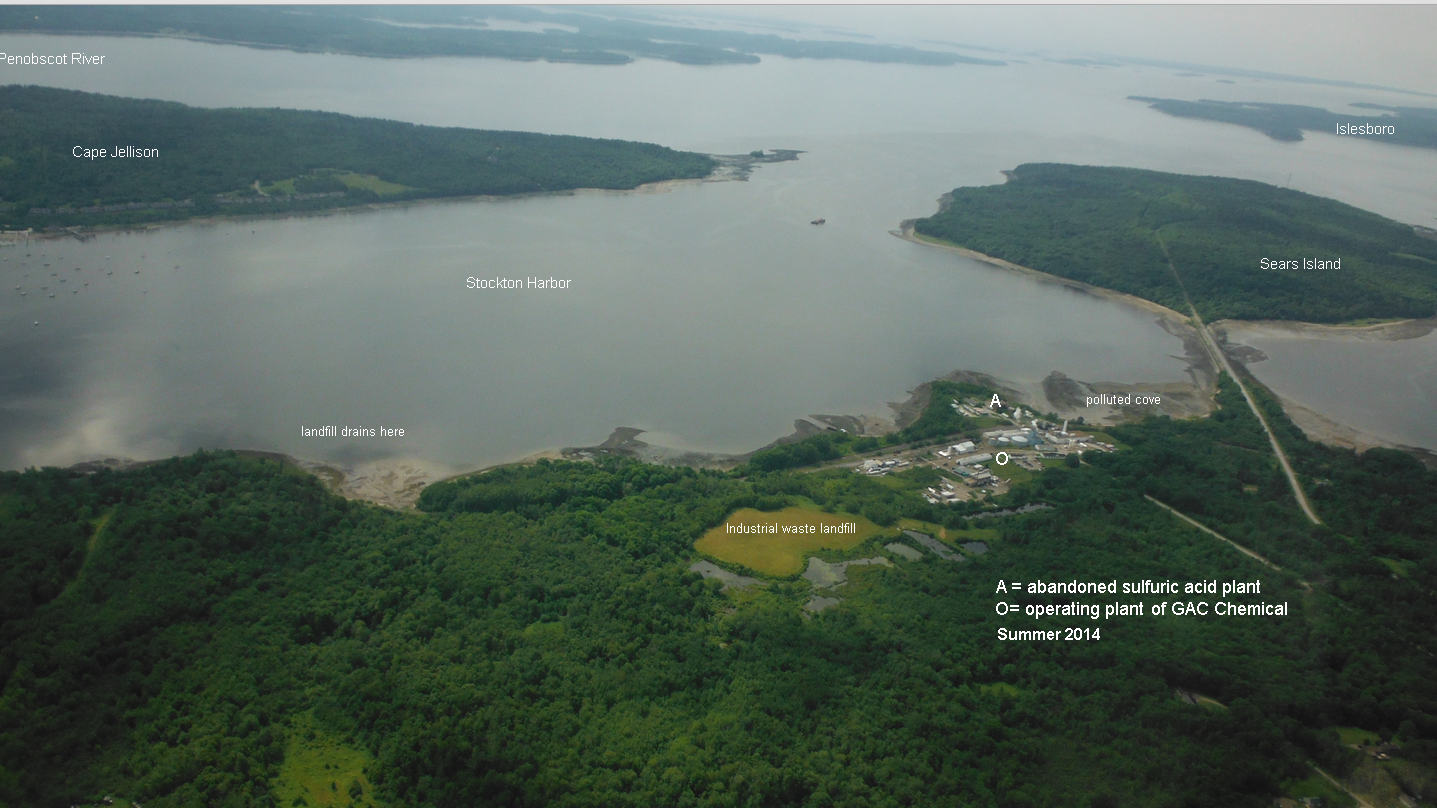
GAC Aerial looking southeast, includes Sears island Islesboro more
GAC aerial abandoned sulfuric acid plant, sand bar and causeway 2013
Historic
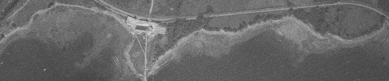
1940 Kidder Pt industrial waterfront, horizontal 1940 waterfront vertical
https://penbay.org/gom/elmr_data_1994_bluehillbay_penbay_muscongus.jpg
https://penbay.org/gom/noaa_elmr_distr_abund_1994_northatlantic.pdf
Virtually fly the Gulf of Maine https://penbay.org/gom/fly_gom.mpg
ROCKPORT
Harbor maps
https://penbay.org/rockport/rockport_rockland_hbr_watersheds.jpg
https://penbay.org/rockport/rockport_harbor_chart_lg.jpg
https://penbay.org/rockport/Rockport_hbr_bathy_chart_sm_vert.jpg
https://penbay.org/rockport/rockporthbr_quartzcliff_topo.jpg
http://penbay.org/rockport/rockport_hbr_quartz_cliffs_1sm_071714.jpg
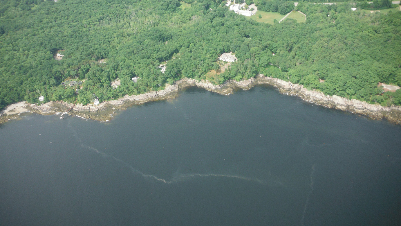
Underwater photos/video
https://penbay.org/rockport/rockport_hbr_101912_biofoulingpictures/
Sewer expansion
https://penbay.org/rockport/rockport_sewer_expansion2.jpg
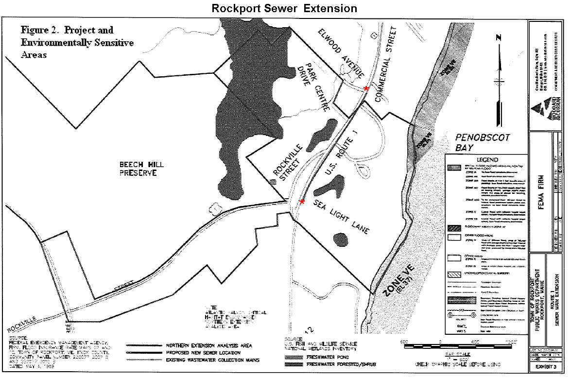
http://penbay.org/rockport/rockport_sewer_expansion.jpg
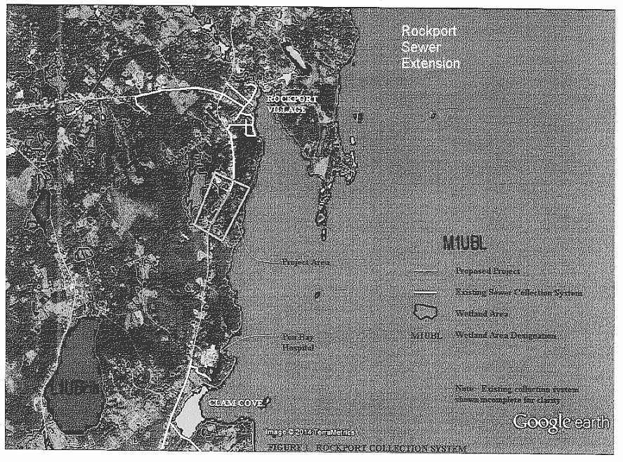
http://penbay.org/rockport/rockport_sprawl_map_capt.jpg
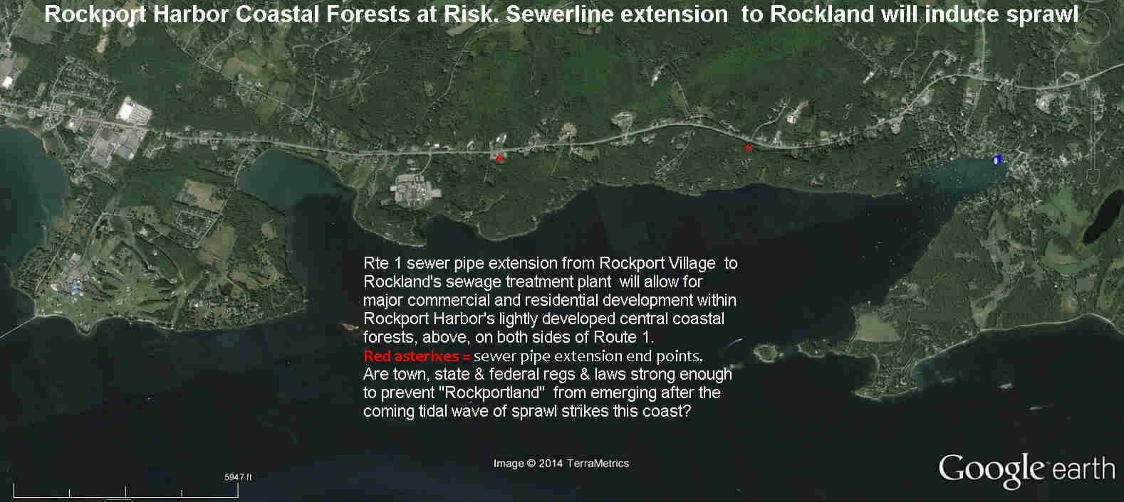
http://penbay.org/rockport/rockporthbr_quartzcliff_topo.jpg
Aerial
GAC Chemical aerial photo 5.1.13 Waste plumes at low tide
GAC Aerial looking southeast, includes Sears island Islesboro more
GAC aerial abandoned sulfuric acid plant, sand bar and causeway 2013
Historic
1940 Kidder Pt industrial waterfront, horizontal 1940 waterfront vertical
No comments:
Post a Comment