Locations for testing and Recommended actions (see recs at end of essay).
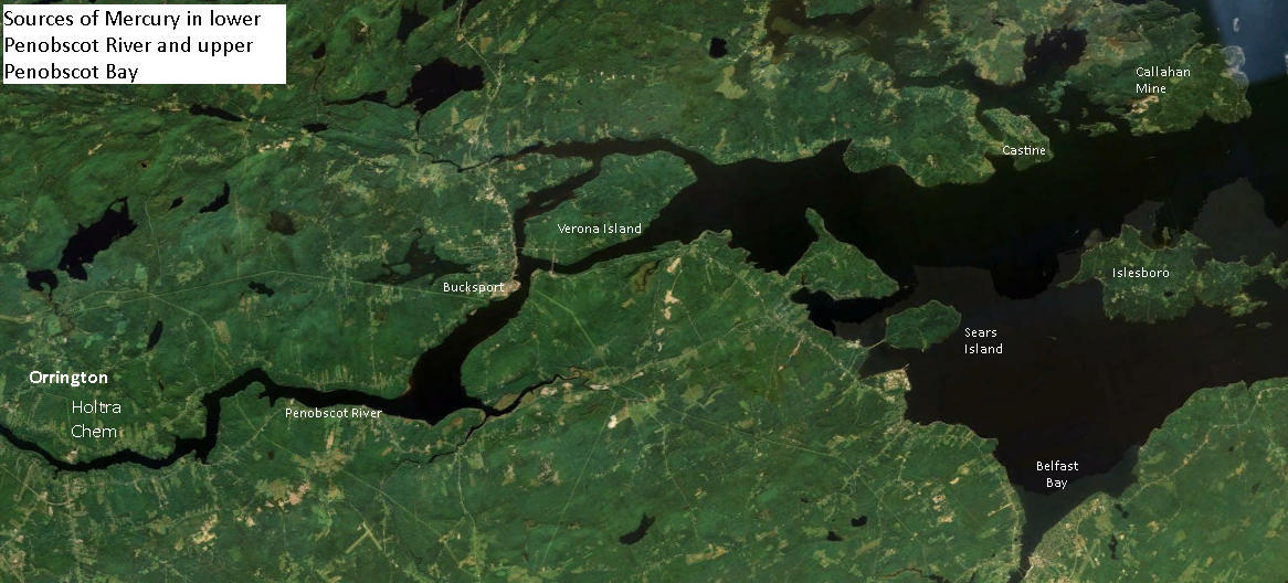
AT ISSUE Reports suggest that the majority of mercury in Penobscot Bay has come down Penobscot River from spills, leaks and dumping of the element by the riverside Holtra Chem Plant in Orrington. History of plant.
QUESTIONS
* Can mercury be detected in the plant and animal biota of Sears Island?
* Can it be measured? Is it moving through island or intertidal foodwebs?

Likely origins, transport vectors, and on island-locations of mercury
According to the Penobscot River Mercury Study Phase I: 2006-2007 Report to Judge Gene Carter, U.S. District Court:
 "The pattern of
contamination of the sediments of the Penobscot River and estuary was....
consistent with a large source from the HoltraChem site at Orrington.....
"The spatial pattern of contamination of various species of biota, such as periwinkles,
mussels, lobsters, tomcod (fish) and cormorants (birds) was also consistent with
elevated inputs of Hg to the lower Penobscot River below the Veazie dam".
.....
[T]hese results indicate that the
most severe contamination of the Penobscot system is between Brewer on the lower
river and about Fort Point or Sears Island in the upper estuary."
(Note: see maps of study sample sites in the river and bay on page 20 of the Penobscot River Mercury Study Phase I)
SEARS ISLAND MERCURY DEPOSITION LOCATIONS
Bathymetry & hydrology questions. Does Sears Island's shape, location, hydrology and bathymetry influence where mercury might accumulate on the island?
 |
| Larger image click here |
TESTING LOCATIONS
In what locations would what Sears Island biota, including intertidal and upland) be likely to absorb mercury? Particularly methyl mercury. What species might have it in detectable quantities?
Army Corps of Engineers' map of its sediment test sites in Searsport Harbor.
Changes in Sears Island Hydrology
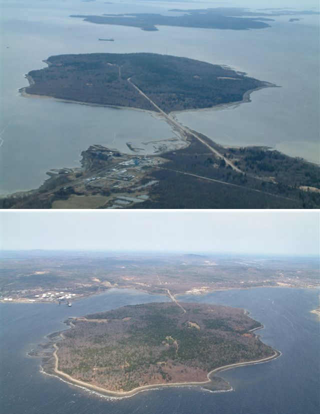
The Sears Island causeway has halted the flow of water around the island since the 980s (See a 1970s picture of causeway-free Sears Island from mainland. (courtesy Maine Historic Preservation Commission). Has this changed the sites of mercury deposition?
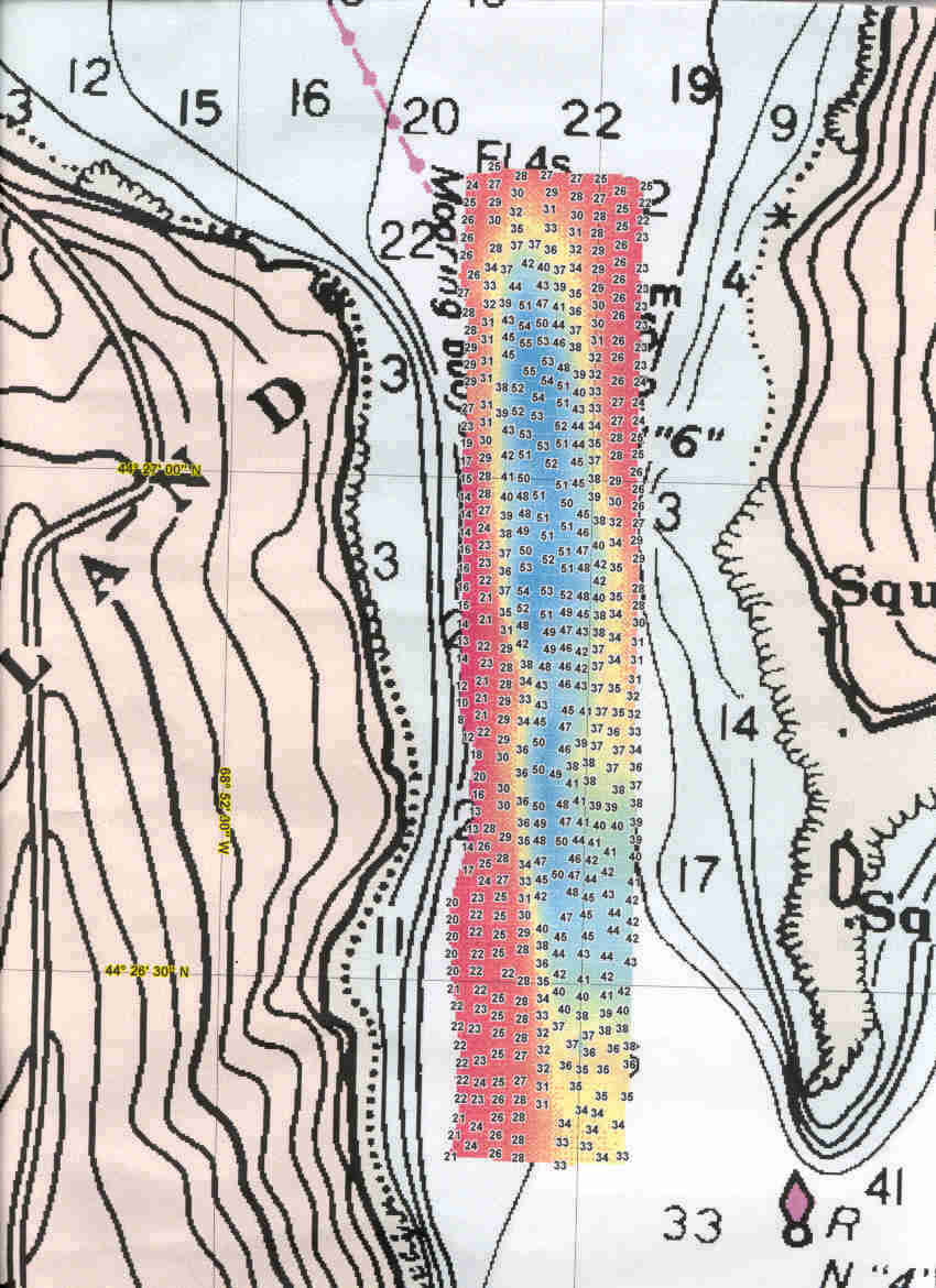
The Jellison Channel between Sears Island and Cape Jellison was surveyed in 1999 by the NOAA vessel Rude (pronounced "Rudy"), at the request of Penobscot Bay Watch. The Rude produced this image of the channel floor (full size) The image shows that currents continue to sweep the floor of the channel clean of mud. Are those currents bringing mercury into Stockton Harbor?
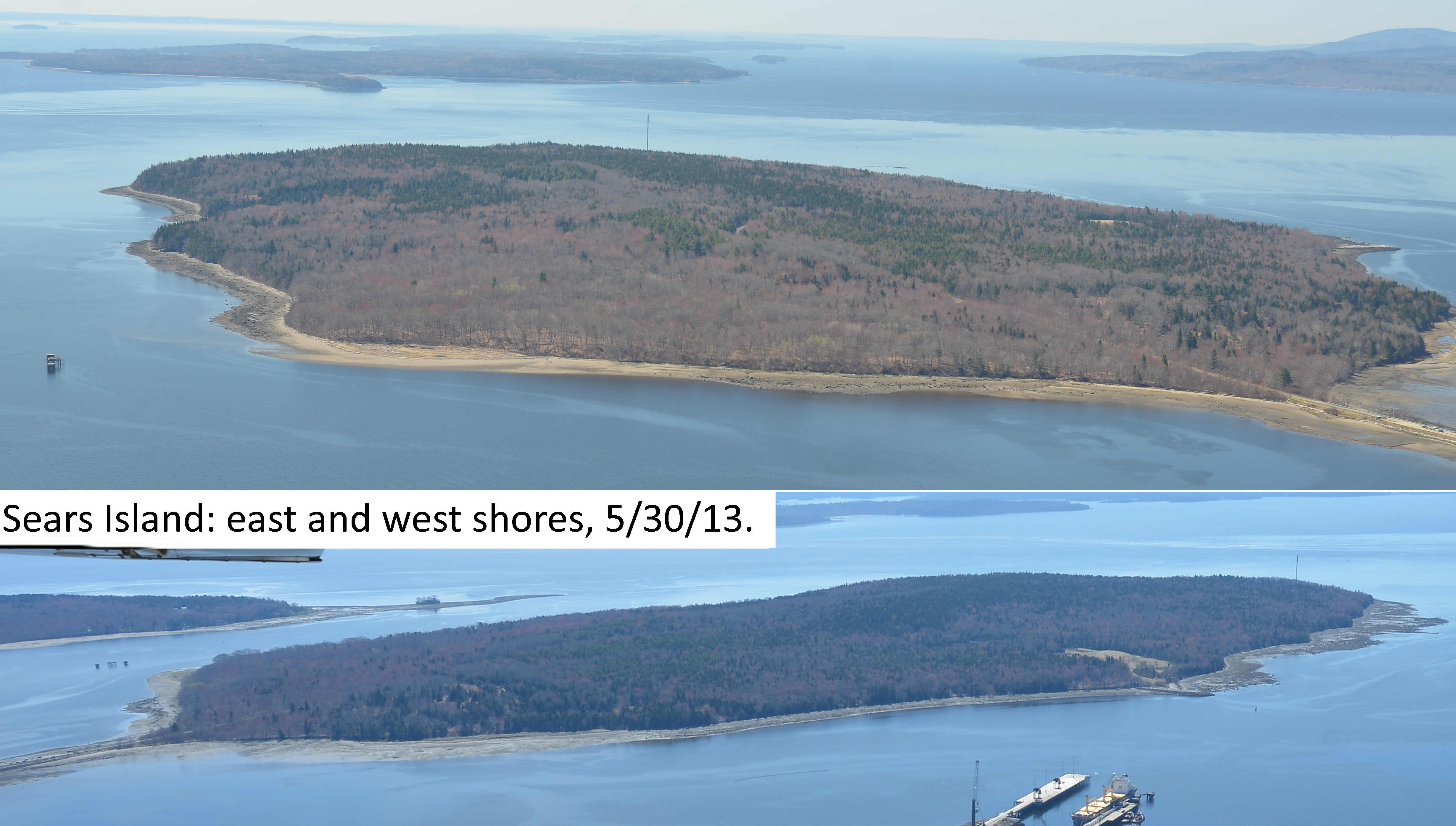
Intertidal flats and beaches on the east or west sides of Sears Island

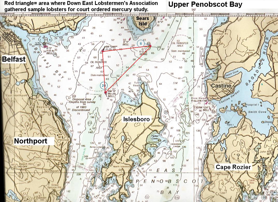
* Penobscot River Mercury Study Phase 2: Upper Penobscot Bay. Belfast lobsterman Mike Dassatt gathered sample lobsters from the upper Bay area under a special license from DMR for mercury examination (Red triangle).
 |
| Click here for fullsized image |
The report has yet to be released. Dassatt described the lobsters collected inside the red triangle (quotes are his words)
"There is a pretty heavy concentration of mercury" along the line between the II Buoy and the Gong 1 Buoy. (the long edge of the triangle).
"But the very hottest reach is the shoal edge above the deeper water east of the DMP buoy", (the shoal edge is the wiggly line inside the red triangle) Mike said that while he did not take sample lobsters from the exact bay floor the Army Corps of Engineers wants to dredge, which is northeast of the DMP buoy, he is confident that the same elevated mercury will be found in that area if they do test lobsters there for it.
Marine fog deposition of upwelling mercury onto upland vegetation.


This has not been examined in Maine to the best of our knowledge. (See 2012 UCSC paper Total and monomethyl mercury in fog water from the central California coast, Peter S. Weiss-Penzias, et al. 2012 and these "general public" articles.
According to that study: "[U]sing a standard fog water collector, depositions of HgT [elemental mercury] and MMHg [methylmercury] via fog were found to range from 42–4600 and 14–1500 ng m−2 y−1, which accounted for 7–42% of HgT and 61–99% of MMHg in total atmospheric deposition (fog, rain, and dry deposition), estimated for the coastal area."
There are several prominent upwelling areas in the upper Penobscot Bay that could carry out that action: The top of the channel According to lobsterman Mike Dassatt, if mercury tainted sediments are dumped in the Rockland Disposal Site prevailing bottom currents will transport it up both sides of Islesboro and back to the upper bay.
RECOMMENDATIONS
1. Sample or collect plant, animal & algae species, driftwood and sediments in intertidal areas on both sizes and both ends of Sears Island.
2. Sample or collect samples from trees and other vegetation & fungi species and soils in a transect across Sears Island to determine if mercury deposition from fog is significant.
3. Use mercury detection paper test strips for initial onsite test results
4. Test for mercury and methylmercury in Unity College lab. Compare results to mercury test strips' results.
5. Use results and determine if initial questions can be answered:
* Can mercury be detected in the plant and animal biota of Sears Island?
* Can it be measured? Is it moving through island or intertidal foodwebs?
No comments:
Post a Comment