It seems unbelievable. NOAA’s Office of Coast Survey, which in 1862 began creating and maintaining the nautical charts of U.S. coastal waters, today announced that starting April 13, 2014, the federal government will no longer print traditional paper nautical charts.
 For a limited time, full-scale PDF nautical charts are available for free download. This is on a "trial basis", so get their pdf maps while they're there.
The Stockton Harbor/Long Cove image is extracted from on of these charts (our caption).
Rear Admiral Gerd Glang, director of NOAA’s Office of Coast Survey said with marvellous understatement: “We know that changing chart formats and availability will be a difficult change for some mariners who love their traditional paper charts."
NOAA said that the decision to stop production is based on the declining use of lithographic charts, the increasing use of digital and electronic charts, and "federal budget realities".
As for electronic charts, NOAA will continue to create and maintain the increasingly popular Print on Demand (POD) charts. They will also maintain NOAA's electronic navigational charts and raster navigational charts, (both updated weekly) along with the pdf nautical charts.
All are available for free download from the Coast Survey website.
 For a limited time, full-scale PDF nautical charts are available for free download. This is on a "trial basis", so get their pdf maps while they're there.
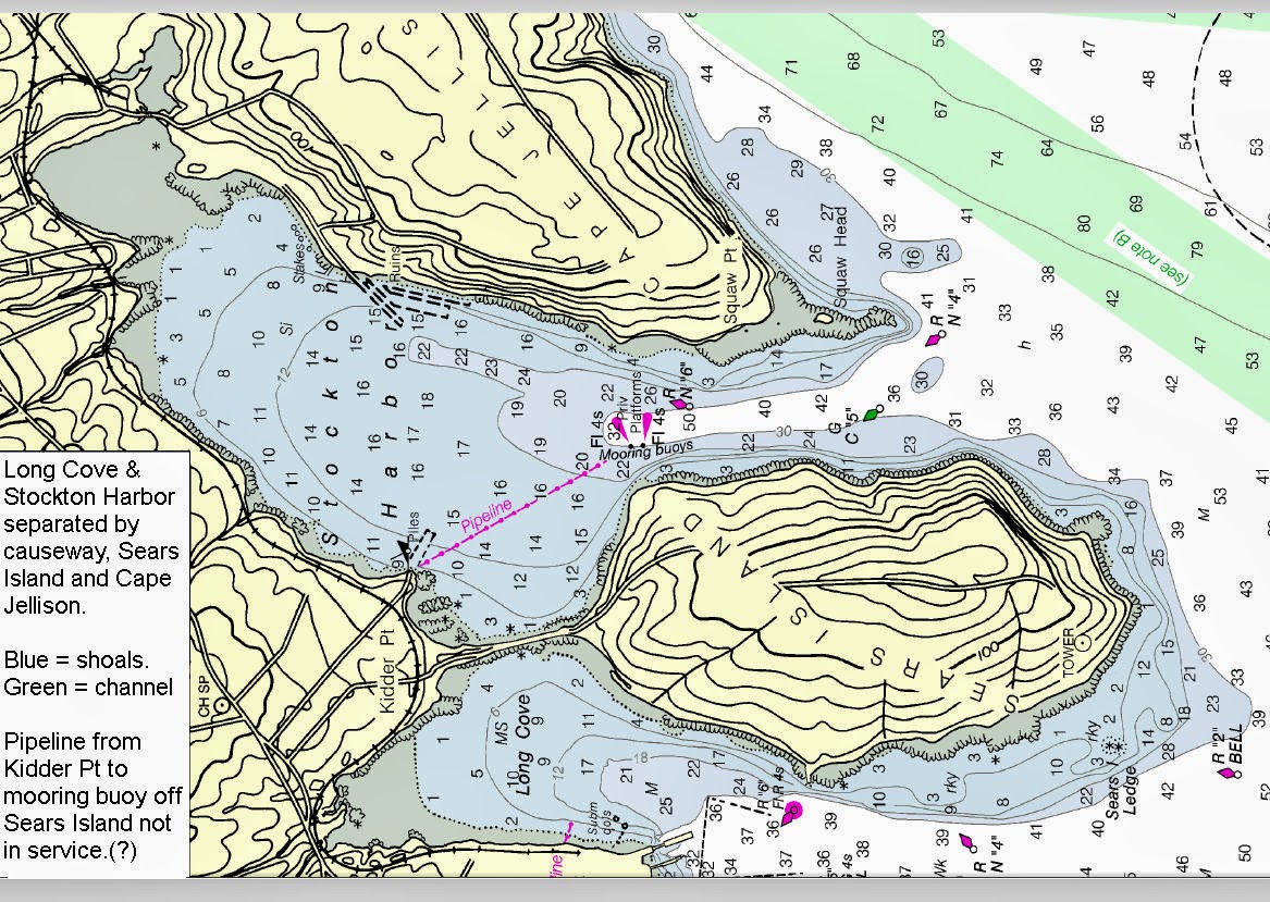
The Stockton Harbor/Long Cove image is extracted from on of these charts (our caption).
Rear Admiral Gerd Glang, director of NOAA’s Office of Coast Survey said with marvellous understatement: “We know that changing chart formats and availability will be a difficult change for some mariners who love their traditional paper charts."
NOAA said that the decision to stop production is based on the declining use of lithographic charts, the increasing use of digital and electronic charts, and "federal budget realities".
As for electronic charts, NOAA will continue to create and maintain the increasingly popular Print on Demand (POD) charts. They will also maintain NOAA's electronic navigational charts and raster navigational charts, (both updated weekly) along with the pdf nautical charts.
All are available for free download from the Coast Survey website.
No comments:
Post a Comment